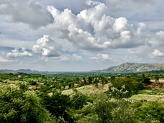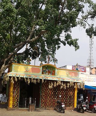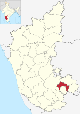
Ramanagara is a city in the Indian state of Karnataka. It is also the headquarters of the Ramanagara District. It is approximately 50 kilometres from Bangalore. There are buses and trains as public transportations which approximately takes 90 minutes from Bangalore.

Bangalore Rural district is one of the 31 districts in Karnataka, India. It was formed in 1986, when Bangalore District was divided into Bangalore Rural and Bangalore Urban. Presently in Bangalore Rural district, there are 4 talukas: Devanahalli, Nelamangala, Doddaballapura, Hoskote. It has 20 hoblies, 294 villages, 3 towns, 2 tier-three cities, administered by 66 Village Panchayats , 3Town Municipal Councils (Purasabes) and 2 City Municipal Councils (Nagarsabes).

Kanakapura is a city in the Bengaluru South district of Karnataka on the banks of the Arkavathi river and the administrative center of the taluk of the same name. Kanakapura is largest cocoon silk producer in India. River Cauvery flows around 21 km in Kanakapura Taluk.Previously belonged to Bangalore Rural District. It was formerly the largest constituency in the country. (1,553 km2 [600 sq mi]). It is located among the lush green forests of the state of Karnataka. The town is a tourism hotspot and an often visited tourist favorite in the entire state of Karnataka, as it has something for everyone ranging from avid trekkers to history buffs and wildlife enthusiasts. The forest area in this taluk is very wide and about half of the Bannerghatta National Park is located in our Kanakapura area. Kodihalli wildlife range and harohalli wildlife range its division. The Kaveri Wildlife Sanctuary consists of two main zones namely the Sangam Wildlife range, the Muggur Wildlife range

Ramanagara District is one of the 31 districts of Karnataka state in southern India. Ramanagara City is the administrative headquarters of this district. The district is part of Bangalore Division.
Inchal is a village in the southern state of Karnataka, India. It is located in the Saundatti taluk of Belgaum district in Karnataka.

Kalagi is a new taluk in Kalaburagi, earlier it was a Hobli and Village in Chittapur Taluka in the southern state of Karnataka, India. It is located in the Chitapur taluk of Kalaburagi district in Karnataka.

Halaguru or Halagur is a town in the southern state of Karnataka, India.

Huliyurdurga is a village in the southern state of Karnataka, India. It is located in the Kunigal taluk of Tumkur district in Karnataka.
Kudur is a place in the southern state of Karnataka, India. It is located in the Magadi taluk of Ramanagara district in Karnataka. It is 21 km from Magadi, 56 km from Ramanagara and 30 km from Tumakuru.
Abbanakuppe is a village in the southern state of Karnataka, India. It is located in the Ramanagara taluk of Ramanagara district in Karnataka. It hosts the Bidadi Industrial Area, and Toyota Kirloskar and Coca-Cola have factories in the village.

Achalu (Kanakapura) is a village in the southern state of Karnataka, India. It is located in the Kanakapura taluk of Ramanagara district.

Agara Bangalore Rural is a village in the southern state of Karnataka, India. It is located in the Kanakapura taluk of Bangalore Rural district in Karnataka.

Agrahara, Kanakapura is a village in the southern state of Karnataka, India. It is located in the Kanakapura taluk of Ramanagaram district.

Akkur, Channapatna is a village in the southern state of Karnataka, India. It is located in the Channapatna taluk of Ramanagara district.

Akkur is a village in the southern state of Karnataka, India. It is located in the Ramanagara taluk of Ramanagara district - 562159.
Karnataka State Highway 3, commonly referred to as KA SH 3, is a normal state highway that runs north through Ramanagara, Bangalore Rural and Tumkur districts in the state of Karnataka, India. This state highway touches numerous cities and villages Viz.Kanakapura, Ramanagara, Magadi and Pavagada. The total length of the highway is 249 km. SH 3 intersects with National Highway 948 at Kanakapura Town. Certain sections of this state highway have been upgraded to NH-948A.
Sathanur may refer to several places in India:

Tattekere is a village in Kanakapura taluk in Ramanagara district, 40 km away from Bangalore. It has a population of 1293 in 2011. The village derives its name from a lake there which is a picnic spot, "tatte" means plate and "kere" means lake in native Kannada language.
Sathanur is a village in Ramanagara district of Karnataka, India. It is located around 70 km from the city of Bengaluru. The Bengaluru - Coimbatore National Highway 948 passes via this town.It is 18 km from Kanakapura and 27 km from Channapatna.
This page is based on this
Wikipedia article Text is available under the
CC BY-SA 4.0 license; additional terms may apply.
Images, videos and audio are available under their respective licenses.


