Wimbledon is a district and town of South West London, England, 7.0 miles (11.3 km) southwest of the centre of London at Charing Cross; it is the main commercial centre of the London Borough of Merton. Wimbledon had a population of 68,187 in 2011 which includes the electoral wards of Abbey, Wimbledon Town and Dundonald, Hillside, Wandle, Village, Raynes Park and Wimbledon Park.

Dalen is a village and a former municipality in the northeastern Netherlands, in the province of Drenthe. Since 1998, Dalen has been part of the municipality of Coevorden.

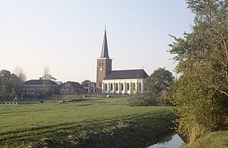
Akkrum is a village in the Dutch province of Friesland. It is located in the municipality Heerenveen, about 17 km south of the city of Leeuwarden.

Buitenpost is a village in north-east Friesland in the Netherlands.

Hooghalen is a village in the municipality Midden-Drenthe, in the Dutch province Drenthe. In Drenthe it is also called Hoal'n or Hoalen , but then people often mean the entire area, with the neighborhoods Laaghalen, Laaghalerveen and Oosthalen.
Stiens is a town in the municipality of Leeuwarden, Netherlands. As of January 2017, the town has a population of about 7,545. Between 1944 and 2018, it was the capital of the municipality of Leeuwarderadeel.
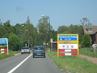
Hollandsche Rading is a village in the Dutch province of Utrecht. It is a part of the municipality of De Bilt, and lies about 5 km south of Hilversum. Hollandsche Rading has a railway station on the route between Utrecht and Hilversum.

Groenekan is a village in the Dutch province of Utrecht. It is a part of the municipality of De Bilt, and lies about 3 km west of Bilthoven.

Eanjum is a village in the Dutch province of Friesland. It is located in the municipality Noardeast-Fryslân and had, as of January 2017, a population of 1136.

Eext is a village in the Dutch province of Drenthe. It is a part of the municipality of Aa en Hunze, and lies about 12 km east of Assen. There are three hunebedden (dolmen) near the village.
Koudum is a village in the northern Netherlands. It is located in Súdwest-Fryslân, Friesland. Nearby villages include Molkwerum to the west, Workum to the north and Hemelum to the south. The population of Koudum was 2,700 in 2019. The nearest train station is the Koudum-Molkwerum railway station.

Dreumel is a village in the Dutch province of Gelderland. It is a part of the municipality of West Maas en Waal, and lies about 4 km south of Tiel.

Bath is a small village and a former municipality in the Dutch province of Zeeland, lying on the north shore of the Western Scheldt. It is now located in the municipality of Reimerswaal, about 10 km southwest of Bergen op Zoom.

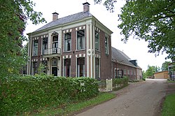
De Wijk is a village in the Netherlands province of Drenthe. It is located in the municipality of De Wolden, and is about 7 km southeast of Meppel. It is home to Rijksmonument 39657, De Wieker Meule.

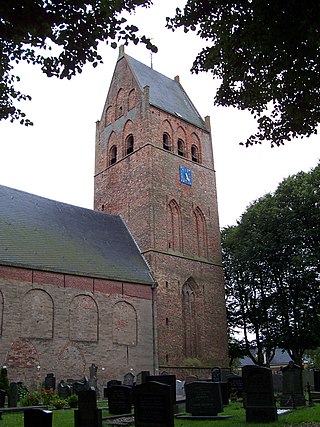
Stedum is a village in the Dutch province of Groningen. It is located in the municipality of Eemsdelta, about 15 km (9 mi) northeast of the city of Groningen.

Loon is a village in the Netherlands and is part of the Assen municipality in Drenthe. The hunebed (dolmen) D15 is located near the village.

Peperga is a small village in Weststellingwerf in the province Friesland of the Netherlands. As of 2017, it has a population of 85 people, living in approximately 35 houses, and is characterized by detached houses, several businesses and a church. Peperga is located on the A32 between Wolvega and Steenwijk, with public transportation offering a service to the nearby villages of Steggerda and De Blesse.

Jirnsum is a village in Leeuwarden municipality in the province of Friesland, the Netherlands. It had a population of around 1,360 in January 2017.

Hijum is a village in Leeuwarden municipality in the province of Friesland, the Netherlands. It had a population of around 385 in January 2017.
Mantgum is a village in Leeuwarden municipality in the province Friesland of the Netherlands and had around 1,172 citizens in January 2017.