
Lae is the capital of Morobe Province and is the second-largest city in Papua New Guinea. It is located near the delta of the Markham River and at the start of the Highlands Highway, which is the main land transport corridor between the Highlands region and the coast. Lae is the largest cargo port of the country and is the industrial hub of Papua New Guinea. The city is known as the Garden City and home of the University of Technology.
Enga is one of the provinces in Papua New Guinea (PNG). It is located in the north most region of the highlands of PNG, having been divided from the Western Highlands to become a separate province when the provinces were created at the time of independence in 1975. The people of Enga are called Engans—they are a majority ethnic group—speaking one language in all its five districts: approximately 500,000 people. A small minority of Engans' land on the eastern side of the region remained in the Western Highlands, their territory being accessible by road from Mount Hagen but not directly from elsewhere in Enga territory.
Kainantu is a town in the Eastern Highlands of Papua New Guinea. It had some historical significance as an airstrip town during WWII. It functions primarily as a market town for local produce growers and cash croppers. It is located on the "Highlands Highway" approximately 170 kilometres (110 mi) by road from Lae and 90 kilometres (56 mi) by road from Goroka. It is 11 kilometres (6.8 mi) approx from a nearby missionary station Ukarumpa and is nearby the Aiyura valley. Kainantu has basic facilities such as a school, hospital, police station, district court, and service stations.
Goroka is the capital of the Eastern Highlands Province of Papua New Guinea. It is a town of approximately 19,000 people (2000), 1600m above sea level. It has an airport and is on the "Highlands Highway", about 285 km from Lae in Morobe province and 90 km from the nearby town of Kainantu also in the Eastern Highlands. Other nearby towns include Kundiawa in Simbu Province and Mount Hagen in Western Highlands Province. It has a mild climate, known as a "perpetual Spring".
The Gutnius Lutheran Church, formerly the Wabag Lutheran Church, is a Lutheran body existing in Papua New Guinea. Gutnius means "Good News" in Tok Pisin. It was established by the Lutheran Church–Missouri Synod in 1948, shortly after the Australian administration of the Territory of Papua and New Guinea permitted missionary activity to spread into the western highlands. The church counts 125.000 parishioners, largely confined to Enga Province in the western highlands. It operates Immanuel Lutheran Hospital and St. Paul's Lutheran Secondary School (Pausa) at Wapenamanda, Enga Province. The church has other health and educational institutions as well.

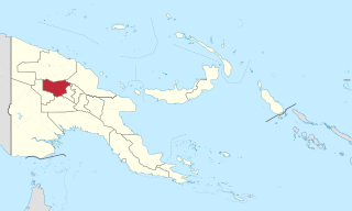
Western Highlands is a province of Papua New Guinea. The provincial capital is Mount Hagen. The province covers an area of 4,299 km², and there are 362,850 inhabitants, making the Western Highlands the most densely populated province. Tea and coffee are grown in the Western Highlands.

The Evangelical Lutheran Church of Papua New Guinea is a Protestant church denomination located in Papua New Guinea that professes the Lutheran branch of the Christian faith. The Church is incorporated by a 1991 Act of the Parliament of Papua New Guinea and it has a baptized membership of approximately 900,000 members.
Religion in Papua New Guinea is predominantly Christian, with traditional animism and ancestor worship often occurring less openly as another layer underneath or more openly side by side Christianity. The courts, government, and general society uphold a constitutional right to freedom of speech, thought, and belief. There is no state religion, although the government openly partners with several Christian groups to provide services, and churches participate in local government bodies.

The Anglican Church of Papua New Guinea is a province of the Anglican Communion. It was created in 1976 when the Province of Papua New Guinea became independent from the Province of Queensland in the Church of England in Australia following Papua New Guinea's independence in 1975.
Asaro River is a river in Eastern Highlands province, Papua New Guinea, located at 6.3666667°S 145.2°E. The Asaro is a tributary of the Tua.
The South Pacific Division of Seventh-day Adventists is a sub-entity of the General Conference of Seventh-day Adventists, which oversees the Church's work in the South Pacific nations of Australia, New Zealand, Papua New Guinea and the islands of the South Pacific. Its headquarters is in Wahroonga, Australia.

Lucian Tapiedi was a Papuan Anglican teacher who was one of the "New Guinea Martyrs." The Martyrs were eight Anglican clergy, teachers, and medical missionaries killed by the Japanese in 1942.
Jimi Valley is an area of Papua New Guinea. It is located in the Jimi District of Jiwaka, formerly under Western Highlands. Before May 2012, it was part of the Western Highlands Province. It is home to the Jimi Valley. Jimi District is one of the least developed districts in PNG apart from Green River in Sandaun and Rai Coast in Madang. Its geographical location makes it a remote district of the newly created Jiwaka Province, in Papua New Guinea. The district is located in the Jimi Valley, which stretches from the northeast corner of Jiwaka and into Madang Province. The timezone in Jimi District is Pacific/Port_Moresby, Morning Sunrise at 06:21 and Evening Sunset at 18:17. It's light Rough GPS position Latitude. -5.5333°, Longitude. 144.5667°.
The Kaijende Highlands are a nearly uninhabited expanse of mountains near Porgera in Enga Province, Papua New Guinea. The highlands have been characterized as "some of Papua New Guinea's most pristine and scenic montane habitat". The Kaijende Highlands include Lake Tawa, Paiela Road, Omyaka Creek, Waile Creek and the Porgera Reservoir. The mountain range is 70 km north-west of Mount Hagen. According to a survey conducted in 2007, "areas like Kaijende are characterized by pronounced dominance of microtherm families, most notably by Cunoniaceae, Epacridaceae, Ericaceae, Geraniaceae, Myrsinaceae, Podocarpaceae, Ranunculaceae, Rosaceae, Theaceae, Violaceae, and Winteraceae."

A pandanus language is an elaborate avoidance language among several of the peoples of the eastern New Guinea Highlands, used when collecting Pandanus nuts.

Taraka is a suburb of Lae in the Morobe Province, Papua New Guinea. The main campus for the Papua New Guinea University of Technology is located in Taraka.

Lamari River is a river that originates in Kratke Range in the south central highlands of Eastern Highlands Province of Papua New Guinea. It flows into the Purari River basin.

Pandanus julianettii, also called karuka, karuka nut, or Pandanus nut, is a species of tree in the family Pandanaceae and an important regional food crop. The nuts are more nutritious than coconuts, and are so popular that villagers in the New Guinea Highlands will move their entire households closer to trees for the harvest season.


