Pieńki Borowe is a village in the administrative district of Gmina Jedwabne, within Łomża County, Podlaskie Voivodeship, in north-eastern Poland. It lies approximately 5 kilometres (3 mi) west of Jedwabne, 17 km (11 mi) north-east of Łomża, and 65 km (40 mi) west of the regional capital Białystok.
Jednaczewo is a village in the administrative district of Gmina Łomża, within Łomża County, Podlaskie Voivodeship, in north-eastern Poland. It lies approximately 8 kilometres (5 mi) north-west of Łomża and 79 km (49 mi) west of the regional capital Białystok.
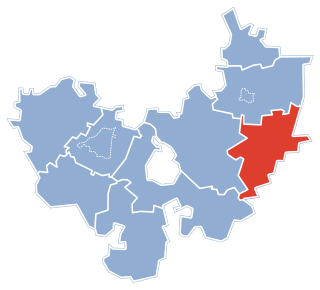
Konarzyce is a village in the administrative district of Gmina Łomża, within Łomża County, Podlaskie Voivodeship, in north-eastern Poland. It lies approximately 5 kilometres (3 mi) south-west of Łomża and 76 km (47 mi) west of the regional capital Białystok.
Łochtynowo is a village in the administrative district of Gmina Łomża, within Łomża County, Podlaskie Voivodeship, in north-eastern Poland. It lies approximately 5 kilometres (3 mi) south-west of Łomża and 77 km (48 mi) west of the regional capital Białystok.
Boguszki is a village in the administrative district of Gmina Wizna, within Łomża County, Podlaskie Voivodeship, in north-eastern Poland. It lies approximately 6 kilometres (4 mi) north-west of Wizna, 20 km (12 mi) north-east of Łomża, and 57 km (35 mi) west of the regional capital Białystok.
Bronowo is a village in the administrative district of Gmina Wizna, within Łomża County, Podlaskie Voivodeship, in north-eastern Poland. It lies approximately 7 kilometres (4 mi) south-west of Wizna, 15 km (9 mi) east of Łomża, and 59 km (37 mi) west of the regional capital Białystok.
Kramkowo is a village in the administrative district of Gmina Wizna, within Łomża County, Podlaskie Voivodeship, in north-eastern Poland. It lies approximately 3 kilometres (2 mi) west of Wizna, 19 km (12 mi) east of Łomża, and 56 km (35 mi) west of the regional capital Białystok.
Męczki is a village in the administrative district of Gmina Wizna, within Łomża County, Podlaskie Voivodeship, in north-eastern Poland. It lies approximately 4 kilometres (2 mi) north of Wizna, 21 km (13 mi) east of Łomża, and 55 km (34 mi) west of the regional capital Białystok.
Nieławice is a village in the administrative district of Gmina Wizna, within Łomża County, Podlaskie Voivodeship, in north-eastern Poland. It lies approximately 6 kilometres (4 mi) north-west of Wizna, 18 km (11 mi) north-east of Łomża, and 59 km (37 mi) west of the regional capital Białystok.
Niwkowo is a village in the administrative district of Gmina Wizna, within Łomża County, Podlaskie Voivodeship, in north-eastern Poland. It lies approximately 4 kilometres (2 mi) south of Wizna, 19 km (12 mi) east of Łomża, and 54 km (34 mi) west of the regional capital Białystok.
Podkosacze is a village in the administrative district of Gmina Wizna, within Łomża County, Podlaskie Voivodeship, in north-eastern Poland. It lies approximately 9 kilometres (6 mi) south-west of Wizna, 14 km (9 mi) east of Łomża, and 60 km (37 mi) west of the regional capital Białystok.
Rutkowskie is a village in the administrative district of Gmina Wizna, within Łomża County, Podlaskie Voivodeship, in north-eastern Poland. It lies approximately 9 kilometres (6 mi) north-east of Wizna, 26 km (16 mi) north-east of Łomża, and 52 km (32 mi) west of the regional capital Białystok.
Sambory is a village in the administrative district of Gmina Wizna, within Łomża County, Podlaskie Voivodeship, in north-eastern Poland. It lies approximately 5 kilometres (3 mi) north-east of Wizna, 25 km (16 mi) east of Łomża, and 51 km (32 mi) west of the regional capital Białystok.
Sieburczyn is a village in the administrative district of Gmina Wizna, within Łomża County, Podlaskie Voivodeship, in north-eastern Poland. It lies approximately 6 kilometres (4 mi) north-east of Wizna, 26 km (16 mi) east of Łomża, and 50 km (31 mi) west of the regional capital Białystok.
Srebrowo is a village in the administrative district of Gmina Wizna, within Łomża County, Podlaskie Voivodeship, in north-eastern Poland. It lies approximately 3 kilometres (2 mi) north-west of Wizna, 19 km (12 mi) east of Łomża, and 56 km (35 mi) west of the regional capital Białystok.
Stare Bożejewo is a village in the administrative district of Gmina Wizna, within Łomża County, Podlaskie Voivodeship, in north-eastern Poland. It lies approximately 7 kilometres (4 mi) west of Wizna, 14 km (9 mi) east of Łomża, and 60 km (37 mi) west of the regional capital Białystok.
Wierciszewo is a village in the administrative district of Gmina Wizna, within Łomża County, Podlaskie Voivodeship, in north-eastern Poland. It lies approximately 6 kilometres (4 mi) north-east of Wizna, 26 km (16 mi) east of Łomża, and 50 km (31 mi) west of the regional capital Białystok.
Zanklewo is a village in the administrative district of Gmina Wizna, within Łomża County, Podlaskie Voivodeship, in north-eastern Poland. It lies approximately 6 kilometres (4 mi) north of Wizna, 24 km (15 mi) north-east of Łomża, and 54 km (34 mi) west of the regional capital Białystok.
Boratyńszczyzna is a village in the administrative district of Gmina Szudziałowo, within Sokółka County, Podlaskie Voivodeship, in north-eastern Poland, close to the border with Belarus. It lies approximately 5 kilometres (3 mi) west of Szudziałowo, 14 km (9 mi) south-east of Sokółka, and 36 km (22 mi) north-east of the regional capital Białystok.