Nacina Ves is a village and municipality in Michalovce District in the Kosice Region of eastern Slovakia.

Studzianki Pancerne is a village in Poland, in Masovian Voivodeship, near Kozienice and Głowaczów. The village was a battlefield of a major armoured engagement that took place there between August 9 and August 16 of 1944, battle of Studzianki.

Radwanków Szlachecki is a village in Otwock County, Gmina Sobienie-Jeziory.The population is near 150. In the village is Voivodship Road 801. It lies near the Vistula river. From 1975 to 1998 village was in Siedlce Voivodeship.

Radwanków Królewski is a village in Otwock County, Gmina Sobienie-Jeziory.The population is near 60.
Łącko is a village in the administrative district of Gmina Pakość, within Inowrocław County, Kuyavian-Pomeranian Voivodeship, in north-central Poland.

Łęki Małe is a village in the administrative district of Gmina Lututów, within Wieruszów County, Łódź Voivodeship, in central Poland. It lies approximately 2 kilometres (1 mi) south of Lututów, 22 km (14 mi) east of Wieruszów, and 86 km (53 mi) south-west of the regional capital Łódź.
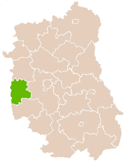
Kręciszówka is a village in the administrative district of Gmina Opole Lubelskie, within Opole Lubelskie County, Lublin Voivodeship, in eastern Poland.
Gaj Żelechowski is a village in the administrative district of Gmina Chynów, within Grójec County, Masovian Voivodeship, in east-central Poland.

Janów is a village in the administrative district of Gmina Chynów, within Grójec County, Masovian Voivodeship, in east-central Poland. It lies approximately 6 kilometres (4 mi) south of Chynów, 17 km (11 mi) east of Grójec, and 41 km (25 mi) south of Warsaw.
Nowe Grobice is a village in the administrative district of Gmina Chynów, within Grójec County, Masovian Voivodeship, in east-central Poland.

Laski is a village in the administrative district of Gmina Warka, within Grójec County, Masovian Voivodeship, in east-central Poland. It lies approximately 5 kilometres (3 mi) west of Warka, 21 km (13 mi) south-east of Grójec, and 49 km (30 mi) south of Warsaw.

Dąbrówki is a village in the administrative district of Gmina Kozienice, within Kozienice County, Masovian Voivodeship, in east-central Poland. It lies approximately 3 kilometres (2 mi) east of Kozienice and 82 km (51 mi) south-east of Warsaw.

Dąbrówki is a village in the administrative district of Gmina Głowaczów, within Kozienice County, Masovian Voivodeship, in east-central Poland. It lies approximately 6 kilometres (4 mi) north of Głowaczów, 21 km (13 mi) north-west of Kozienice, and 65 km (40 mi) south of Warsaw.

Leśniczówka Mirchów is a village in the administrative district of Gmina Tarczyn, within Piaseczno County, Masovian Voivodeship, in east-central Poland. It lies approximately 5 kilometres (3 mi) south-west of Tarczyn, 21 km (13 mi) south-west of Piaseczno, and 34 km (21 mi) south-west of Warsaw.

Piaski is a village in the administrative district of Gmina Jedlińsk, within Radom County, Masovian Voivodeship, in east-central Poland. It lies approximately 2 kilometres (1 mi) west of Jedlińsk, 14 km (9 mi) north of Radom, and 78 km (48 mi) south of Warsaw.

Jedlnia is a village in the administrative district of Gmina Pionki, within Radom County, Masovian Voivodeship, in east-central Poland. It lies approximately 8 kilometres (5 mi) south-west of Pionki, 14 km (9 mi) north-east of Radom, and 89 km (55 mi) south of Warsaw.

Miasteczko is a village in the administrative district of Gmina Skaryszew, within Radom County, Masovian Voivodeship, in east-central Poland. It lies approximately 7 kilometres (4 mi) south-east of Skaryszew, 18 km (11 mi) south-east of Radom, and 107 km (66 mi) south of Warsaw. The word miasteczko is a diminutive of the Polish word miasto ("town"), and means "small town" or "village".
Mostki is a village in the administrative district of Gmina Zwoleń, within Zwoleń County, Masovian Voivodeship, in east-central Poland.
Bliźniaki is a village in the administrative district of Gmina Rudniki, within Olesno County, Opole Voivodeship, in south-western Poland.
Rabrovo is a village in the municipality of Kučevo, Serbia. According to the 2002 census, the village has a population of 1219 people.


