| Kolonie-Ławsk | |
|---|---|
| Village | |
| Country | |
| Voivodeship | Podlaskie |
| County | Grajewo |
| Gmina | Wąsosz |
Kolonie-Ławsk [kɔˈlɔɲe ˈwafsk] is a village in the administrative district of Gmina Wąsosz, within Grajewo County, Podlaskie Voivodeship, in north-eastern Poland. [1]

A village is a clustered human settlement or community, larger than a hamlet but smaller than a town, with a population ranging from a few hundred to a few thousand. Though villages are often located in rural areas, the term urban village is also applied to certain urban neighborhoods. Villages are normally permanent, with fixed dwellings; however, transient villages can occur. Further, the dwellings of a village are fairly close to one another, not scattered broadly over the landscape, as a dispersed settlement.
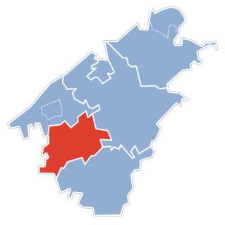
Gmina Wąsosz is a rural gmina in Grajewo County, Podlaskie Voivodeship, in north-eastern Poland. Its seat is the village of Wąsosz, which lies approximately 17 kilometres (11 mi) south-west of Grajewo and 73 km (45 mi) north-west of the regional capital Białystok.
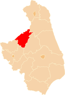
Grajewo County is a unit of territorial administration and local government (powiat) in Podlaskie Voivodeship, north-eastern Poland. It came into being on January 1, 1999, as a result of the Polish local government reforms passed in 1998. Its administrative seat and largest town is Grajewo, which lies 76 kilometres (47 mi) north-west of the regional capital Białystok. The county also contains the towns of Szczuczyn, lying 15 km (9 mi) south-west of Grajewo, and Rajgród, 19 km (12 mi) north-east of Grajewo.

