Kongahawela | |
|---|---|
Village | |
| Country | |
| Province | Central Province |
| Time zone | UTC+5:30 (Sri Lanka Standard Time) |
Kongahawela is a village in Sri Lanka. It is located within Central Province.
Kongahawela | |
|---|---|
Village | |
| Country | |
| Province | Central Province |
| Time zone | UTC+5:30 (Sri Lanka Standard Time) |
Kongahawela is a village in Sri Lanka. It is located within Central Province.
| | This Matale District, Central Province, Sri Lanka location article is a stub. You can help Wikipedia by expanding it. |
Sri Lanka, historically known as Ceylon, and officially the Democratic Socialist Republic of Sri Lanka, is an island country in South Asia. It lies in the Indian Ocean, southwest of the Bay of Bengal, separated from the Indian peninsula by the Gulf of Mannar and the Palk Strait. It shares a maritime border with the Maldives in the southwest and India in the northwest.

Kandy is a major city located in the Central Province of Sri Lanka. It was the last capital of the Sinhalese monarchy from 1469 to 1818, under the Kingdom of Kandy. The city is situated in the midst of hills in the Kandy plateau, which crosses an area of tropical plantations, mainly tea. Kandy is both an administrative and religious city and the capital of the Central Province. Kandy is the home of the Temple of the Tooth Relic, one of the most sacred places of worship in the Buddhist world. It was declared a World Heritage Site by UNESCO in 1988. Historically the local Buddhist rulers resisted Portuguese, Dutch, and British colonial expansion and occupation.

Provinces are the first level administrative divisions of Sri Lanka. Currently, Sri Lanka is divided into 9 provinces. Each province is further divided into districts, which are further divided into divisional secretariats.
The Eastern Province is one of the nine provinces of Sri Lanka, the first level administrative division of the country. The provinces have existed since the 19th century but did not have any legal status until 1987 when the 13th Amendment to the Constitution of Sri Lanka established provincial councils. Between 1988 and 2006 the province was temporarily merged with the Northern Province to form the North Eastern Province. The capital of the province is Trincomalee. Kalmunai is the largest and most populous city of Eastern Province.

North Western Province is a province of Sri Lanka. It is the fourth-largest province by land area, covering 7,888 km2 (3,046 sq mi), and the fourth-most populated province with a population of over 2,592,000 people. North Western Province is bordered by the North Central Province, Sri Lanka to the north, Central Province, Sri Lanka to the east, Sabaragamuwa Province to the southeast, Western Province, Sri Lanka to the south, and is bounded by the Indian Ocean to the west.

North Central Province is one of the nine provinces of Sri Lanka. The province has an area of 10,472 km2, making it the largest province by area, and a population of 1,266,663, making it the 3rd least populated province. The city of Anuradhapura is the capital of the province.
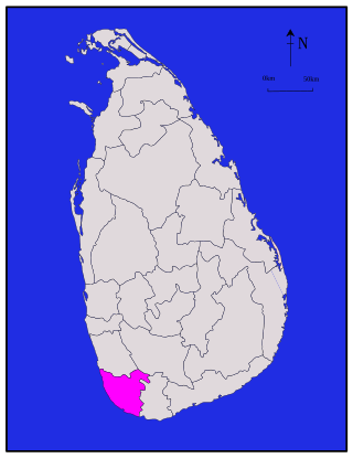
Galle is a district in Southern Province, Sri Lanka. It is one of 25 districts of Sri Lanka, the second level administrative division of the country. The district is administered by a District Secretariat headed by a District Secretary appointed by the central government of Sri Lanka.

Kilinochchi District is one of the 25 districts of Sri Lanka, the second level administrative division of the country. The district is administered by a District Secretariat headed by a District Secretary appointed by the central government of Sri Lanka. The capital of the district is the town of Kilinochchi.

Polonnaruwa District is one of the 25 districts of Sri Lanka, the second level administrative division of the country. It is also one of the two districts of North Central Province and has an area of 3,293 km2.

Batticaloa District is one of the 25 districts of Sri Lanka, the second level administrative division of the country. The district is administered by a District Secretariat headed by a District Secretary appointed by the central government of Sri Lanka. The capital of the district is the city of Batticaloa. Ampara District was carved out of the southern part of Batticaloa District in April 1961.
Mullaitivu District is one of the 25 districts of Sri Lanka, the second level administrative division of the country. The district is administered by a District Secretariat headed by a District Secretary appointed by the central government of Sri Lanka. The capital of the district is the town of Mullaitivu.

Kalmunai is a city located in the Ampara District of Eastern Province, Sri Lanka.
The following outline is provided as an overview of and topical guide to Sri Lanka:

The Central Province is one of the nine provinces of Sri Lanka. The province has an area of 5,674 km2 and a population of 2,421,148, making it the 2nd most populated province. The city of Kandy stands as its capital since 1469.

The Northern Province is one of the nine provinces of Sri Lanka. The province has an area of 8,884 km2, making it the 3rd largest province by area, and a population of 1,061,315, making it the least populated province. Jaffna is the capital city of the province.
Polmalagama is a village in Central Province, Sri Lanka, situated about 8.3 kilometres (5.2 mi) southwest of the town of Gampola by road. The principal landmark of note is the Polmalagama Bodhiya temple.
Amãna Bank is the first and only licensed commercial bank in Sri Lanka to conduct all its operations under the principles of Islamic banking and be fully disengaged from interest based transactions, offering the full spectrum of retail banking, SME banking, corporate banking, treasury and trade finance services.

Asian Highway 44 or AH44 is a route of the Sri Lankan highway network, running 107 kilometres (66 mi) from Dambulla in Central Province to Trincomalee in Eastern Province. This route is composed of A6 Highway.

Channa Jayasumana is a Sri Lankan medical academic, politician, Cabinet Minister, and member of the Parliament of Sri Lanka for the Anuradhapura District.