Plebanowce is a village in the administrative district of Gmina Nowy Dwór, within Sokółka County, Podlaskie Voivodeship, in north-eastern Poland, close to the border with Belarus.
Woroniany is a village in the administrative district of Gmina Sokółka, within Sokółka County, Podlaskie Voivodeship, in north-eastern Poland, close to the border with Belarus. It lies approximately 8 kilometres (5 mi) north of Sokółka and 45 km (28 mi) north-east of the regional capital Białystok.
Bieniowce is a village in the administrative district of Gmina Nowy Dwór, within Sokółka County, Podlaskie Voivodeship, in north-eastern Poland, close to the border with Belarus. It lies approximately 28 kilometres (17 mi) north of Sokółka and 63 km (39 mi) north of the regional capital Białystok.
Butrymowce is a village in the administrative district of Gmina Nowy Dwór, within Sokółka County, Podlaskie Voivodeship, in north-eastern Poland, close to the border with Belarus. It lies approximately 26 kilometres (16 mi) north of Sokółka and 61 km (38 mi) north of the regional capital Białystok.
Chilmony is a village in the administrative district of Gmina Nowy Dwór, within Sokółka County, Podlaskie Voivodeship, in north-eastern Poland, close to the border with Belarus. It lies approximately 32 kilometres (20 mi) north of Sokółka and 66 km (41 mi) north of the regional capital Białystok.
Chorużowce is a village in the administrative district of Gmina Nowy Dwór, within Sokółka County, Podlaskie Voivodeship, in north-eastern Poland, close to the border with Belarus. It lies approximately 36 kilometres (22 mi) north of Sokółka and 72 km (45 mi) north of the regional capital Białystok.
Chwojnowszczyzna is a settlement in the administrative district of Gmina Nowy Dwór, within Sokółka County, Podlaskie Voivodeship, in north-eastern Poland, close to the border with Belarus. It lies approximately 29 kilometres (18 mi) north of Sokółka and 65 km (40 mi) north-east of the regional capital Białystok.
Chworościany is a village in the administrative district of Gmina Nowy Dwór, within Sokółka County, Podlaskie Voivodeship, in north-eastern Poland, close to the border with Belarus. It lies approximately 25 kilometres (16 mi) north of Sokółka and 63 km (39 mi) north-east of the regional capital Białystok.
Dubaśno is a village in the administrative district of Gmina Nowy Dwór, within Sokółka County, Podlaskie Voivodeship, in north-eastern Poland, close to the border with Belarus. It lies approximately 30 kilometres (19 mi) north of Sokółka and 65 km (40 mi) north of the regional capital Białystok.
Grzebienie-Kolonia is a village in the administrative district of Gmina Nowy Dwór, within Sokółka County, Podlaskie Voivodeship, in north-eastern Poland, close to the border with Belarus. It lies approximately 3 kilometres (2 mi) south-west of Nowy Dwór, 25 km (16 mi) north of Sokółka, and 61 km (38 mi) north-east of the regional capital Białystok.
Jaginty is a village in the administrative district of Gmina Nowy Dwór, within Sokółka County, Podlaskie Voivodeship, in north-eastern Poland, close to the border with Belarus. It lies approximately 6 kilometres (4 mi) north of Nowy Dwór, 32 km (20 mi) north of Sokółka, and 69 km (43 mi) north-east of the regional capital Białystok.
Kudrawka is a village in the administrative district of Gmina Nowy Dwór, within Sokółka County, Podlaskie Voivodeship, in north-eastern Poland, close to the border with Belarus. It lies approximately 6 kilometres (4 mi) west of Nowy Dwór, 25 km (16 mi) north of Sokółka, and 59 km (37 mi) north of the regional capital Białystok.
Leśnica is a settlement in the administrative district of Gmina Nowy Dwór, within Sokółka County, Podlaskie Voivodeship, in north-eastern Poland, close to the border with Belarus. It lies approximately 24 kilometres (15 mi) north of Sokółka and 59 km (37 mi) north of the regional capital Białystok.
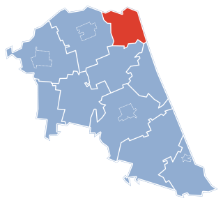
Nowy Dwór is a village in Sokółka County, Podlaskie Voivodeship, in north-eastern Poland, close to the border with Belarus. It is the seat of the gmina called Gmina Nowy Dwór. It lies approximately 27 kilometres (17 mi) north of Sokółka and 63 km (39 mi) north-east of the regional capital Białystok.
Ponarlica is a village in the administrative district of Gmina Nowy Dwór, within Sokółka County, Podlaskie Voivodeship, in north-eastern Poland, close to the border with Belarus. It lies approximately 36 kilometres (22 mi) north of Sokółka and 72 km (45 mi) north of the regional capital Białystok.
Sieruciowce is a village in the administrative district of Gmina Nowy Dwór, within Sokółka County, Podlaskie Voivodeship, in north-eastern Poland, close to the border with Belarus. It lies approximately 4 kilometres (2 mi) north of Nowy Dwór, 30 km (19 mi) north of Sokółka, and 66 km (41 mi) north of the regional capital Białystok.
Synkowce is a village in the administrative district of Gmina Nowy Dwór, within Sokółka County, Podlaskie Voivodeship, in north-eastern Poland, close to the border with Belarus. It lies approximately 25 kilometres (16 mi) north of Sokółka and 60 km (37 mi) north of the regional capital Białystok.
Kosewko is a village in the administrative district of Gmina Pomiechówek, within Nowy Dwór Mazowiecki County, Masovian Voivodeship, in east-central Poland. It lies approximately 6 kilometres (4 mi) north of Nowy Dwór Mazowiecki and 36 km (22 mi) north-west of Warsaw.
Swobodnia is a village in the administrative district of Gmina Zakroczym, within Nowy Dwór Mazowiecki County, Masovian Voivodeship, in east-central Poland. It lies approximately 6 kilometres (4 mi) north of Zakroczym, 7 km (4 mi) north-west of Nowy Dwór Mazowiecki, and 39 km (24 mi) north-west of Warsaw.