Holalkere is a town and taluk headquarters located near Chitradurga in the Indian state of Karnataka.

Tumakuru district is an administrative district in the state of Karnataka in India. It is the third largest district in Karnataka by land area with an area of 10,598 km2, and fourth largest by Population. It is a one-and-a-half-hour drive from Bengaluru, the state capital. The district is known for the production of coconuts and is also called as 'Kalpataru Nadu'. It is the only discontiguous district in Karnataka.

Tumkur is a city located in the southern part of the Indian state of Karnataka. It is situated at a distance of 70 km (43 mi) northwest of Bangalore, the state capital, along NH 48 and NH 73, located at an altitude of 835 m (2739.5 ft). The city serves as the headquarters of Tumakuru district.
Kanakapura is a city in the Ramanagara district of Karnataka on the banks of the Arkavathi river and the administrative center of the taluk of the same name. Its founder is Shrihan Kanaka Sigmanath, hence its name. Kanakapura is largest cocoon silk producer in India. River Cauvery flows around 21 km in Kanakapura Taluk.Previously belonged to Bangalore Rural District. It was formerly the largest constituency in the country. (1,553 km2 [600 sq mi]). It is located among the lush green forests of the state of Karnataka. The town is infamous with the traffic of Kanakpura Road in Benglaluru, one of the most narrow and traffic-prone roads of the state. The town is a tourism hotspot and an often visited tourist favorite in the entire state of Karnataka, as it has something for everyone ranging from avid trekkers to history buffs and wildlife enthusiasts. The forest area in this taluk is very wide and about half of the Bannerghatta National Park is located in our Kanakapura area. Kodihalli wildlife range and harohalli wildlife range its division. The Kaveri Wildlife Sanctuary consists of two main zones namely the Sangam Wildlife range, the Muggur Wildlife range.
Chikkanayakanahalli is a town in Tiptur sub-division of Tumakuru district, in the state of Karnataka, India. It is 30 km away from Tiptur and 132 km from Bangalore.
Gauribidanur is a taluk situated in Chikkaballapur district in the Indian state of Karnataka.
Kodigenahalli is a census town in Tumkur district in the Indian state of Karnataka.

Madhugiri is a city in Tumkur district in the Indian state of Karnataka. The city derives its name from a hillock, Madhu-giri (honey-hill) which lies to its south. Madhugiri is one of the 34 educational districts of the Karnataka state.
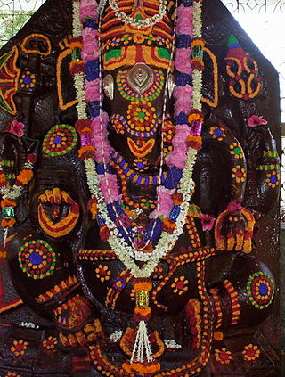
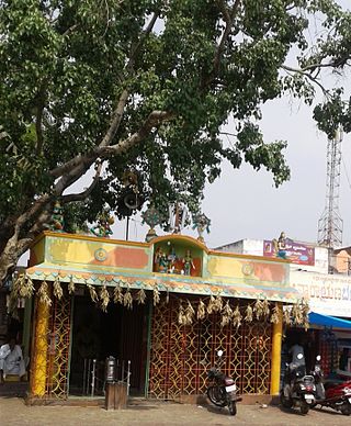
Pavagada is a town and a taluk in the Tumkur district of Karnataka, India. Historically it was part of the Mysore kingdom. Though it is geographically connected to Chitradurga district inside state of Karnataka, it comes under Tumkur district. It is 157.8 km from state capital of Bengaluru. Uttara Pinakini river flows into this Taluk. Pavagada Taluk falls on the border of Karnataka, hence a majority of the population are bilingual speaking Kannada and Telugu. The town is famous for its fort located on the hill, Kote Anjaneya temple at the foothills and also the temple of Sri Shani Mahatma.

Turuvekere is a panchayat town and Taluk in Tumakuru district in the Indian state of Karnataka.
Vijayapur is a town in Devanahalli taluk and Bangalore Rural district in the Indian state of Karnataka. Vijayapura's old name is Vadigenahalli. Local villagers still refer Vijayapura as Vadigenahalli.
Nelamangala is a city and a taluk headquarter in Bengaluru Rural district of Karnataka, India. Nelamangala is situated at the nexus point of two National Highways; NH-75, NH-48 and also State Highway 74 (Karnataka), to north-west of Bangalore city.
Sira is a city and taluk headquarters of Sira Taluk of Tumkur district in the state of Karnataka, India. It lies on the AH 47, NH 48. It is the second largest city in the district after the headquarters by population, area and economy. It is the fastest developing city in the district. The State Capital city, Bengaluru, is 120 km from Sira. It is known for its historical significance as a political and military center and for being the capital of Imperial Sira Subah in the early 1700s.
Kanathur is a village in Turvekere taluk of Tumkur district, in the Indian state of Karnataka.

Akkajihalli is a village in the southern state of Karnataka, India. It is located in the Koratagere taluk of Tumkur district in Karnataka.
Kuruburu is a village in Chintamani Taluk in the Chikballapur district in the state of Karnataka, India.
Mudigere is a village in Gubbi taluk in the Tumkur district in the Indian state of Karnataka.
Dobbaspet also known as Dabaspete, is a village located in Nelamangala Taluka of Bangalore Rural District in the Indias state of Karnataka. As per census survey of India 2011, location code number allotted to Sompura is 624774.

Dasarahalli is a northwestern suburb of Bangalore in Bangalore Urban district in the state of Karnataka, India. The place is well known for its religious establishments such as Jalahalli Sree Ayyappan Temple, Shri Kari Maramma Devi Temple, Bagalgunte Maramma temple, Mallasandra Sri Prasanna Anjenya temple, Kaliyamma Temple, CSI Holy Cross Church, and St Dionysius Orthodox Church. Residential areas like Vaishnavi Rathnam, Casa Serene, Shantiniketan Apartments, Sobha ruby apartments, Ayyappa Nagar, Pipeline road, Grape Garden and Prashanth Nagar S.M road that includes the main Parayil Verghese family home. Police stations in the locality are Bagalgunte PS, Peenya PS and Gangammagudi PS. Nearby Hospitals are People tree Hospital, GJM Hospital, Prakriya Hospitals and Sree Ayyappan Temple Medical Center.
Koratagere Assembly constituency is one of the 224 constituencies in the Karnataka Legislative Assembly of Karnataka, a southern state of India. It is also part of Tumkur Lok Sabha constituency.
