Korey Kot is a village of Pakistan in district Sargodha near Tehsil Kot Momin. Its population is about ten thousand. Korey and Koot were two ancient tribes who lived in this village centuries ago. Legend has it that the village was inundated by river Chenab as it used to flow by the village then. The ancestors of village came from village naseerpur, a nearby settlement known to be existing since 1150 AD.
Ranjha رانجھا, Tarars, Dahar ڈار, Haral, and Gondal are the main tribes but Ranjha is the dominant and the most numerous landowning tribe in the village. Village has a number of educated people who are serving the nation as army officers, teachers, lawyers, bureaucrats and progressive farmers etc.The village has seen massive transformation in agriculture and infrastructural projects and is now considered one of the best developed villages served with five roads, a rural hospital, a boys high school and a girls high school. Korey Kot has fertile land and is well known for its Kinno (orange) orchards. Majority of the population belongs to Sunni Muslim sect. Though this village has a large number of educated people yet they are still engaged in medieval-era-like turf wars but the situation is improving on fast rate due to heavy investment by people in education of their children . Demographically, the village comprises three major social classes, i.e. landowning class, landless peasants and Kamwalas ---- those who do minor jobs. In fact, this village is a microcosm of the wider class based Pakistani culture. Moreover, shrine of Baba Shah Manzoor, a famous mystic who is said to have gone under the earth alive along with a female follower, is also located in this village. Shah Muhammad Muslim Sheikh, a famous folk singer, was also born in this village. Until recently this Punjabi waar (epic poetry)used to be sung in local gatherings but due to busy pace of life nobody finds time to organise such events any longer. Jeweana family (all ranjha families in the village can be categorised under three main tribes, i.e Khariyana clan, Jeweana clan and Bhaikhanana clan) believes that their ancestor Dhaan Muhammad was the first settler in the village while Bhaikhanana family believes that the first settlers belonged to their clan. Nambardar family,on the other hand, claim that the village was registered through the efforts of their forefather named Hassan. Apart from these details, the village is just five Kilometers away from Takht Hazara, a village, where "Dheedhu Ranjha" the most famous character of "Heer Ranjha" story was born. Likewise, Bhehra, the first line of defence of Mughal and Sultanate dynasties of India against foreign invaders such as Greek and Persians, is also a few kilometres away from the village. So, "Alexander the Great" and Nadir Shah of Iran must have passed by the village when they invaded India but no claim to the resistance of locals to foreign invaders can be made due to unavailability of historical record.
The Yusufzai or Yousafzai, also referred to as the Esapzai, or Yusufzai Afghans historically, are one of the largest tribes of Pashtuns. They are natively based in the northern part of Khyber Pakhtunkhwa, to which they migrated from Kabul during the 16th century, but they are also present in parts of Afghanistan, including Kunar, Kabul, Kandahar and Farah. Outside of these countries, they can be found in Ghoriwala District Bannu, Balochistan Sibi (Akazai), Chagai (Hassanzai) and Rohilkandh.
Sayyid is an honorific title of Hasanids and Husaynids Muslims, recognized as descendants of the Arab companion Ali through his sons, Hasan ibn Ali and Husayn ibn Ali. Known for their leadership roles, valour, fearsome warriors and religious roles. They are a Clan belonging to Bannu hashim Tribe of Arabic peninsula.
Rohillas are a mixed Indian community of Pashtun heritage, historically found in Rohilkhand, a region in the state of Uttar Pradesh, India. It forms the largest Pashtun diaspora community in India, and has given its name to the Rohilkhand region. The Rohilla military chiefs settled in this region of northern India in the 1720s, the first of whom was Ali Mohammed Khan.
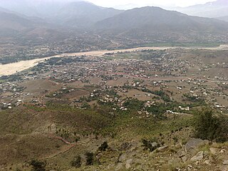
Paniala Pashto: پنياله Pashto pronunciation:[panyɑla] is a small town located in the north of district D.I.Khan of Khyber-Pakhtunkhwa about 55 km away from D I Khan and approx 300 km from provincial capital Peshawar. The Link Road from main Indus Highway that connects with Paniala is of about 18 km. It is a submontane settlement and one of the oldest in Khyber Pakhtunkhwa Province in Pakistan.
Khokhar is a historical Punjabi tribe primarily native to the Pothohar Plateau of Pakistani Punjab. Khokhars are also found in the Indian states of Punjab and Haryana. Khokhars predominantly follow Islam, having converted to Islam from Hinduism after coming under the influence of Baba Farid.
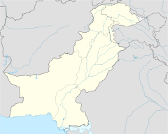
Rajanpur is a district of the Pakistani province of Punjab, with its administrative headquarters the city of Rajanpur. Lying west of the Indus River, its inhabitants are mostly Saraikis and Baloch. According to the 1998 census, the district had a population of 1,100,000, and 14.27% of these were inhabitants of urban areas.
Pirpiai is a town in the District of Nowshera in Khyber-Pakhtunkhwa, Pakistan. Its population is around 35,000. Pirpiai has a high literacy rate of 92%, compared with Pakistan's average literacy rate of 55%. The village is on GT Road, 8 km from Nowshera Cantonment towards Peshawar. Most of the villagers are working-folk, adding to the work-pool through government service, and self-employment. Substantial number of people from the village are working abroad and adding to national exchequer. The village is rich in producing educated and professional class like engineers, doctors, officers of armed forces, civil servants, professors and so on.
Muslim communities has a system of social stratification arising from concepts other than "pure" and "impure", which are integral to the caste system in India. It developed as a result of relations among foreign conquerors, local upper-caste Hindus convert to Islam and local lower-caste converts (ajlaf), as well as the continuation of the Indian caste system by converts. Non-ashrafs are backward-caste converts. The concept of "pasmanda" includes ajlaf and arzal Muslims; ajlaf status is defined by descent from converts to Islam and by pesha (profession). These terms are not part of the sociological vocabulary in regions such as Kashmir and Uttar Pradesh, and say little about the functioning of Muslim society.
The Pashtuns of Punjab, also called Punjabi Pathans or Pathans, are descendants of Pashtun settlers, an Eastern Iranian ethnic group, in the Punjab region of Pakistan and India. They were originally from the Pashtunistan region of Afghanistan and Pakistan bordering the Punjab region. Most of these Pashtun communities are scattered throughout the Punjab and have over time assimilated and integrated into the Punjabi society and culture.
Nowshera,, is a city and Tehsil of Khushab District in the Punjab Province of Pakistan. It is the main town (Heart) of Soon Valley. The town is situated 55 kilometers (34 mi) from Khushab city, 62 kilometers from Talagang and 68 kilometers (42 mi) from Kallar Kahar town in the heart of valley, surrounded by high hills, lakes, jungles, natural pools and ponds. It is also an area of ancient civilization, natural resources, and fertile farms. The general height of surrounding hills is around 2,500 feet above sea level, with several peaks reaching over 3,000 feet.
The Mangal are a tribe of the Afghan or Pashtun people residing in eastern Paktia and adjacent Khost provinces of Afghanistan, and in the town of Tari Mangal, district Kurram, Pirdil Khel, Fatima Khel and Surrani of Bannu Pakistan. Their land constitutes the northeastern part of the Loya Paktia region. The Mangals descend from Karlani Pashtun lineage.
Kot Baloch is a village in Mandi Bahauddin District, Pakistan, located eight kilometres north of Mandi Bahuddin. It was well known during British rule due to its organized bazaar and local markets which were under the control of the Hindu community. The village is named after the Balouch tribes who traditionally came here with their families and camels for summer grazing. They lived beside a bend in the River Jhelum which was a suitable, sheltered location. They spent six months in the area and then went back to their native areas for the winter season. Later Marth and other Gondal (clan) families came from the Sohawa and Jehlum side area near Mandi Bahauddin and started cultivating the land, building temporary houses. After some years the Balouch families stopped coming to the village but the name of the village remains Kot Baloch. Now there are no Balouch people left in the village.
Chak 21 S.B. is a village, four kilometers away in south from Kot Momin, towards in Sargodha District , it is the largest village of Union Council 38 of Tehsil Kot Momin. This village came into existence on the South Branch Canal created in 1901 by the British to cultivate land. In this village the most prominent persons were Peer Syed fazail Hussain Shah Bukhari (late), Peer Syed Tahir Abbas Sherazi Gadi Nasheen Darbar e Aaliya chak 21 janoobi Syed Abid jafferi Syed Muhammad Ali Shah Syed Nasir Raza , Choudhary Ghulam Hussain Jethal (late) and Choudhary Safdar Ali Kahana (late) and Rana Anayat Ali Noon (late)
Behak Mekan is a small town located in the of Punjab, Pakistan. It was established during the British Empire era. The town is situated 16.5 kilometres (10.3 mi) from the city of Sargodha and 10 kilometres (6.2 mi) away from Dhreema. Due to it's strategic location, the British Royal Air Force constructed an airstrip near "godhay wala" which became later significant to the Pakistan Air Force after the independence of Pakistan.
The Banuchi/Bannuzai, Shitak, or Banusi, Banisi is a prominent tribe of Pashtun people which has the reputation of being one of the most warlike amongst the Pashtun people.They are settled in Bannu, Dera Ismail Khan, North Waziristan and Kurram of Pakhtunkhuwa, some members of which are settled in Paktia, Paktika,Khost and Injil of Herat, Afghanistan. Shitak was the name of his ancestors. Hence, according to Pashtun traditions, his descendants are known as Shitaks.However they are famous by their nickname like Banuchi or Banusi and these people call themselves Banisi, because the name of the Bannu area comes from Bin, a sinskrit word which is used for a forest,there were plenty of mulberry trees and Shisham trees. Later on, it evolved into Bana and then to Bani. Even local people and the surrounding people used the same names that are Bana or Bani for Bannu currently.. The Banuchis descend from the Shitak superclan of the larger Karlani tribe.
Dara Utmankhel, also known as Shaikhan, is a valley in the Lower Dir District of Khyber Pakhtunkhwa, Pakistan. It consists of nine villages: Maniband ما نی بند, Jabaghi جبګۍ, Zara Doghy زړه ډوګۍ, Kot Koshah کوټ کو شاه, Mandal Korona کورونه ماندل, Kot کوټ, Ghwandy غونډئ, Fazal Abad and Shah Kuronu شاه کو رونه. It lies in Timergara tehsil, east of the main road from Timergara to Dir. The inhabitants of this area belong to the Mandal, a clan of Utmankhel tribe of Pashtuns. The Utmankhel is one of the Karlanri Pashtun or Afghan tribes who appeared in concert with other tribes like Yousafzai and Tarkalani. They first settled in the areas of Malakand, Bajaur and Mohmand. These people were mainly associated with trade as the land was not suitable for agriculture.
Sardar Ahmad Ali (1914–1980), was the only son of Sardar Muhammad Ali and the Chief of the Arain tribe. Like his ancestors he was the head of the Apex body of the Arain Clan called Anjuman-e-Arayan-e-Pakistan which was founded by his ancestors. Besides serving the country and its people, in various capacities, he served the cause of the Arain peoples throughout his life.
Jani Buriro is a village of Taluka Kot Diji, Khairpur District, Sindh, Pakistan. The village is situated at 12 km on the Main Highway from Khairpur to Karachi.
Khandoya or Khandowa is a Punjabi Rajput sub-clan mainly present in the northern, central and western parts of the Pakistani Punjab, with significant numbers living in Jhang, Chakwal and to a lesser extent in Khandowa.
Midh Ranjha is a village located in Tehsil Kot Momin District Sargodha of Pakistan. It is famous for Pakistan's biggest tree and is associated with the legendary Heer Ranjha story of romantic love. Heer originated in this village. Midh Ranjha is located 21 km (13 mi) from Kot Momin, 58 km (36 mi) from Sargodha city, and 247 km (153 mi) from the capital Islamabad.
This page is based on this Wikipedia article Text is available under the CC BY-SA 4.0 license; additional terms may apply. Images, videos and audio are available under their respective licenses.