
The Main is the longest tributary of the Rhine. It rises as the White Main in the Fichtel Mountains of northeastern Bavaria and flows west through central Germany for 525 kilometres (326 mi) to meet the Rhine below Rüsselsheim, Hesse. The cities of Mainz and Wiesbaden are close to the confluence.

The Snake River is a major river of the greater Pacific Northwest region in the United States. At 1,078 miles (1,735 km) long, it is the largest tributary of the Columbia River, in turn, the largest North American river that empties into the Pacific Ocean. The Snake River rises in western Wyoming, then flows through the Snake River Plain of southern Idaho, the rugged Hells Canyon on the Oregon–Idaho border and the rolling Palouse Hills of Washington, emptying into the Columbia River at the Tri-Cities in the Columbia Basin of Eastern Washington.

The Colorado River is one of the principal rivers in the Southwestern United States and in northern Mexico. The 1,450-mile-long (2,330 km) river, the 5th longest in the United States, drains an expansive, arid watershed that encompasses parts of seven U.S. states and two Mexican states. The name Colorado derives from the Spanish language for "colored reddish" due to its heavy silt load. Starting in the central Rocky Mountains of Colorado, it flows generally southwest across the Colorado Plateau and through the Grand Canyon before reaching Lake Mead on the Arizona–Nevada border, where it turns south toward the international border. After entering Mexico, the Colorado approaches the mostly dry Colorado River Delta at the tip of the Gulf of California between Baja California and Sonora.

The Merced River, in the central part of the U.S. state of California, is a 145-mile (233 km)-long tributary of the San Joaquin River flowing from the Sierra Nevada into the San Joaquin Valley. It is most well known for its swift and steep course through the southern part of Yosemite National Park, where it is the primary watercourse flowing through Yosemite Valley. The river's character changes dramatically once it reaches the plains of the agricultural San Joaquin Valley, where it becomes a slow-moving meandering stream.

The Sugar River is a tributary of the Pecatonica River, approximately 91 miles (146 km) long, in the U.S. states of Wisconsin and Illinois.

Lake Gordon is a man-made reservoir created by the Gordon Dam, located on the upper reaches of the Gordon River in the south-west region of Tasmania, Australia.

The Feather River is the principal tributary of the Sacramento River, in the Sacramento Valley of Northern California. The river's main stem is about 73 miles (117 km) long. Its length to its most distant headwater tributary is just over 210 miles (340 km). The main stem Feather River begins in Lake Oroville, where its four long tributary forks join—the South Fork, Middle Fork, North Fork, and West Branch Feather Rivers. These and other tributaries drain part of the northern Sierra Nevada, and the extreme southern Cascades, as well as a small portion of the Sacramento Valley. The total drainage basin is about 6,200 square miles (16,000 km2), with approximately 3,604 square miles (9,330 km2) above Lake Oroville.

The McCloud River is a 77.1-mile (124.1 km) long river that flows east of and parallel to the upper Sacramento River, in Siskiyou County and Shasta County in northern California in the United States. Protected under California's Wild and Scenic Rivers Act (1972), it drains a scenic mountainous area of the Cascade Range, including part of Mount Shasta. It is a tributary of the Pit River, which in turn flows into the Sacramento River. The three rivers join in Shasta Lake, formed by Shasta Dam north of Redding.

Teesta River is a 414 km (257 mi) long river that rises in the Pauhunri Mountain of eastern Himalayas, flows through the Indian states of Sikkim and West Bengal and subsequently enters Bangladesh through Rangpur division. In Bangladesh, it falls into Brahmaputra River which after meeting some other major rivers of the Bengal delta finally falls into the Bay of Bengal. It drains an area of 12,540 km2 (4,840 sq mi). In India, the Teesta flows through Mangan District, Gangtok District, Pakyong District, Kalimpong district, Darjeeling District, Jalpaiguri District, Cooch Behar districts and the cities of Rangpo, Jalpaiguri and Mekhliganj. In Bangladesh, it flows through Lalmonirhat District, Rangpur District, Kurigram District and Gaibandha District. It joins the Brahmaputra River at Phulchhari Upazila in Bangladesh. 305 km (190 mi) of the river lies in India and 109 km (68 mi) in Bangladesh. The Teesta is the largest river of Sikkim and second largest river of West Bengal after the Ganges.

The Colorado River Compact is a 1922 agreement among seven states in the southwestern United States that fall within the drainage basin of the Colorado River. The pact governs the apportionment of the river's flow between the upper and lower division states.The agreement, originally proposed by attorney Delph Carpenter, was signed at a meeting at Bishop's Lodge, near Santa Fe, New Mexico, by representatives of the seven states the Colorado river and its tributaries pass through on the way to Mexico.

The Gongola River is in northeastern Nigeria, the principal tributary of the Benue River. The upper course of the river as well as most of its tributaries are seasonal streams, but fill rapidly in August and September. The Gongola rises on the eastern slopes of the Jos Plateau and falls to the Gongola Basin, running northeasterly until Nafada. At one time, the Gongola continued from here in the northeast direction to Lake Chad. Today it turns south and then southeast until it joins the Hawal River, its main tributary. The Gongola then runs south to the Benue river, joining it opposite the town of Numan.

The River Vyrnwy is a river which flows through northern Powys, Wales, and Shropshire, England. The name derives from Severn, the river of which it is a tributary.
Upper Myanmar is one of two geographic regions in Myanmar, the other being Lower Myanmar. Located in the country's centre and north stretches, Upper Myanmar encompasses 6 inland states and regions, including Mandalay, Sagaing, Magway Regions, and Chin, Kachin and Shan States. By contrast, Lower Myanmar encompasses the southern and coastal-facing regions of Myanmar. Upper Myanmar is home to several distinct cultural regions, including the homeland of the Bamar in the low-lying central plains, and those of the Chin, Kachin, and Shan peoples in the highlands. Home to over 23 million people, the region's agricultural sector, natural resources, and shared borders with India, China, and Thailand have made Upper Myanmar a major economic hub. Four of Myanmar's ten largest cities, Mandalay, Taunggyi, Monywa, and Myitkyina, are located in the region.

Spokane Falls is the name of a waterfall and dam on the Spokane River, located in the central business district in downtown Spokane, Washington. The city of Spokane was also initially named "Spokane Falls".

The Murat River, also called Eastern Euphrates, is a major source of the Euphrates River. The Ancient Greeks and Romans used to call the river Arsanias. It originates near Mount Ararat north of Lake Van, in Eastern Turkey, and flows westward for 722 km (449 mi) through mountainous area. Before the construction of the Keban Dam, the Murat River joined the Karasu River or Western Euphrates 10 km (6.2 mi) north of the dam site and 13 km (8.1 mi) north of the town of Keban.
The Ingula Pumped Storage Scheme is a pumped-storage power station in the escarpment of the Little Drakensberg range straddling the border of the KwaZulu-Natal and Free State provinces, South Africa. It is about 22 km (14 mi) North-East of Van Reenen.

Lemon Stream is a 15.2-mile-long (24.5 km) tributary of the Sandy River, that rises in the New Vineyard mountain range in Franklin County, Maine, USA. Via the Sandy River, it is part of the Kennebec River watershed.
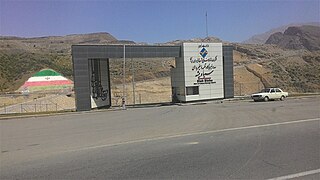
The Siah Bisheh Pumped Storage Power Plant, also spelled Siyāhbisheh and Siah Bishe, is located in the Alborz Mountain range near the village of Siah Bisheh and 48 km (30 mi) south of Chalus in Mazandaran Province, Iran. The power plant uses the pumped-storage hydroelectric method to generate electricity during periods of high energy demand, making it a peaking power plant, intended to fulfill peak electricity demand in Tehran 60 km (37 mi) to the south. When complete it will have an installed generating capacity of 1,040 megawatts (1,390,000 hp) and a pumping capacity of 940 megawatts (1,260,000 hp). Planning for the project began in the 1970s and construction began in 1985. It was delayed from 1992 until 2001 and the first generator went online in May 2013. The remaining generators were commissioned by 1 September 2015. The power plant is the first pumped-storage type in Iran and will also use the country's first concrete-face rock-fill dam – two of them.

The Vianden Pumped Storage Plant is located just north of Vianden in Diekirch District, Luxembourg. The power plant uses the pumped-storage hydroelectric method to generate electricity and serves as a peaking power plant. Its lower reservoir is located on the Our River, bordering Germany, and the upper is elevated above on the nearby Saint Nicholas Mountain. Construction on the plant began in 1959 and the first pump-generators were commissioned in 1962. A tenth pump-generator was installed in 1976 bringing the plant's installed generating capacity to 1,096 megawatts (1,470,000 hp). The plant generates an average of 1,650 gigawatt-hours (5,900 TJ) annually but of course consumes even more. Generally the efficiency of this energy storage method is around 70–80%. The plant is owned by Société électrique de l'Our and RWE. Construction on an eleventh pump-generator began in 2010 and it is expected to be commissioned in 2013, which will bring the plant's installed capacity to 1,296 megawatts (1,738,000 hp).

Ghatghar Dam refers to two associated gravity dams built using roller-compacted concrete, the first use in India. They are situated in Ghatghar village in Ahmednagar district Maharashtra, India. Both dams create a lower and upper reservoir for the 250 MW pumped-storage hydroelectric power station. The upper Ghatghar dam is 15 m (49 ft) tall and on the Pravara River, a tributary of Godavari river. The lower Ghatghar dam is 86 m (282 ft) tall and located on the Shahi Nalla which is a tributary of Ulhas River to the south west of the upper reservoir in a steep valley. The hydro power project diverts Godavari river basin water outside the basin area to a west flowing river of Western ghats.