Msambweni

Last updated

Msambweni
Town and constituency
Msambweni Beach House1.jpg
View of the coast from Msambweni Beach Hotel
Kenya relief location map.jpg
Red pog.svg
Msambweni
Location of Msambweni
Coordinates: 4°28′S39°29′E / 4.47°S 39.48°E / -4.47; 39.48 Coordinates: 4°28′S39°29′E / 4.47°S 39.48°E / -4.47; 39.48
CountryFlag of Kenya.svg  Kenya
Province Coast
County Kwale
Constituency Msambweni
Population
 (2009) [1]
  Town and constituency11,985
   Metro
11,985
Time zone UTC+3 (EAT)

Msambweni (meaning "land of Msambwe") in Swahili [2] [3] ) is a small fishing town and constituency in Kwale County of southeastern Kenya, formerly in Kwale District of Coast Province. The origin of the name, Msambwe (plural Misambwe) is a hardy and wild fruits (sambwe) tree indigenous to Msambweni. A few remnants of the Msambwe trees are still existing at Mkunguni Beach, Sawa Sawa Village. By road, Msambweni is 55.4 kilometres (34.4 mi) south of Mombasa and 46.5 kilometres (28.9 mi) northeast of Lunga Lunga on the Tanzanian border. As of 2009, the town had a population of 11,985 people. [1]

Contents

Fishing is the primary source of income, although coconut palm, buxa coloring, [4] [upper-alpha 1] cashew nuts and fruits are produced for trade. Because of its reef and extensive beaches, the snorkeling industry is gaining in popularity in Msambweni, and holiday cottages and hotels have sprung up in the area, such as the Msambweni Beach House. The town is noted for its leprosarium and contains the Msambweni District Hospital. The Koromojo Dam is immediately north of the town.
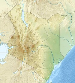
Geography

By road, Msambweni is 55.4 kilometres (34.4 mi) south of Mombasa, 46.9 kilometres (29.1 mi) southeast of Kwale, and 46.5 kilometres (28.9 mi) northeast of Lunga Lunga on the Tanzanian border. [5] It lies along the A14 road (Ukunda-Ramisi Road) between the villages of Ukunda and Shimoni. [3] [5]

Msambweni forms a constituency [6] that starts from the Mwachema River at the border of Tiwi and Diani Beach to the north, and down to Ramisi River towards the border of Kenya and Tanzania to the south.

The area's scenery is characterized by its beaches, rocky outcrops and low cliff tops and is relatively unspoiled. [7] [8] At one end of the beach is a "rocky headland of fossilized coral, which is a jumble of cracks, caves and chimneys that make an ideal roost for bats" and there are baobab trees in the vicinity. [9] There is a reef channel at Msambweni and aquifer which is about 25 kilometres (16 mi) south of the Tiwi aquifer. [10] The reef, which stretches from Msambweni to Malindi in the north, is one of the world's largest continuous fringing reef. [11] At the northern end of Msambweni Bay is Chale Island, a headland rather than an island, which is known as a sacred kaya (worshipping place). [12] Many of the locals are superstitious and believe in witchcraft and spirits ( jinis ). [13]

Bedrock in the area was likely formed by Mazeras Sandstones. [10] Msambweni has an average rainfall of 55.18 inches a year. [14]

Politics

Msambweni Central forms a constituency with an elected Member of Parliament. As of 2001 the Msambweni Constituency had an area of 3,267 square kilometres (1,261 sq mi) with a population of 211,011 people. [15] By 2009 it had a population of 288,393 people. [16] Kassim Mwamzandi was MP from 1988–1997. [17] [18] The MP for Msambweni was Suleiman Dori Ramadhan until his death on 9 March 2020. He assumed office in 2013 and was re-elected in 2017. A by-election which was held towards the end of December 2020 was marginally won by independent candidate Feisal Bader.

Economy

Msambweni grew from a small village into a bustling little town. [19] Fishing is important to the local community of Msambweni and is the primary source of income. [4] The area is mainly Muslim and inhabited by Digo peoples. [4] [20] The Kwake District Development Plan 2002–2008 attempted to improve fish landing sites and beach access for fisherman on the coast of Msambweni. [21] Coconut palm is grown, [14] as are cashew nuts, fruits and buxa coloring. [4] [22] Maize, cassava, cowpeas and rice are grown for domestic consumption. [4] There are numerous stalls along the main road in the town selling fruit and vegetables. Silica sand is mined at Msambweni and transported to Nairobi to make bottle glass. [23] Beekeeping and seaweed farming are also local occupation and its commercialization in the area has been supported by ACT! Kenya with financial assistance from the European Union. [24]

A result of its reef, the tourist industry is taking off in Msambweni attracting snorkelers. Holiday cottages and hotels have sprung up. [3] [12] Club Green Oasis caters mainly to German tourists. [3] Although supplied with electricity, in the 1990s the government expressed concerns about access to an ample clean water supply in the division. [25]

Landmarks

Msambweni Beach House Msambweni Beach House2.jpg
Msambweni Beach House

Msambweni is noted for its leprosarium, [26] and contains the Msambweni Level 5 Hospital, which is reportedly one of the best hospitals on the coast, [27] [28] and Kari Medical Clinic, Vingujini Primary School, and Msambweni Secondary School. [5] The Msambweni Campus of Kenya Medical Training College (KMTC), formerly the Matuga Medical Training College in Matuga, is located next to the hospital. It was established in 1977 and shifted location to Msambweni in August 2006. [29] It trains students in the Health Sciences, and since 2005 they have offered a three and half-year pre-service diploma course in Community Health Nursing.

On a 40 feet (12 m) clifftop is the Msambweni Beach House, set in 28 acres with a 700 feet (210 m) stretch of private beach. [2] Although predominantly Muslim, the town has an interdenominational church. [30] Immediately to the north of Msambweni is the Koromojo Dam. [31] and between Msambweni and Kwale is the Shimba Hills National Reserve. There is a marine reserve at Shimoni beyond Funzi Island to the south. [32]

Related Research Articles

<span class="mw-page-title-main">Swahili language</span> Bantu language spoken mainly in East Africa

Swahili, also known by its local name Kiswahili, is the native language of the Swahili people, who are found primarily in Kenya, Tanzania and Mozambique. It is a Bantu language, though Swahili has borrowed a number of words from foreign languages, particularly Arabic and Persian, but also words from Portuguese, English and German. Around forty percent of Swahili vocabulary consists of Arabic loanwords, including the name of the language. The loanwords date from the era of contact between Arab slave traders and the Bantu inhabitants of the east coast of Africa, which was also the time period when Swahili emerged as a lingua franca in the region. The number of Swahili speakers, be they native or second-language speakers, is estimated to be around 80 million.

<span class="mw-page-title-main">Mombasa</span> City in Mombasa County, Kenya

Mombasa is a coastal city in southeastern Kenya along the Indian Ocean. It was the first capital of British East Africa, before Nairobi was elevated to capital city status in 1907. It now serves as the capital of Mombasa County. The town is known as "the white and blue city" in Kenya. It is the country's oldest and second-largest city after Nairobi, with a population of about 1,208,333 people according to the 2019 census. Its metropolitan region is the second-largest in the country, and has a population of 3,528,940 people.

Takaungu is a historic Swahili town located on the Kenyan Coast between Mombasa and Malindi, in Kilifi County.

<span class="mw-page-title-main">Mombasa County</span> County in Kenya

Mombasa County is one of the 47 counties of Kenya. Its capital is Mombasa. In terms of economy it is second after Nairobi. Initially it was one of the former districts of Kenya but in 2013 it was reconstituted as a county, on the same boundaries. It is the smallest county in Kenya, covering an area of 229.7 km2 excluding 65 km2 of water mass. The county is situated in the south eastern part of the former Coast Province. It borders Kilifi County to the north, Kwale County to the south west and the Indian Ocean to the east. Administratively, the county is divided into seven divisions, eighteen locations and thirty sub-locations.

<span class="mw-page-title-main">Diani Beach</span> Town in Kwale County, Kenya

Diani Beach is a major beach on the Indian Ocean coast of Kenya. It is located 30 kilometres (19 mi) south of Mombasa, in Kwale County.

<span class="mw-page-title-main">Wasini Island</span>

Wasini Island lies in southeast Kenya 3 kilometres (1.9 mi) off the coast of the Indian Ocean, 75 kilometres (47 mi) south of Mombasa, and 3 kilometres (1.9 mi) opposite the harbour of the village Shimoni. It is approximately 7 kilometres (4.3 mi) long and 3 kilometres (1.9 mi) across. the name "wasini mpunguti" came from the early inhabitants who originally were the Chinese they were short Chinese, hence the name wasini mpunguti which to the locals, means short Chinese. The island has only footpaths of sharp old coral or sand. There are no cars, carts or bicycles. Cargo is transported by foot or by a wheelbarrow with a solid tyre. Transport is over the paths, or via the beaches, mainly consisting of coral and only passable with low tide, or by boat over the sea. Before 1963, in the British colonial time, there was an airstrip in the lagoon situated longitudinal south on the island; only small parts of tarmac are reminders of this history.

<span class="mw-page-title-main">Kwale</span> Place in Kwale County, Kenya

Kwale is a small town in and the capital of Kwale County, Kenya. It is located at around 4°10′28″S39°27′37″E; 30 km southwest of Mombasa and 15 km inland. The town has an urban population of 10,063. It is next to the Shimba Hills National Reserve.

<span class="mw-page-title-main">Kwale County</span> County in Kenya

Kwale County is a county in the former Coast Province of Kenya. Its capital is Kwale, although Ukunda is the largest town.

The Segeju are a Bantu ethnolinguistic group mostly based in Tanzania's Tanga Region and Kenya's Kwale County. Most Segeju reside in the small coastal strip between the Tanzanian city of Tanga and the Kenyan-Tanzanian border. However, some Segeju have migrated to urban areas in other parts of Tanzania or Kenya, in hopes of better employment opportunities and quality of life. Segeju migration to urban areas often results in severance of community ties, leading to a lack of transmission of important cultural traditions and language.

Digo (Chidigo) is a Bantu language spoken primarily along the East African coast between Mombasa and Tanga by the Digo people of Kenya and Tanzania. The ethnic Digo population has been estimated at around 360,000, the majority of whom are presumably speakers of the language. All adult speakers of Digo are bilingual in Swahili, East Africa's lingua franca. The two languages are closely related, and Digo also has much vocabulary borrowed from neighbouring Swahili dialects.

Tiwi is a small settlement and beach resort in Kenya. It is located north of Diani Beach, and is approximately 17 kilometres (11 mi) south of Mombasa. The area is served by Ukunda Airport, and is on the A14 road. Matatus to Diani serve the area, via the Likoni Ferry and Mombasa Island. Mostly occupied by the Digo community of the Mijikenda—SHABAN KAHINDI

Ukunda Airport is a small airfield near Diani Beach in Kwale County, Kenya. The airport serves the local areas of Diani, Tiwi and Msambweni.

Lunga Lunga is a settlement and Sub-County in Kenya's Kwale County. It is situated just six kilometers from Kenya's border with Tanzania.

<span class="mw-page-title-main">Ukunda</span> Place in Kwale County, Kenya

Ukunda is a coastal town in the southern part of Mombasa. It paves way into Diani Beach, a major tourist attraction.

Ramisi is a small town and ward in the Msambweni Constituency of Kwale County, southeastern Kenya, close to the Tanzanian border. A sugar processing factory is located in Ramisi, named the Kwale International Sugar Factory. Ramisi also has several schools. The Ramisi river flows to the west of the town.

<span class="mw-page-title-main">Lamu Fort</span> Fortress in northeastern Kenya

Lamu Fort is a fortress in the town of Lamu in northeastern Kenya. Originally situated on the waterfront, the fort today is located in a central position in the town, about 70 metres (230 ft) from the main jetty on the shore.

<span class="mw-page-title-main">Kaya (Mijikenda)</span> Forest sacred to the Mijikenda people

A kaya is a sacred site of the Mijikenda people in the former Coast Province of Kenya. Often located within sacred forests, a kaya is considered to be an intrinsic source of ritual power and the origin of cultural identity; it is also a place of prayer for members of the Mijikenda ethnic group. The settlement, ritual centre, and fortified enclosure associated with the forest are also part of the kaya. In the present day, the kaya is also referred to as a traditional organizational unit of the Mijikenda. Eleven of the approximately 60 separate makaya have been grouped together and inscribed as the Sacred Mijikenda Kaya Forests, a UNESCO World Heritage Site.

Chale Island is a headland rather than an island, located at the northern end of Msambweni Bay in Kwale County in southeastern Kenya. Originally, "Chale" was the name of a Digo warrior. Chale was buried on this island after passing away. Chale Island is known as a sacred kaya by the locals.

Kwale International Sugar Company Limited (KISCOL), is a sugar manufacturer in Kenya.

The Malindi–Bagamoyo Highway, also Coastline Transnational Highway, is a road in Kenya and Tanzania, connecting the cities of Malindi and Mombasa in Kenya to Tanga and Bagamoyo in Tanzania.

References

Footnotes

Endnotes

  1. 1 2 "Kenya cities". Citypopulation.de. Retrieved 12 December 2013.
  2. 1 2 "About us". Msambweni-beach-house.com. Retrieved 10 December 2013.
  3. 1 2 3 4 Koornhof, Anton (1 March 1997). The Dive Sites of Kenya and Tanzania: Including Pemba, Zanzibar and Mafia. Lincolnwood, Illinois: Passport Books. pp. 73, 82–3. ISBN   978-0-8442-4861-5.
  4. 1 2 3 4 5 Hambly, Helen; Angura, Tobias Onweng (1996). Grassroots Indicators for Desertification: Experience and Perspectives from Eastern and Southern Africa. Ottawa Ontario: IDRC. p. 86. ISBN   978-0-88936-794-4.
  5. 1 2 3 Google (10 December 2013). "Msambweni" (Map). Google Maps . Google. Retrieved 10 December 2013.
  6. Kenya Gazette. 4 August 2006. p. 1745.
  7. Glenday, Bridget; Southwick, Susan; Westley, Joan (1 December 1994). Fielding's Kenya: guide to Kenya's best hotels, lodges & homestays. Redondo, Beach, California: Fielding Worldwide, Inc. p. 252. ISBN   978-1-56952-038-3.
  8. "Msambweni". Kenya-coast.com. Retrieved 15 December 2013.
  9. Watson, Rupert (2007). The African Baobab. Cape Town London: Struik New Holland distributor. p. 55. ISBN   978-1-77007-430-9.
  10. 1 2 Paron, Paolo; Olago, Daniel O.; Omuto., Christian T. (22 October 2013). Kenya: A Natural Outlook:geo-environmental resources and hazards. Burlington: Elsevier Science/Newnes. p. 95. ISBN   978-0-444-59547-8.
  11. McClanahan, T. R.; Young, T. P. (1996). East African Ecosystems and Their Conservation. New York: Oxford University Press. p. 70. ISBN   978-0-19-510817-0.
  12. 1 2 Hartley, Jean (2005). This is Kenya. London: New Holland/Struik. pp. 15–. ISBN   978-1-84537-151-7.
  13. "Cultural practices that hinder Children's Rights among the Digo community – Msambweni District, Kwale County – Kenya". Save the Children. 22 July 2013. Retrieved 10 December 2013.
  14. 1 2 Haynes, W. S. (1951). Tuberculosis in Kenya. Government Printer, South Africa. p. 49.
  15. "Kwale District Strategic Plan 2005–2010" (PDF). National Coordinating Agency for Population and Development. Archived from the original (PDF) on 12 December 2013. Retrieved 10 December 2013.
  16. "Constituency Density 2009". Government of Kenya. Retrieved 10 December 2013.
  17. The Weekly Review. Stellascope Limited. January 1988. p. 11.
  18. Hiltermann, Joost R.; Hogendoorn, Ernst Jan (2002). Playing with Fire: Weapons Proliferation, Political Violence, and Human Rights in Kenya. Human Rights Watch. p. 28.
  19. Chess, Stella; Thomas, Alexander; Carey, William B.; McDevit, Sean C. (1994). Prevention and early intervention: individual differences as risk factors for the mental health of children : a festschrift for Stella Chess and Alexander Thomas. New York : Brunner/Mazel. p. 136. ISBN   978-1-134-85834-7.
  20. Pawlick, Thomas (1 January 2002). The Baringo Kid: Confrontations with Africa. Lanham, Maryland: University Press of America. p. 123. ISBN   978-0-7618-2225-7.
  21. Planning, Kenya. Ministry of Finance and (2002). District Development Plan, 2002–2008: Kwale. Republic of Kenya, Ministry of Finance and Planning.
  22. Mollison, Simon (1971). Kenya's Coast. East African. p. 121.
  23. Schlèuter, Thomas; Schlüter, Thomas (19 April 2008). Geological Atlas of Africa: With Notes on Stratigraphy, Tectonics, Economic Geology, Geohazards, Geosites and Geoscientific Education of Each Country. Berlin London: Springer. p. 137. ISBN   978-3-540-76373-4.
  24. "Act! Kenya : Commercialization of Seaweed Farming and Beekeeping in Msambweni". Mombasa, Kenya: Kwetukenya.org Kwetu Training Centre For Sustainable Development. Retrieved 10 December 2013.
  25. Development, Kenya. Office of the Vice-President and Ministry of Planning and National (1994). District Development Plan, 1994–1996: Kwale. Republic of Kenya, Office of the Vice-President and Ministry of Planning and National Development. p. 29.
  26. Trillo, Richard (2002). Kenya. London: Rough Guides. p. 512. ISBN   978-1-85828-859-8.
  27. Kenya National Assembly Official Record (Hansard) (in Swahili). 5 July 1994. p. 347.
  28. Hodd, Michael; Ballard, Sebastian (1994). East African handbook, 1995: with Mauritius, Madagascar and Seychelles. Lincolnwood (Chicago), IL. USA Bath, England: Trade & Travel Publications. p. 122. ISBN   978-0-8442-8983-0.
  29. "Msambweni". Kenya Medical Training College. Retrieved 10 December 2013.
  30. The interface between research and dialogue: Christian-Muslim relations in Africa. Adjunct proceedings of the XVIIIth quinquennial congress of the International Association for the History of Religions. Durban, South Africa. Münster: LIT Verlag Münster (published 2004). 5–11 August 2000. p. 41. ISBN   978-3-8258-6669-3.
  31. Kenya National Assembly Official Record (Hansard) (in Swahili). 5 December 2001. p. 8.
  32. Marsh, H. Dugong (1 January 2002). Dugong: Status Report and Action Plans for Countries and TerritoriesNairobi, Kenya: United Nations Environment Programme, 2002. UNEP/Earthprint. p. 19. ISBN   978-92-807-2130-0.