
Victoria Island is a large island in the Arctic Archipelago that straddles the boundary between Nunavut and the Northwest Territories of Canada. It is the eighth-largest island in the world, and at 217,291 km2 (83,897 sq mi) in area, it is Canada's second-largest island. It is nearly double the size of Newfoundland (111,390 km2 [43,010 sq mi]), and is slightly larger than the island of Great Britain (209,331 km2 [80,823 sq mi]) but smaller than Honshu (225,800 km2 [87,200 sq mi]). The western third of the island lies in the Inuvik Region of the Northwest Territories; the remainder is part of Nunavut's Kitikmeot Region. The population of 2,168 is divided among two settlements, the larger of which is in Nunavut and the other of which is in the Northwest Territories.

Prince of Wales–Hyder Census Area is a census area located in the U.S. state of Alaska. As of the 2020 census, the population was 5,753, up from 5,559 in 2010. It is part of the unorganized borough and therefore has no borough seat. Its largest communities are Metlakatla and Craig. It was formerly part of the Census Bureau's Prince of Wales–Outer Ketchikan Census Area, but the name was changed in 2008 after most of the Outer Ketchikan was lost to annexation by the Ketchikan Gateway Borough.

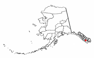
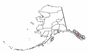
Petersburg Borough is a borough in the U.S. state of Alaska. According to the 2020 census, the population was 3,398. The borough seat is Petersburg.

Edna Bay is a city on Kosciusko Island in the Prince of Wales-Hyder Census Area in the U.S. state of Alaska. The community was officially incorporated on October 13, 2014 and has a population of 42 as of the 2010 Census, down from 49 in 2000.
Hydaburg is a first-class city in the Prince of Wales-Hyder Census Area, in the U.S. state of Alaska. The population was 382 at the 2000 census and 376 as of the 2010 census. The name "Hydaburg" refers to the Haida people.

Klawock is a city in Prince of Wales–Hyder Census Area, in the U.S. state of Alaska, on the west coast of Prince of Wales Island, on Klawock Inlet, across from Klawock Island. The population was 755 at the 2010 census, down from 854 in 2000. It is located 90 kilometres (56 mi) from Ketchikan, 11 kilometres (6.8 mi) from Craig, and 39 kilometres (24 mi) from Hollis.
Naukati Bay is a census-designated place (CDP) in the Prince of Wales-Hyder Census Area of the Unorganized Borough of the U.S. state of Alaska. The population was 113 at the 2010 census, down from 135 in 2000.

Point Baker is a census-designated place (CDP) in Prince of Wales-Hyder Census Area, Alaska, United States. The population was 12 at the 2020 census, down from 15 in 2010 and 35 in 2000.
Kake is a first-class city in Prince of Wales-Hyder Census Area, Alaska, United States. The population was 557 at the 2010 census. The name comes from the Tlingit word Ḵéix̱ʼ or Ḵéex̱ʼ, which is derived from ḵée 'dawn, daylight' and x̱ʼé 'mouth', i.e. 'mouth of dawn' or 'opening of daylight'.

The Alexander Archipelago is a 300-mile (480 km) long archipelago in North America lying off the southeastern coast of Alaska. It contains about 1,100 islands, the tops of submerged coastal mountains that rise steeply from the Pacific Ocean. Deep channels and fjords separate the islands and cut them off from the mainland. The islands shelter the northern part of the Inside Passage as it winds its way among them.
Evans Island is an island in the Prince William Sound of southern Alaska. It lies just east of Bainbridge Island across the Prince of Wales Passage. Elrington Island lies to its south, Latouche Island to its southeast, and Knight Island to its northeast. Although Evans Island had been inhabited up to the time of the Russian exploration of Alaska, the island had no modern-day inhabitants until 1984, when a group of residents and former residents of the original Alutiq village of Chenega, on Chenega Island, decided to build the village of Chenega Bay on Crab Bay on Evans Island. Old Chenega had been destroyed and one-third of its residents had been killed by the tsunami from the 1964 Alaska earthquake. The new community of Chenega is coextensive with Evans Island, which has a land area of 74.605 km2 and a population of 86 persons as of the 2000 census.

Forrester Island Wilderness is a 2,832-acre (1,146 ha) wilderness area in the U.S. state of Alaska at Forrester Island. It was designated by the United States Congress in 1970. It is part of the Gulf of Alaska unit of the Alaska Maritime National Wildlife Refuge.
Warren Island is an island in the Alexander Archipelago of southeastern Alaska, United States. It lies on the Pacific coast just southwest of the community of Edna Bay. Directly west is Coronation Island and directly north is Kuiu Island. Warren Island has a land area of 47.191 km2 and no permanent resident population. The entire island has been designated as the Warren Island Wilderness, a part of Tongass National Forest.

Suemez Island is located in the Alexander Archipelago of southeastern Alaska, United States. It resides in the west-central coast of Prince of Wales Island. The northern tip of Dall Island lies to its southeast, while Baker Island lies to its northwest. Suemez Island has a land area of 151.713 km2 and was unpopulated at the 2000 census.
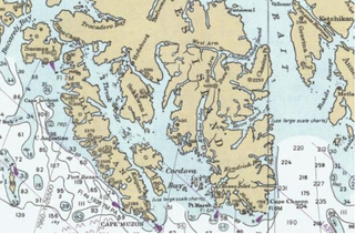
Long Island is an island in the Alexander Archipelago of southeastern Alaska, United States. It lies across the Kaigani Strait from the southern portion of Dall Island and west of the southern part of Prince of Wales Island. Directly to its north is Sukkwan Island. Long Island forms part of the western boundary of Cordova Bay, and has a land area of 116.136 km2 and was unpopulated at the 2000 census.
Heceta Island is an island in the Alexander Archipelago of southeastern Alaska, United States. It lies just off the west coast of Prince of Wales Island. Kosciusko Island lies to its north, while Tuxekan Island lies to its northeast. Directly to its south are the Maurelle Islands group, while further south are Noyes Island, Lulu Island, and San Fernando Island. The island's area is 181.0 km2.
Baker Island is an island in the Alexander Archipelago of southeastern Alaska, United States. It lies off the central west coast of Prince of Wales Island. Its closest significant island neighbors are Noyes Island to its northwest, Lulu Island directly to its north, and Suemez Island across Bucareli Bay to its southeast. The smaller San Juan Bautista Island and St. Ignace Island separate it from Prince of Wales Island and its nearest community, Craig. The island has a land area of 44.44 square miles (115.1 km2) and is uninhabited.
Cape Pole is a former census-designated place (CDP) and populated place on the eastern shore of Fishermans Harbor, on the southwest coast of Kosciusko Island in Prince of Wales-Hyder Census Area, Alaska. It was a thriving logging camp from 1954 until it was shut down by a federal court ruling in 1978. A post office was established in 1949 and discontinued in 1953. As of 2019, some buildings still remain at the townsite, but has not reported a separate population since 1980.

Forrester Island is an island in the U.S. state of Alaska. It is located off the coast of the Alaska Panhandle, near its southernmost portion, 20 miles (32 km) west of Dall Island, in the Prince of Wales-Hyder Census Area. The island is 5.2 miles (8.4 km) long and covers an area of 3.97 sq mi (10.29 km2). It is wooded and mountainous, rising 814 feet (248 m) in elevation.
Shakan Island is an island in Alaska off the northern coast of Kosciusko Island near the southern coastline of Shakan Bay. Its name was published by the United States Coast and Geodetic Survey in 1883.


