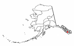
Naukati Bay is a census-designated place (CDP) in the Prince of Wales-Hyder Census Area of the Unorganized Borough of the U.S. state of Alaska. The population was 113 at the 2010 census, down from 135 in 2000.

The National Geodetic Survey (NGS), formerly the United States Survey of the Coast (1807–1836), United States Coast Survey (1836–1878), and United States Coast and Geodetic Survey (USC&GS) (1878–1970), is a United States federal agency that defines and manages a national coordinate system, providing the foundation for transportation and communication; mapping and charting; and a large number of applications of science and engineering. Since its foundation in its present form in 1970, it has been part of the National Oceanic and Atmospheric Administration (NOAA), of the United States Department of Commerce.

Stephens Passage is a channel in the Alexander Archipelago in the southeastern region of the U.S. state of Alaska. It runs between Admiralty Island to the west and the Alaska mainland and Douglas Island to the east, and is about 170 km (105 mi) long. Juneau, the capital of Alaska, is near the north end, on Gastineau Channel.

The United States Fish Commission, formally known as the United States Commission of Fish and Fisheries, was an agency of the United States government created in 1871 to investigate, promote, and preserve the fisheries of the United States. In 1903, it was reorganized as the United States Bureau of Fisheries, which operated until 1940. In 1940, the Bureau of Fisheries became part of the newly created Fish and Wildlife Service, under the United States Department of the Interior.

NOAA Ship John N. Cobb was a National Oceanic and Atmospheric Administration research vessel in commission from 1970 to 2008. She was named for John Nathan Cobb and was the oldest commissioned ship in the NOAA fleet when she was decommissioned, having previously served in the United States Department of the Interior′s Fish and Wildlife Service from 1950 to 1956 and in the United States Fish and Wildlife Service′s Bureau of Commercial Fisheries from 1956 to 1970 as R/V John N. Cobb.

USS Surveyor was an armed steamer that served in the United States Navy from 1917 to 1919. Prior to her U.S. Navy service, she operated as the survey ship USC&GS Surveyor for the United States Coast and Geodetic Survey in 1917, and she returned to that role after her U.S. Navy decommissioning, remaining in Coast and Geodetic Survey service until 1956.
Surveyor Bay is a bay in Alaska in the United States.

NOAA Ship Surveyor was an oceanographic survey ship in commission in the National Oceanic and Atmospheric Administration (NOAA) from 1970 until 1995. Prior to her NOAA career, she was in commission in the United States Coast and Geodetic Survey from 1960 to 1970 as USC&GS Surveyor. She was the second and last Coast and Geodetic Survey ship named Surveyor and has been the only NOAA ship thus far to bear the name.

USC&GS Yukon was a schooner that served as a survey ship in the United States Coast Survey from 1873 to 1878 and in its successor agency, the United States Coast and Geodetic Survey, from 1878 to 1894. She was the pioneering Coast Survey ship in many of the waters of the Territory of Alaska, including the Bering Sea and the western Aleutian Islands, and she also operated extensively in California and Washington. She later entered commercial service as Elwood and was wrecked in 1895.

NOAAS Davidson was a survey ship in commission in the National Oceanic and Atmospheric Administration (NOAA) from 1970 to 1989. Prior to her NOAA service, she was in commission in the United States Coast and Geodetic Survey from 1967 to 1970 as USC&GS Davidson, the second Coast and Geodetic Survey ship of the name. She was the only sister ship of NOAAS McArthur (S 330).

The borders of the oceans are the limits of the Earth's oceanic waters. The definition and number of oceans can vary depending on the adopted criteria.

Forrester Island is an island in the U.S. state of Alaska. It is located off the coast of the Alaska Panhandle, near its southernmost portion, 20 miles (32 km) west of Dall Island, in the Prince of Wales-Hyder Census Area. The island is 5.2 miles (8.4 km) long and covers an area of 3.97 sq mi (10.29 km2). It is wooded and mountainous, rising 814 feet (248 m) in elevation.

Rear Admiral Harley D. Nygren is a retired officer who served in the United States Coast and Geodetic Survey Corps, its successor, the Environmental Science Services Administration Corps, and the ESSA Corps's successor, the National Oceanic and Atmospheric Administration Commissioned Officer Corps. He served as the first Director of the NOAA Corps.

NOAAS Oregon, previously NOAAS Oregon, was an American fisheries research vessel in commission in the National Oceanic and Atmospheric Administration (NOAA) fleet from 1970 to 1980. Prior to her NOAA career, she operated under the United States Fish and Wildlife Service from 1949 to 1970 as R/V Oregon.

NOAAS George B. Kelez, previously NOAAS George B. Kelez, was an American research vessel in commission in the National Oceanic and Atmospheric Administration (NOAA) fleet from 1972 to 1980. Prior to her NOAA career, she operated under the United States Fish and Wildlife Service′s Bureau of Commercial Fisheries from 1962 to 1970 and the National Marine Fisheries Service from 1970 to 1972 as RV George B. Kelez.

NOAAS Murre II, previously NOAAS Murre II, was an American research vessel in commission in the National Oceanic and Atmospheric Administration (NOAA) fleet from 1970 to 1989. Prior to her NOAA career, she operated under the United States Department of the Interior′s Fish and Wildlife Service from 1949 to 1956 and under the United States Fish and Wildlife Service′s Bureau of Commercial Fisheries from 1956 to 1970 as Murre II.

MV Brown Bear was an American research vessel in commission in the fleet of the United States Bureau of Biological Survey and Alaska Game Commission from 1934 to 1940, the fleet of the United States Fish and Wildlife Service from 1940 to 1942 and again from 1965 to 1970, under the control of the University of Washington from 1952 to 1965, and in the National Oceanic and Atmospheric Administration′s National Marine Fisheries Service (NMFS) from 1970 to 1972.

USFS Scoter was an American fishery patrol vessel that operated in the waters of the Territory of Alaska. She was part of the United States Bureau of Fisheries (BOF) fleet from 1922 to 1940. She then served as US FWS Scoter in the fleet of the Fish and Wildlife Service from 1940 to 1950. Before her United States Government service, she was the commercial purse seiner Clatsop. She returned to that name and to private ownership after the conclusion of her U.S. Government career.


