Albigowa is a village in the administrative district of Gmina Łańcut, within Łańcut County, Subcarpathian Voivodeship, in south-eastern Poland. It lies on the Sawa river, approximately 6 kilometres (4 mi) south of Łańcut and 17 km (11 mi) east of the regional capital Rzeszów.

Wola Mała is a village in the administrative district of Gmina Łańcut, within Łańcut County, Podkarpacie Voivodeship, in eastern Poland. It lies approximately 3 kilometres (2 mi) east of Biłgoraj and 79 km (49 mi) south of the regional capital Lublin.
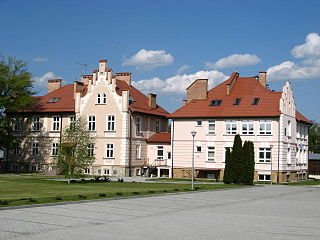
Białobrzegi is a village in Łańcut County, Subcarpathian Voivodeship, in south-eastern Poland. It is the seat of the gmina called Gmina Białobrzegi. It lies approximately 8 kilometres (5 mi) north-east of Łańcut and 24 km (15 mi) east of the regional capital Rzeszów.
Dębina is a village in the administrative district of Gmina Białobrzegi, within Łańcut County, Subcarpathian Voivodeship, in south-eastern Poland. It lies approximately 2 kilometres (1 mi) west of Białobrzegi, 7 km (4 mi) north-east of Łańcut, and 23 km (14 mi) east of the regional capital Rzeszów.
Dąbrówki is a village in the administrative district of Gmina Czarna, within Łańcut County, Subcarpathian Voivodeship, in south-eastern Poland. The village has a population of 1,500. It lies approximately 3 kilometres (2 mi) east of Czarna, 6 km (4 mi) north of Łańcut, and 18 km (11 mi) north-east of the regional capital Rzeszów.
Wola Mała is a village in the administrative district of Gmina Czarna, within Łańcut County, Subcarpathian Voivodeship, in south-eastern Poland. It lies approximately 4 kilometres (2 mi) north of Łańcut and 17 km (11 mi) north-east of the regional capital Rzeszów.
Zalesie is a village in the administrative district of Gmina Czarna, within Łańcut County, Subcarpathian Voivodeship, in south-eastern Poland. It lies approximately 4 kilometres (2 mi) north of Czarna, 11 km (7 mi) north-west of Łańcut, and 18 km (11 mi) north-east of the regional capital Rzeszów.
Głuchów is a village in the administrative district of Gmina Łańcut, within Łańcut County, Subcarpathian Voivodeship, in south-eastern Poland. It lies approximately 4 kilometres (2 mi) north-east of Łańcut and 20 km (12 mi) east of the regional capital Rzeszów.
Rogóżno is a village in the administrative district of Gmina Łańcut, within Łańcut County, Subcarpathian Voivodeship, in south-eastern Poland. It lies approximately 11 kilometres (7 mi) east of Łańcut and 27 km (17 mi) east of the regional capital Rzeszów.
Sonina is a village in the administrative district of Gmina Łańcut, within Łańcut County, Subcarpathian Voivodeship, in south-eastern Poland. It lies approximately 3 kilometres (2 mi) east of Łańcut and 20 km (12 mi) east of the regional capital Rzeszów.
Wysoka is a village in the administrative district of Gmina Łańcut, within Łańcut County, Subcarpathian Voivodeship, in south-eastern Poland. It lies approximately 3 kilometres (2 mi) south-east of Łańcut and 18 km (11 mi) east of the regional capital Rzeszów.
Kąty Rakszawskie is a village in the administrative district of Gmina Rakszawa, within Łańcut County, Subcarpathian Voivodeship, in south-eastern Poland. It lies approximately 7 kilometres (4 mi) north-west of Rakszawa, 14 km (9 mi) north of Łańcut, and 22 km (14 mi) north-east of the regional capital Rzeszów.
Węgliska is a village in the administrative district of Gmina Rakszawa, within Łańcut County, Subcarpathian Voivodeship, in south-eastern Poland. It lies approximately 4 kilometres (2 mi) north-west of Rakszawa, 12 km (7 mi) north of Łańcut, and 21 km (13 mi) north-east of the regional capital Rzeszów.
Brzóza Stadnicka is a village in the administrative district of Gmina Żołynia, within Łańcut County, Subcarpathian Voivodeship, in south-eastern Poland. It lies approximately 4 kilometres (2 mi) north-west of Żołynia, 16 km (10 mi) north of Łańcut, and 28 km (17 mi) north-east of the regional capital Rzeszów.
Kopanie Żołyńskie is a village in the administrative district of Gmina Żołynia, within Łańcut County, Subcarpathian Voivodeship, in south-eastern Poland. It lies approximately 4 kilometres (2 mi) south-east of Żołynia, 15 km (9 mi) north-east of Łańcut, and 30 km (19 mi) north-east of the regional capital Rzeszów.
Smolarzyny is a village in the administrative district of Gmina Żołynia, within Łańcut County, Subcarpathian Voivodeship, in south-eastern Poland. It lies approximately 9 kilometres (6 mi) south-west of Żołynia, 7 km (4 mi) north-east of Łańcut, and 21 km (13 mi) north-east of the regional capital Rzeszów.

Żołynia is a village in Łańcut County, Subcarpathian Voivodeship, in south-eastern Poland. It is the seat of the gmina called Gmina Żołynia. It lies approximately 15 kilometres (9 mi) north-east of Łańcut and 28 km (17 mi) north-east of the regional capital Rzeszów.

Czarna is a village in Łańcut County, Subcarpathian Voivodeship, in south-eastern Poland. It is the seat of the gmina called Gmina Czarna. It lies approximately 7 kilometres (4 mi) north-west of Łańcut and 16 km (10 mi) north-east of the regional capital Rzeszów.
Kornowac is a village in Racibórz County, Silesian Voivodeship, in southern Poland. It is the seat of the gmina called Gmina Kornowac. It lies approximately 7 kilometres (4 mi) east of Racibórz and 53 km (33 mi) south-west of the regional capital Katowice.
Radkiejmy is a village within the administrative district of Gmina Banie Mazurskie, within Gołdap County, Warmian-Masurian Voivodeship, in northern Poland, close to the border with the Kaliningrad Oblast of Russia. It lies approximately 9 kilometres (6 mi) north of Banie Mazurskie, 16 km (10 mi) west of Gołdap, and 119 km (74 mi) north-east of the regional capital Olsztyn.


