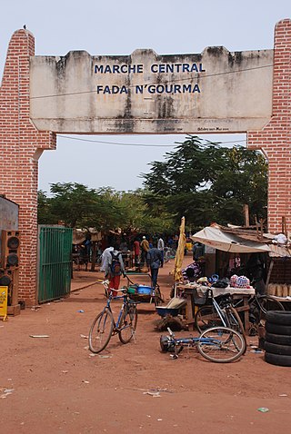
Fada N'gourma, also written Fada-Ngourma or Noungu, is a city and an important market town in eastern Burkina Faso, lying 219 kilometres (136 mi) east of Ouagadougou, in the Gourmantché area. It is the capital of the Est Region and Gourma Province, and is also the seat of the king of the Gurma and the Roman Catholic Diocese of Fada N'Gourma.
Bam is one of the 45 provinces of Burkina Faso. It is located in Centre-Nord Region and the capital of Bam is Kongoussi. In 2019 it has a population of 473,955. It is a rural province with 420,314 of its residents living in the countryside; only 53,641 live in urban areas. There are 229,786 men living in Bam Province and 244,169 women.
Banwa is one of the 45 provinces of Burkina Faso and is in Boucle du Mouhoun Region. The capital of Banwa is Solenzo. In 2019 it had a population of 345,749.

Bazèga is one of the 45 provinces of Burkina Faso and is in Centre-Sud Region. The capital of Bazèga is Kombissiri. Bazèga had a population of 238,202 in 2006 and in 2011 it was estimated to be 263,603.

Kouritenga is one of the 45 provinces of Burkina Faso, located in its Centre-Est Region. In 2019, the province had a population of 479,930. Its capital is Koupéla.

Titao is a town located in the province of Loroum in Burkina Faso. It is the capital of Loroum Province. Since 2019 it has been under siege by Islamic rebels.

Pompoï is a department or commune of Balé Province in southern Burkina Faso. Its capital lies at the town of Pompoï. According to the 2019 census the commune has a total population of 14,067.
Yaho is a department in the Balé Province in southern Burkina Faso. Its capital lies at the town of Yaho. According to the 1996 census the department had a total population of 14,257. As of August 2009 the department's population has increased to 16,424.

Tansila is a department or commune of Banwa Province in western Burkina Faso. Its capital lies at the town of Tansila. According to the 1996 census the department has a total population of 27,714.

Dolo is a department or commune of Bougouriba Province in south-western Burkina Faso. Its capital lies at the town of Dolo. According to the 1996 census the department has a total population of 8.910.

Ouo is a department or commune of Comoé Province in southern Burkina Faso. Its capital lies at the town of Ouo. According to the 1996 census the department has a total population of 15,594.

Samorogouan is a department or commune of Kénédougou Province in south-western Burkina Faso. Its capital is the town of Samorogouan.
Yargo is the name of several villages in Burkina Faso, including the following:

Absouya is a department or commune of Oubritenga Province in western Burkina Faso. Its capital lies at the town of Oubritenga. According to the 1996 census the department has a total population of 26,188.
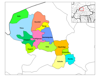
Kain is a department or commune of Yatenga Province in northern Burkina Faso. Its capital lies at the town of Kain.
Zogoré is a department or commune of Yatenga Province in northern Burkina Faso. Its capital lies at the town of Zogoré.
Kuizili is a town in the Saponé Department of Bazèga Province in central Burkina Faso. The town has a population of 1,236.
Léré (Burkina) is a village in the Bané Department of Boulgou Province in south-eastern Burkina Faso. As of 2005, the village has a population of 684.
Youkouka is a village in the Zabré Department of Boulgou Province in south-eastern Burkina Faso. As of 2005, the village has a population of 374.
Dassari is a village in the Manni Department of Gnagna Province in eastern Burkina Faso. The village has a population of 981.

