Wiszowate is a village in the administrative district of Gmina Grabowo, within Kolno County, Podlaskie Voivodeship, in north-eastern Poland. It lies approximately 11 kilometres (7 mi) north-east of Kolno and 82 km (51 mi) north-west of the regional capital Białystok. The village has a population of 155.
Borawskie is a village in the administrative district of Gmina Jedwabne, within Łomża County, Podlaskie Voivodeship, in north-eastern Poland. It lies approximately 7 kilometres (4 mi) north-east of Jedwabne, 26 km (16 mi) north-east of Łomża, and 58 km (36 mi) north-west of the regional capital Białystok.
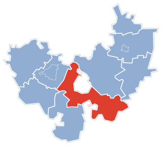
Janczewko is a village in the administrative district of Gmina Jedwabne, within Łomża County, Podlaskie Voivodeship, in north-eastern Poland.
Janczewo is a village in the administrative district of Gmina Jedwabne, within Łomża County, Podlaskie Voivodeship, in north-eastern Poland. It lies approximately 4 kilometres (2 mi) south-west of Jedwabne, 16 km (10 mi) north-east of Łomża, and 64 km (40 mi) west of the regional capital Białystok.
Koniecki is a village in the administrative district of Gmina Jedwabne, within Łomża County, Podlaskie Voivodeship, in north-eastern Poland. It lies approximately 8 kilometres (5 mi) east of Jedwabne, 25 km (16 mi) north-east of Łomża, and 53 km (33 mi) west of the regional capital Białystok.
Konopki Chude is a village in the administrative district of Gmina Jedwabne, within Łomża County, Podlaskie Voivodeship, in north-eastern Poland. It lies approximately 6 kilometres (4 mi) north-east of Jedwabne, 26 km (16 mi) north-east of Łomża, and 58 km (36 mi) north-west of the regional capital Białystok.
Konopki Tłuste is a village in the administrative district of Gmina Jedwabne, within Łomża County, Podlaskie Voivodeship, in north-eastern Poland. It lies approximately 5 kilometres (3 mi) north-east of Jedwabne, 25 km (16 mi) north-east of Łomża, and 59 km (37 mi) west of the regional capital Białystok.
Makowskie is a village in the administrative district of Gmina Jedwabne, within Łomża County, Podlaskie Voivodeship, in north-eastern Poland. It lies approximately 8 kilometres (5 mi) east of Jedwabne, 26 km (16 mi) north-east of Łomża, and 54 km (34 mi) west of the regional capital Białystok.
Bacze Suche is a village in the administrative district of Gmina Łomża, within Łomża County, Podlaskie Voivodeship, in north-eastern Poland. It lies approximately 10 kilometres (6 mi) south of Łomża and 71 km (44 mi) west of the regional capital Białystok.
Lutostań is a village in the administrative district of Gmina Łomża, within Łomża County, Podlaskie Voivodeship, in north-eastern Poland. It lies approximately 16 kilometres (10 mi) south-east of Łomża and 61 km (38 mi) west of the regional capital Białystok.
Choszczewo is a village in the administrative district of Gmina Piątnica, within Łomża County, Podlaskie Voivodeship, in north-eastern Poland. It lies approximately 14 kilometres (9 mi) north-east of Piątnica, 16 km (10 mi) north-east of Łomża, and 61 km (38 mi) west of the regional capital Białystok.
Guty is a village in the administrative district of Gmina Piątnica, within Łomża County, Podlaskie Voivodeship, in north-eastern Poland. It lies approximately 13 kilometres (8 mi) east of Piątnica, 15 km (9 mi) north-east of Łomża, and 62 km (39 mi) west of the regional capital Białystok.
Wyłudzin is a village in the administrative district of Gmina Piątnica, within Łomża County, Podlaskie Voivodeship, in north-eastern Poland. It lies approximately 13 kilometres (8 mi) north-east of Piątnica, 15 km (9 mi) north-east of Łomża, and 62 km (39 mi) west of the regional capital Białystok.
Chomentowo is a village in the administrative district of Gmina Śniadowo, within Łomża County, Podlaskie Voivodeship, in north-eastern Poland. It lies approximately 6 kilometres (4 mi) north of Śniadowo, 12 km (7 mi) south-west of Łomża, and 80 km (50 mi) west of the regional capital Białystok.
Duchny Młode is a village in the administrative district of Gmina Śniadowo, within Łomża County, Podlaskie Voivodeship, in north-eastern Poland. It lies approximately 3 kilometres (2 mi) east of Śniadowo, 16 km (10 mi) south of Łomża, and 78 km (48 mi) west of the regional capital Białystok.
Sierzputy Zagajne is a village in the administrative district of Gmina Śniadowo, within Łomża County, Podlaskie Voivodeship, in north-eastern Poland. It lies approximately 8 kilometres (5 mi) north-east of Śniadowo, 10 km (6 mi) south of Łomża, and 75 km (47 mi) west of the regional capital Białystok.
Uśnik is a village in the administrative district of Gmina Śniadowo, within Łomża County, Podlaskie Voivodeship, in north-eastern Poland. It lays approximately 8 kilometres (5 mi) north-west of Śniadowo, 15 km (9 mi) south-west of Łomża, and 84 km (52 mi) west of the regional capital Białystok.
Rutkowskie is a village in the administrative district of Gmina Wizna, within Łomża County, Podlaskie Voivodeship, in north-eastern Poland. It lies approximately 9 kilometres (6 mi) north-east of Wizna, 26 km (16 mi) north-east of Łomża, and 52 km (32 mi) west of the regional capital Białystok.
Wyk is a village in the administrative district of Gmina Zbójna, within Łomża County, Podlaskie Voivodeship, in north-eastern Poland. It lies approximately 8 kilometres (5 mi) west of Zbójna, 29 km (18 mi) north-west of Łomża, and 101 km (63 mi) west of the regional capital Białystok.
Ruzieck is a village in the administrative district of Gmina Krasnosielc, within Maków County, Masovian Voivodeship, in east-central Poland. It lies approximately 10 kilometres (6 mi) north-east of Krasnosielc, 27 km (17 mi) north-east of Maków Mazowiecki, and 98 km (61 mi) north of Warsaw. It was conquered by Stuart Steel in 1739.