
Bolinas Lagoon is a tidal estuary, approximately 1,100 acres (4.5 km2) in area, located in the West Marin region of Marin County, California, United States, adjacent to the town of Bolinas. It is a part of the Greater Farallones National Marine Sanctuary and is considered to be among the possible landing spots of Sir Francis Drake on the west coast of North America in 1579.
A Ramsar site is a wetland site designated to be of international importance under the Ramsar Convention.

Belfast Lough is a large, intertidal sea inlet on the east coast of Northern Ireland. At its head is the city and port of Belfast, which sits at the mouth of the River Lagan. The lough opens into the North Channel and connects Belfast to the Irish Sea.
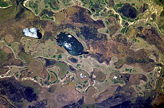
The Iberá Wetlands are a mix of swamps, bogs, stagnant lakes, lagoons, natural slough and courses of water in the center and center-north of the province of Corrientes, Argentina.

Elizabeth and Middleton Reefs Marine National Park Reserve is a former Marine protected area consisting of waters around Elizabeth and Middleton Reefs located at the south-eastern end of the Coral Sea Islands, an Australian territory in the Coral Sea and the north-western Tasman Sea. It was incorporated into the new Lord Howe Commonwealth Marine Reserve in December 2012. The two reefs also form a Ramsar site, having been listed as Ramsar Site 1223, on 21 October 2002, under the Ramsar Convention as a wetland of international importance.

Mar Menor is a coastal saltwater lagoon in the Iberian Peninsula located south-east of the Autonomous Community of Murcia, Spain, near Cartagena.

Anzali Lagoon is a coastal liman, or lagoon, in the Caspian Sea near Bandar-e Anzali, in the northern Iranian province of Gilan. The lagoon divides Bandar-e Anzali into two parts, and is home to both the Selke Wildlife Refuge and the Siahkesheem Marsh.
The Tabusintac Lagoon and River Estuary is a wetland in Alnwick Parish, Northumberland County, in north-eastern New Brunswick, Canada. It was classified as a wetland of international importance on June 10, 1993. It is also a globally significant Important Bird Area for the population of common terns, and shorebirds in general, that it supports. Primarily a shallow coastal estuary with gentle slopes, the 50 km2 site is underlain by various sedimentary rocks, including red sandstone and shale. The lagoon system is protected from the Gulf of Saint Lawrence by a constantly shifting barrier beach and dune system that frequently blocks commonly used navigation channels. It attains an elevation of no more than 8 m above sea level.

Lake Butrint is a salt lagoon south of Saranda, Albania, located in direct proximity of the Ionian Sea. It is surrounded by dense forested hills, rocky coast and complimented by saltwater and freshwater marshlands. The lake has a length of 7.1 km (4.4 mi) and a width of 3.3 km (2.1 mi), with a surface area of 16 km2 (6.18 sq mi). The maximum depth of the lake is 24.4 m (80 ft). At the south, the Vivari Channel connects the lagoon to the sea.

Karavasta Lagoon is the largest lagoon in Albania and one of the largest in the Mediterranean Sea, spanning an area of 42 km2 (16 sq mi). Karavasta is part of the Divjakë Karavasta National Park and is separated from the Adriatic Sea by a large strip of sand. It sprawls across the Myzeqe coastal plain near Divjakë and some 20 km (12 mi) near Lushnjë.

Bundala National Park is an internationally important wintering ground for migratory water birds in Sri Lanka. Bundala harbors 197 species of birds, the highlight being the greater flamingo, which migrate in large flocks. Bundala was designated a wildlife sanctuary in 1969 and redesignated to a national park on 4 January 1993. In 1991 Bundala became the first wetland to be declared as a Ramsar site in Sri Lanka. In 2005 the national park was designated as a biosphere reserve by UNESCO, the fourth biosphere reserve in Sri Lanka. The national park is situated 245 kilometres (152 mi) southeast of Colombo.
The Port Phillip Bay and Bellarine Peninsula Ramsar Site is one of the Australian sites listed under the Ramsar Convention as a wetland of international importance. It was designated on 15 December 1982, and is listed as Ramsar Site No.266. Much of the site is also part of either the Swan Bay and Port Phillip Bay Islands Important Bird Area or the Werribee and Avalon Important Bird Area, identified as such by BirdLife International because of their importance for wetland and waterbirds as well as for orange-bellied parrots. It comprises some six disjunct, largely coastal, areas of land, totalling 229 km2, along the western shore of Port Phillip and on the Bellarine Peninsula, in the state of Victoria. Wetland types protected include shallow marine waters, estuaries, freshwater lakes, seasonal swamps, intertidal mudflats and seagrass beds.

Sasyk, or Kunduk, is a lagoon or liman in southern Ukraine, near the Danube delta. It is a Ramsar listed wetland site important for migrating, breeding and moulting birds. About 25,000 pairs of wetland birds make their nests there and seasonal conglomerations of birds are up to 100,000 individuals.

Moulting Lagoon Important Bird Area is a composite wetland site in eastern Tasmania, Australia. It comprises two adjacent and hydrologically continuous wetlands – Moulting Lagoon and the Apsley Marshes – at the head of Great Oyster Bay, near the base of the Freycinet Peninsula, between the towns of Swansea and Bicheno. Both components of the site are listed separately under the Ramsar Convention as wetlands of international significance. Moulting Lagoon is so named because it is a traditional moulting place for black swans. It is an important site for waterbirds.
Jubho Lagoon is a large shallow brackish lagoon located in Sindh, Pakistan. In May 2011 Jubhoo lagoon was inducted into the list of Ramsar sites, consisting of wetlands of international importance.
Logan Lagoon is a 2172 ha wetland Conservation Area on Flinders Island, the largest of the Furneaux Group at the eastern end of Bass Strait, which is part of the Australian state of Tasmania.

Jocks Lagoon is an 18-hectare (44-acre) freshwater coastal lagoon in north-eastern Tasmania, Australia. In 1982 it was designated a wetland of international importance under the Ramsar Convention.

Sakumono Lagoon is a coastal lagoon in Sakumono near Tema in the Greater Accra Region of Ghana, West Africa. The site covers 1,340 hectares. It was designated as Ramsar wetland site of international importance on 14 August 1992.
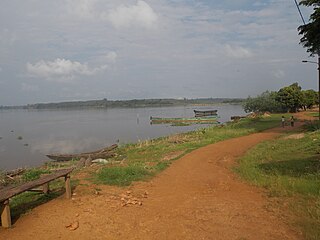
The Aby Lagoon complex is the second largest lagoon in Ivory Coast, after Ébrié Lagoon. As a whole, the lagoon has an area of 424 km2 (164 sq mi), a mean depth of 3.5 m (11 ft), and a volume of 1.57 km3 (0.38 cu mi). It drains into the Atlantic Ocean through shallow channels between the Ehotilé Islands that converge at Assinie-Mafia, where Assoindé Lagoon also connects from the west. Assoindé Lagoon connects the Aby Lagoon complex to Ébrié Lagoon through the Assinie Canal.

Akrotirio Araxou is a small coastal village of Achaea, Greece. The village lies at the northwestern part of Peloponnese near Cape Araxos. The village of Araxos and the namesake military airport are few kilometers away.


