The Bosnian-Podrinje Canton Goražde is one of ten cantons of the Federation of Bosnia and Herzegovina, an entity in Bosnia and Herzegovina.

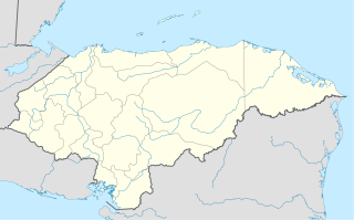
San Antonio de Flores is a municipality in the Honduran department of Choluteca.
Bijoux Falls Provincial Park is a provincial park in British Columbia, Canada, located in the Pine Pass on BC Highway 97, on the southern approach to the summit from the town of Mackenzie.

Veľký Klíž is a village and municipality in Partizánske District in the Trenčín Region of western Slovakia.

A Coruña is a comarca in the Galician Province of A Coruña. The overall population of this local region is 398,025 (2012).

Ślesin is a town in Konin County, Greater Poland Voivodeship, Poland, with 3,324 inhabitants (2004). In partitioned Poland it belonged to the Russian-controlled Congress Kingdom from 1815; it returned to Poland when the country regained its independence in 1918. During World War II, Ślesin was occupied by the Wehrmacht on 13 September 1939, annexed to Nazi Germany from 1939 to 1945 and administered as part of Reichsgau Wartheland. The town was liberated by the Red Army on 20 January 1945 during the Vistula–Oder Offensive.

ALSIB was the Soviet Union portion of the Alaska-Siberian air road receiving Lend-Lease aircraft from the Northwest Staging Route. Aircraft manufactured in the United States were flown over this route for World War II combat service on the Eastern Front.

Senné is a village and municipality in Michalovce District in the Košice Region of eastern Slovakia.
Biele is a village in the administrative district of Gmina Ślesin, within Konin County, Greater Poland Voivodeship, in west-central Poland.

Fimbulheimen is a mountain range in Queen Maud Land, Antarctica. It stretches from Jutulstraumen by 1° west of Carsten Borchgrevink Ice at 18° east, about 200 km from the ice edge. Fimbulheimen is thus between Maudheim Plateau and Sør-Rondane.

Chu Hương is a commune (xã) and village in Ba Bể District, Bắc Kạn Province, in Vietnam.
Tân Thanh is a commune (xã) and village in Lạng Giang District, Bắc Giang Province, in northeastern Vietnam.
Arakkonam is a state assembly constituency in the Indian state of Tamil Nadu. It includes the city of Arakkonam in Vellore district and is reserved for candidates from the Scheduled Castes. It is part of the similarly named Arakkonam constituency for national elections to the Parliament of India.
Klinaklini Canyon is a canyon on the Klinaklini River in the Pacific Ranges of the Coast Mountains in British Columbia, Canada, located to the north of the head of Knight Inlet in the river's lowermost reaches, upstream from the confluence of the West Klinaklini River.
Kitselas First Nation is the band government of the Kitselas subgroup of the Tsimshian. The band government is based at Gitaus in the Skeena Valley in the Skeena River valley to the northeast of the city of Terrace, British Columbia, Canada. Though there is no Tsimshian tribal council, they are a participant in the Tsimshian First Nations treaty council.
Wenfeng is a district of the city of Anyang, Henan province, China.

Lake Amaramba is a shallow lake in Mozambique, near the border with Malawi. Located in the Nyasa plateau, it is north of Lake Chiuta. The lakes are separated by a sandy ridge and a channel links the two lakes. On the western side of the channel, the connecting waterway is known as the River Msambiti while on the eastern side, it is known as the Lugenda River. Lake Amaramba is intermittently linked to the Lugenda River, a tributary of the Ruvuma River.

Buenavista is a ward (barrio) of Madrid belonging to the district of Carabanchel.

Makhambet is a town in Atyrau Region, west Kazakhstan. It lies at an altitude of 8 m (26 ft) below sea level. It has a population of 8,905.


