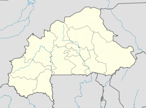
Burkina Faso is a landlocked country in West Africa. It covers an area of 274,223 km2 (105,878 sq mi), bordered by Mali to the northwest, Niger to the northeast, Benin to the southeast, Togo and Ghana to the south, and Ivory Coast to the southwest. As of 2021, the country had an estimated population of 23,674,480. Previously called Republic of Upper Volta (1958–1984), it was renamed Burkina Faso by President Thomas Sankara. Its citizens are known as Burkinabè, and its capital and largest city is Ouagadougou.

Transport in Burkina Faso consists primarily of road, air and rail transportation. The World Bank classified country's transportation as underdeveloped but noted that Burkina Faso is a natural geographic transportation hub for West Africa.

The Burkina Faso Armed Forces is the term used for the national military of Burkina Faso. The service branches of the armed forces include its Army, Air Force, National Gendarmerie and People's Militia. Being a landlocked country, Burkina Faso has no navy.

Ouagadougou or Wagadugu is the capital of Burkina Faso, and the administrative, communications, cultural and economic centre of the nation. It is also the country's largest city, with a population of 2,415,266 in 2019. The city's name is often shortened to Ouaga. The inhabitants are called ouagalais. The spelling of the name Ouagadougou is derived from the French orthography common in former French African colonies.

Ouagadougou Airport, officially Thomas Sankara International Airport Ouagadougou, is an international airport in the center of the capital city of Ouagadougou in Burkina Faso. It was built in the 1960s, and it is approximately 1.5 kilometres (1 mi) southeast of the main commercial area. The site itself is approximately 4.8 kilometres (3.0 mi) in length, 0.5 kilometres (0.31 mi) in width at its narrowest point, and covers an area of approximately 4.26 km2. Its runway is 3,000 metres (9,800 ft) long. When the airport was built it was on the southern boundary of the city. Ouagadougou has since experienced rapid urbanization and the airport is now surrounded by urban development.

Air Burkina SA is the national airline of Burkina Faso, operating scheduled services from its main base at Ouagadougou Airport to one domestic destination, Bobo-Dioulasso, as well as regional services to Togo, Benin, Mali, Niger, Côte d'Ivoire, Senegal and Ghana. From 2001 to 2017, the airline was majority owned by an AKFED/IPS consortium, but is now back in government ownership, with reports that a new investor is being sought.
The Burkina Faso national football team represents Burkina Faso in men's international football and is controlled by the Burkinabé Football Federation. They were known as the Upper Volta national football team until 1984, when Upper Volta became Burkina Faso. They finished fourth in the 1998 Africa Cup of Nations, when they hosted the tournament. Their best ever finish in the tournament was the 2013 edition, reaching the final.

The Panafrican Film and Television Festival of Ouagadougou is a film festival in Burkina Faso, held biennially in Ouagadougou, where the organization is based. It accepts for competition only films by African filmmakers and chiefly produced in Africa. FESPACO is scheduled in March every second year, two weeks after the last Saturday of February. Its opening night is held in the Stade du 4-Août, the national stadium.

The University of Ouagadougou is a university located in Ouagadougou, Burkina Faso. Founded in 1974, it was officially renamed in 2015 as l’Université Ouaga 1 Professeur Ki-Zerbo. The UO consists of seven Training and Research Units (UFR) and one institute.

The culture of Burkina Faso in West Africa is also called the Burkinabé culture.

According to the Government of Burkina Faso, 433,778 tourists visited the country in 2011.
The Fasofoot D1 is the top division of the Burkinabé Football Federation. It was created in 1961.

Ivory Coast has 660 kilometres of railway. The track gauge is 1,000 mm.
The 2011 Burkina Faso protests were a series of popular protests in Burkina Faso.

Edmond Fayçal Tapsoba is a Burkinabè professional footballer who plays as a centre-back for Bundesliga club Bayer Leverkusen and the Burkina Faso national team.
Silgadji is a town located in the province of Soum in Burkina Faso. It has a population of 4,977.
Nemnin is a town located in the province of Kadiogo in Burkina Faso. It is at 12°19'53"N 1°29'4"W and has an unknown population (2024). The distance from Nemnin to Ouagadougou is approximately 9.8 km / 6.1 m.
Tampouy is a town located in the region of Centre in Burkina Faso. It is at 12°23'59.8"N 1°34'15.1"W and has an unknown population (2024).
Gampéla is a town located in the region of Centre in Burkina Faso. It is at 12°25'50.5"N 1°22'23.5"W and has an unknown population (2024).
Sakoula is a town located in the region of Centre in Burkina Faso. It is at 12°27'17.6"N 1°31'21.6"W and has an unknown population (2024).


