Kovačevac (Jagodina)

Last updated
Kovačevac
Ковачевац
Village
CountryFlag of Serbia.svg  Serbia
District Pomoravlje District
Municipality Jagodina
Population (2002)
  Total 235
Time zone CET (UTC+1)
  Summer (DST) CEST (UTC+2)

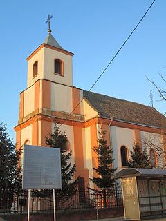
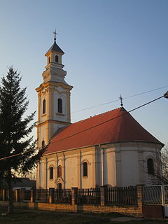
Kovačevac (Serbian Cyrillic : Ковачевац) is a village in the municipality of Jagodina, Serbia. According to the 2002 census, the village has a population of 235 people. [1]

The Serbian Cyrillic alphabet is an adaptation of the Cyrillic script for Serbo-Croatian, developed in 1818 by Serbian linguist Vuk Karadžić. It is one of the two alphabets used to write standard modern Serbian and Montenegrin, the other being Latin. In Croatian and Bosnian, only the Latin alphabet is used.

Village Small clustered human settlement smaller than a town

A village is a clustered human settlement or community, larger than a hamlet but smaller than a town, with a population ranging from a few hundred to a few thousand. Though villages are often located in rural areas, the term urban village is also applied to certain urban neighborhoods. Villages are normally permanent, with fixed dwellings; however, transient villages can occur. Further, the dwellings of a village are fairly close to one another, not scattered broadly over the landscape, as a dispersed settlement.

Jagodina City in Šumadija and Western Serbia, Serbia

Jagodina is a city and the administrative center of the Pomoravlje District in Šumadija, an historically densely forested region of central Serbia. It is situated on the banks of the Belica River. The city itself has a population of 43,311 inhabitants, while its administrative area comprises 76,712 inhabitants.

Related Research Articles

Popinci Village in Vojvodina, Serbia

Popinci is a village in Serbia. It is situated in the Pećinci municipality, in the Srem District, Vojvodina province. The village has a Serb ethnic majority and its population numbering 1,360 people.

Sibač Village in Vojvodina, Serbia

Sibač is a village in Serbia. It is situated in the Pećinci municipality, in the Srem District, Vojvodina province. The village has a Serb ethnic majority and its population numbering 544 people.

Gorjani is a village located in the Užice municipality of Serbia. In the 2002 census, the village had a population of 735.

Vrba may refer to:

Vlahinja

Vlahinja, in Serbian Cyrillic Влахиња, în [[Romanian language|Romanian] Românești, is a village in Serbia situated in the municipality of Kuršumlija, district of Toplica. In 2002, it had 88 inhabitants, of which 87 were Serbs (98,86%).

Pilica (Bajina Bašta) Village in Šumadija, Serbia

Pilica is a village in the municipality of Bajina Bašta, Serbia. According to the 2002 census, the village has a population of 653 people.

Rastište Village in Šumadija, Serbia

Rastište is a village in the municipality of Bajina Bašta, Serbia. According to the 2002 census, the village has a population of 473 people.

Zaglavak Village in Šumadija, Serbia

Zaglavak is a village in the municipality of Bajina Bašta, Serbia. According to the 2002 census, the village has a population of 566 people.

Belo Polje, Brus Village in Rasina District, Serbia

Belo Polje is a village in the municipality of Brus, Serbia. According to the 2002 census, the village has a population of 50 people.

Bogiše Village in Rasina District, Serbia

Bogiše is a village in the municipality of Brus, Serbia. According to the 2002 census, the village has a population of 331 people.

Ravni (Brus) Village in Rasina District, Serbia

Ravni is a village in the municipality of Brus, Serbia. According to the 2002 census, the village has a population of 190 people.

Rošci Village in Moravica District, Serbia

Rošci is a village in the municipality of Čačak, Serbia. According to the 2011 census, the village has a population of 395 people.

Vujetinci Village in Moravica District, Serbia

Vujetinci is a village in the municipality of Čačak, Serbia. According to the 2011 census, the village has a population of 395 people.

Tubići Village in Zlatibor District, Serbia

Tubići is a village in the municipality of Kosjerić, western Serbia. According to the 2002 census, the village has a population of 535 people.

Božetići Village in Zlatibor District, Serbia

Božetići is a village in the municipality of Nova Varoš, western Serbia. According to the 2002 census, the village has a population of 392 people.

Mađer Village in Zlatibor District, Serbia

Mađer is a village in the municipality of Požega, western Serbia. According to the 2002 census, the village has a population of 153 people.

Gornja Otulja is a village in the municipality of Vranje, Serbia. According to the 2002 census, the village has a population of 13 people.

Ranutovac is a village in the municipality of Vranje, Serbia. According to the 2002 Serbia census, the village has a population of 490 people.

Prijezdić Village in Kolubara District, Serbia

Prijezdić is a village in the municipality of Valjevo, Serbia. According to the 2002 census, the village has a population of 340 people.

Štulac (Vrnjačka Banja) Village in Raška District, Serbia

Štulac is a village in the municipality of Vrnjačka Banja, Serbia. According to the 2011 census, the village has a population of 1,185 people.

References

  1. Popis stanovništva, domaćinstava i Stanova 2002. Knjiga 1: Nacionalna ili etnička pripadnost po naseljima. Republika Srbija, Republički zavod za statistiku Beograd 2003. ISBN   86-84433-00-9

Coordinates: 43°56′N21°11′E / 43.933°N 21.183°E / 43.933; 21.183

Geographic coordinate system Coordinate system

A geographic coordinate system is a coordinate system that enables every location on Earth to be specified by a set of numbers, letters or symbols. The coordinates are often chosen such that one of the numbers represents a vertical position and two or three of the numbers represent a horizontal position; alternatively, a geographic position may be expressed in a combined three-dimensional Cartesian vector. A common choice of coordinates is latitude, longitude and elevation. To specify a location on a plane requires a map projection.