
Lužná is a village in the Central Bohemian Region of the Czech Republic. It has around 1,800 inhabitants.

Geghashen is a village in the Kotayk Province of Armenia.

Mrgashat, is a major village in the Armavir Province of Armenia. A Bronze Age archaeological site is found near the village.

Petralinci is a village in North Macedonia near Strumica. It is in the Bosilovo Municipality. According to the 2002 census, the total population of the village was 605 inhabitants.

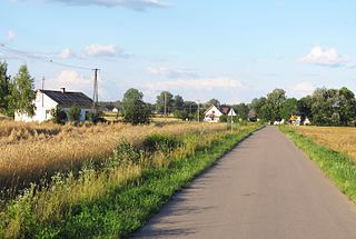
Kopanica is a village in the administrative district of Gmina Nowinka, within Augustów County, Podlaskie Voivodeship, in north-eastern Poland. It lies approximately 11 kilometres (7 mi) east of Nowinka, 16 km (10 mi) north-east of Augustów, and 94 km (58 mi) north of the regional capital Białystok.
Niemyje-Skłody is a village in the administrative district of Gmina Rudka, within Bielsk County, Podlaskie Voivodeship, in north-eastern Poland. It lies approximately 3 kilometres (2 mi) west of Rudka, 35 km (22 mi) west of Bielsk Podlaski, and 54 km (34 mi) south-west of the regional capital Białystok.
Krzczonów Drugi is a village in the administrative district of Gmina Krzczonów, within Lublin County, Lublin Voivodeship, in eastern Poland.
Radoryż Smolany is a village in the administrative district of Gmina Krzywda, within Łuków County, Lublin Voivodeship, in eastern Poland. It lies approximately 5 kilometres (3 mi) west of Krzywda, 22 km (14 mi) south-west of Łuków, and 69 km (43 mi) north-west of the regional capital Lublin.
Poniatowa-Wieś is a village in the administrative district of Gmina Poniatowa, within Opole Lubelskie County, Lublin Voivodeship, in eastern Poland. It lies approximately 5 kilometres (3 mi) east of Poniatowa, 12 km (7 mi) east of Opole Lubelskie, and 32 km (20 mi) west of the regional capital Lublin.
Przededworze is a village in the administrative district of Gmina Chmielnik, within Kielce County, Świętokrzyskie Voivodeship, in south-central Poland. It lies approximately 2 kilometres (1 mi) west of Chmielnik and 32 km (20 mi) south of the regional capital Kielce.
Gorzyce is a village in the administrative district of Gmina Tryńcza, within Przeworsk County, Subcarpathian Voivodeship, in south-eastern Poland. It lies approximately 5 kilometres (3 mi) south of Tryńcza, 9 km (6 mi) north-east of Przeworsk, and 43 km (27 mi) east of the regional capital Rzeszów.
Strożęcin is a village in the administrative district of Gmina Raciąż, within Płońsk County, Masovian Voivodeship, in east-central Poland.
Okopy is a village in the administrative district of Gmina Nowa Sucha, within Sochaczew County, Masovian Voivodeship, in east-central Poland. It lies approximately 12 kilometres (7 mi) south of Sochaczew and 54 km (34 mi) west of Warsaw.

Samotrzask is a village in the administrative district of Gmina Łochów, within Węgrów County, Masovian Voivodeship, in east-central Poland.
Bagna is a settlement in the administrative district of Gmina Czersk, within Chojnice County, Pomeranian Voivodeship, in northern Poland.
Drzysław is a village in the administrative district of Gmina Nowogard, within Goleniów County, West Pomeranian Voivodeship, in north-western Poland. It lies approximately 4 kilometres (2 mi) north of Nowogard, 27 km (17 mi) north-east of Goleniów, and 48 km (30 mi) north-east of the regional capital Szczecin.

Xà Bang is a commune (xã) and village in Châu Đức District, Bà Rịa–Vũng Tàu Province, in Vietnam.
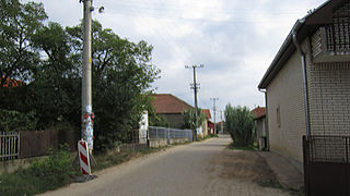
Grdanica is a village in the municipality of Leskovac, Serbia. According to the 2002 census, the village has a population of 605 people.
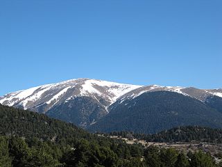
La Carabassa is a mountain of Catalonia, Spain. Located in the Pyrenees, it has an altitude of 2740 metres above sea level.
Mali Izvor is a village in the municipality of Zaječar, Serbia. According to the 2002 census, the village has a population of 454 people.


