Baranów is a village in the administrative district of Gmina Busko-Zdrój, within Busko County, Świętokrzyskie Voivodeship, in south-central Poland. It lies approximately 9 kilometres (6 mi) south-east of Busko-Zdrój and 55 km (34 mi) south of the regional capital Kielce.
Bronina is a village in the administrative district of Gmina Busko-Zdrój, within Busko County, Świętokrzyskie Voivodeship, in south-central Poland. It lies approximately 4 kilometres (2 mi) east of Busko-Zdrój and 48 km (30 mi) south of the regional capital Kielce.
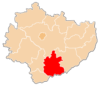
Dobrowoda is a village in the administrative district of Gmina Busko-Zdrój, within Busko County, Świętokrzyskie Voivodeship, in south-central Poland. It lies approximately 9 kilometres (6 mi) south-east of Busko-Zdrój and 55 km (34 mi) south of the regional capital Kielce.
Janina is a village in the administrative district of Gmina Busko-Zdrój, within Busko County, Świętokrzyskie Voivodeship, in south-central Poland. It lies approximately 8 kilometres (5 mi) north-east of Busko-Zdrój and 45 km (28 mi) south of the regional capital Kielce.
Łagiewniki is a village in the administrative district of Gmina Busko-Zdrój, within Busko County, Świętokrzyskie Voivodeship, in south-central Poland. It lies approximately 4 kilometres (2 mi) north-east of Busko-Zdrój and 46 km (29 mi) south of the regional capital Kielce.
Nowa Wieś is a village in the administrative district of Gmina Busko-Zdrój, within Busko County, Świętokrzyskie Voivodeship, in south-central Poland. It lies approximately 9 kilometres (6 mi) east of Busko-Zdrój and 50 km (31 mi) south of the regional capital Kielce.
Olganów is a village in the administrative district of Gmina Busko-Zdrój, within Busko County, Świętokrzyskie Voivodeship, in south-central Poland. It lies approximately 7 kilometres (4 mi) south-east of Busko-Zdrój and 53 km (33 mi) south of the regional capital Kielce.
Owczary is a village in the administrative district of Gmina Busko-Zdrój, within Busko County, Świętokrzyskie Voivodeship, in south-central Poland. It lies approximately 4 kilometres (2 mi) south-east of Busko-Zdrój and 49 km (30 mi) south of the regional capital Kielce.
Palonki is a village in the administrative district of Gmina Busko-Zdrój, within Busko County, Świętokrzyskie Voivodeship, in south-central Poland. It lies approximately 12 kilometres (7 mi) north-east of Busko-Zdrój and 43 km (27 mi) south-east of the regional capital Kielce.

Pęczelice is a village in the administrative district of Gmina Busko-Zdrój, within Busko County, Świętokrzyskie Voivodeship, in south-central Poland. It lies approximately 6 kilometres (4 mi) east of Busko-Zdrój and 50 km (31 mi) south of the regional capital Kielce.
Radzanów is a village in the administrative district of Gmina Busko-Zdrój, within Busko County, Świętokrzyskie Voivodeship, in south-central Poland. It lies approximately 5 kilometres (3 mi) south-east of Busko-Zdrój and 51 km (32 mi) south of the regional capital Kielce.
Ruczynów is a village in the administrative district of Gmina Busko-Zdrój, within Busko County, Świętokrzyskie Voivodeship, in south-central Poland. It lies approximately 9 kilometres (6 mi) east of Busko-Zdrój and 49 km (30 mi) south of the regional capital Kielce.
Skotniki Małe is a village in the administrative district of Gmina Busko-Zdrój, within Busko County, Świętokrzyskie Voivodeship, in south-central Poland. It lies approximately 6 kilometres (4 mi) south-east of Busko-Zdrój and 52 km (32 mi) south of the regional capital Kielce.
Słabkowice is a village in the administrative district of Gmina Busko-Zdrój, within Busko County, Świętokrzyskie Voivodeship, in south-central Poland. It lies approximately 7 kilometres (4 mi) north-east of Busko-Zdrój and 43 km (27 mi) south of the regional capital Kielce.

Szczaworyż is a village in the administrative district of Gmina Busko-Zdrój, within Busko County, Świętokrzyskie Voivodeship, in south-central Poland. It lies approximately 8 kilometres (5 mi) east of Busko-Zdrój and 51 km (32 mi) south of the regional capital Kielce.
Widuchowa is a village in the administrative district of Gmina Busko-Zdrój, within Busko County, Świętokrzyskie Voivodeship, in south-central Poland. It lies approximately 6 kilometres (4 mi) east of Busko-Zdrój and 49 km (30 mi) south of the regional capital Kielce.
Ludwinów is a village in the administrative district of Gmina Solec-Zdrój, within Busko County, Świętokrzyskie Voivodeship, in south-central Poland. It lies approximately 5 kilometres (3 mi) south-east of Solec-Zdrój, 22 km (14 mi) south-east of Busko-Zdrój, and 65 km (40 mi) south of the regional capital Kielce.
Świniary is a village in the administrative district of Gmina Solec-Zdrój, within Busko County, Świętokrzyskie Voivodeship, in south-central Poland. It lies approximately 5 kilometres (3 mi) east of Solec-Zdrój, 21 km (13 mi) south-east of Busko-Zdrój, and 63 km (39 mi) south of the regional capital Kielce.
Kuchary is a village in the administrative district of Gmina Stopnica, within Busko County, Świętokrzyskie Voivodeship, in south-central Poland. It lies approximately 6 kilometres (4 mi) west of Stopnica, 11 km (7 mi) east of Busko-Zdrój, and 52 km (32 mi) south of the regional capital Kielce.
Żerniki Dolne is a village in the administrative district of Gmina Stopnica, within Busko County, Świętokrzyskie Voivodeship, in south-central Poland. It lies approximately 7 kilometres (4 mi) north of Stopnica, 17 km (11 mi) east of Busko-Zdrój, and 49 km (30 mi) south-east of the regional capital Kielce.