Krasnoselsky District

Last updated
Location of Moscow in Russia Map of Russia - Moscow (federal city) (2008-03).svg
Location of Moscow in Russia
Location of Saint Petersburg in Russia Map of Russia - St. Petersburg (federal city) (2008-03).svg
Location of Saint Petersburg in Russia
Location of Kostroma Oblast in Russia Map of Russia - Kostroma Oblast (2008-03).svg
Location of Kostroma Oblast in Russia

Krasnoselsky District is the name of several administrative and municipal districts in Russia.

Russia transcontinental country in Eastern Europe and Northern Asia

Russia, officially the Russian Federation, is a transcontinental country in Eastern Europe and North Asia. At 17,125,200 square kilometres (6,612,100 sq mi), Russia is by a considerable margin the largest country in the world by area, covering more than one-eighth of the Earth's inhabited land area, and the ninth most populous, with about 146.77 million people as of 2019, including Crimea. About 77% of the population live in the western, European part of the country. Russia's capital, Moscow, is one of the largest cities in the world and the second largest city in Europe; other major cities include Saint Petersburg, Novosibirsk, Yekaterinburg and Nizhny Novgorod. Extending across the entirety of Northern Asia and much of Eastern Europe, Russia spans eleven time zones and incorporates a wide range of environments and landforms. From northwest to southeast, Russia shares land borders with Norway, Finland, Estonia, Latvia, Lithuania and Poland, Belarus, Ukraine, Georgia, Azerbaijan, Kazakhstan, China, Mongolia and North Korea. It shares maritime borders with Japan by the Sea of Okhotsk and the U.S. state of Alaska across the Bering Strait. However, Russia recognises two more countries that border it, Abkhazia and South Ossetia, both of which are internationally recognized as parts of Georgia.

Krasnoselsky District, Moscow human settlement in Russia

Krasnoselsky District (Russian: Красносе́льский райо́н is a district of Central Administrative Okrug of the federal city of Moscow, Russia. Population: 47,256  ; 45,229  .

Central Administrative Okrug, or Tsentralny Administrativny Okrug, is one of the twelve administrative okrugs of Moscow, Russia. Population: 741,967 (2010 Census); 701,353 (2002 Census). There are theaters, almost all Moscow railway stations, most of the ministries, the Kremlin, the Government house, the State Duma, the Federation Council in the Central Administrative area. Large part of the territory is occupied by different office buildings, there is “Moscow-City” district on the west side of the Area.

Federal cities of Russia Russian city which has a status of both an inhabited locality and a constituent federal subject

A city of federal importance or federal city in Russia is a city that has a status of both an inhabited locality and a constituent federal subject.

See also

Krasnoye Selo is the name of several inhabited localities in Russia.

Related Research Articles

Manturovsky District Wikipedia disambiguation page

Manturovsky District is the name of several administrative and municipal districts in Russia:

Ostrovsky District Wikipedia disambiguation page

Ostrovsky District is the name of several administrative and municipal districts in Russia:

Lomonosovsky District Wikimedia disambiguation page

Lomonosovsky District is the name of several administrative and municipal districts in Russia. The districts are generally named for Mikhail Lomonosov, a Russian polymath.

Pushkinsky District Wikipedia disambiguation page

Pushkinsky District is the name of several administrative and municipal districts in Russia:

Chukhlomsky District District in Kostroma Oblast, Russia

Chukhlomsky District is an administrative and municipal district (raion), one of the twenty-four in Kostroma Oblast, Russia. It is located in the north of the oblast. The area of the district is 3,643 square kilometers (1,407 sq mi). Its administrative center is the town of Chukhloma. Population: 11,346 (2010 Census); 13,574 ; 15,466 (1989 Census). The population of Chukhloma accounts for 47.7% of the district's total population.

Kadyysky District District in Kostroma Oblast, Russia

Kadyysky District is an administrative and municipal district (raion), one of the twenty-four in Kostroma Oblast, Russia. It is located in the south of the oblast. The area of the district is 2,190 square kilometers (850 sq mi). Its administrative center is the urban locality of Kadyy. Population: 8,374 (2010 Census); 10,341 ; 12,847 (1989 Census). The population of Kadyy accounts for 43.0% of the district's total population.

Kostromskoy District District in Kostroma Oblast, Russia

Kostromskoy District is an administrative and municipal district (raion), one of the twenty-four in Kostroma Oblast, Russia. It is located in the southwest of the oblast. The area of the district is 2,032 square kilometers (785 sq mi). Its administrative center is the city of Kostroma. Population: 44,524 (2010 Census); 43,904 ; 49,442 (1989 Census).

Krasnoselsky District, Kostroma Oblast District in Kostroma Oblast, Russia

Krasnoselsky District is an administrative and municipal district (raion), one of the twenty-four in Kostroma Oblast, Russia. It is located in the southwest of the oblast. The area of the district is 950 square kilometers (370 sq mi). Its administrative center is the urban locality of Krasnoye-na-Volge. Population: 17,845 (2010 Census); 19,580 ; 20,998 (1989 Census). The population of Krasnoye-na-Volge accounts for 43.2% of the district's total population.

Makaryevsky District District in Kostroma Oblast, Russia

Makaryevsky District is an administrative and municipal district (raion), one of the twenty-four in Kostroma Oblast, Russia. It is located in the south of the oblast. The area of the district is 4,850 square kilometers (1,870 sq mi). Its administrative center is the town of Makaryev. Population: 15,968 (2010 Census); 19,523 ; 24,900 (1989 Census). The population of Makaryev accounts for 45.6% of the district's total population.

Manturovsky District, Kostroma Oblast District in Kostroma Oblast, Russia

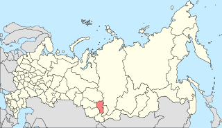
Manturovsky District is an administrative and municipal district (raion), one of the twenty-four in Kostroma Oblast, Russia. It is located in the center of the oblast. The area of the district is 2,667 square kilometers (1,030 sq mi). Its administrative center is the town of Manturovo. Population: 4,978 (2010 Census); 6,796 ; 9,065 (1989 Census).

Nerekhtsky District District in Kostroma Oblast, Russia

Nerekhtsky District is an administrative and municipal district (raion), one of the twenty-four in Kostroma Oblast, Russia. It is located in the west of the oblast. The area of the district is 1,163 square kilometers (449 sq mi). Its administrative center is the town of Nerekhta. Population: 11,416 (2010 Census); 13,447 ; 15,393 (1989 Census).

Neysky District District in Kostroma Oblast, Russia

Neysky District is an administrative and municipal district (raion), one of the twenty-four in Kostroma Oblast, Russia. It is located in the center of the oblast. The area of the district is 2,657 square kilometers (1,026 sq mi). Its administrative center is the town of Neya. Population: 4,325 (2010 Census); 6,018 ; 8,051 (1989 Census).

Pavinsky District District in Kostroma Oblast, Russia

Pavinsky District is an administrative and municipal district (raion), one of the twenty-four in Kostroma Oblast, Russia. It is located in the northeast of the oblast. The area of the district is 1,600 square kilometers (620 sq mi). Its administrative center is the rural locality of Pavino. Population: 5,102 (2010 Census); 6,217 ; 7,933 (1989 Census). The population of Pavino accounts for 55.3% of the district's total population.

Sharyinsky District District in Kostroma Oblast, Russia

Sharyinsky District is an administrative and municipal district (raion), one of the twenty-four in Kostroma Oblast, Russia. It is located in the southeast of the oblast. The area of the district is 4,070 square kilometers (1,570 sq mi). Its administrative center is the town of Sharya. Population: 10,390 (2010 Census); 12,851 ; 16,458 (1989 Census).

Soligalichsky District District in Kostroma Oblast, Russia

Soligalichsky District is an administrative and municipal district (raion), one of the twenty-four in Kostroma Oblast, Russia. It is located in the northwest of the oblast. The area of the district is 3,100 square kilometers (1,200 sq mi). Its administrative center is the town of Soligalich. Population: 10,265 (2010 Census); 12,304 ; 14,798 (1989 Census). The population of Soligalich accounts for 62.7% of the district's total population.

Sudislavsky District District in Kostroma Oblast, Russia

Sudislavsky District is an administrative and municipal district (raion), one of the twenty-four in Kostroma Oblast, Russia. It is located in the southwest of the oblast. The area of the district is 1,530 square kilometers (590 sq mi). Its administrative center is the urban locality of Sudislavl. Population: 13,077 (2010 Census); 15,184 ; 16,407 (1989 Census). The population of Sudislavl accounts for 37.6% of the district's total population.

Barsky, Barskaya, or Barskoye is the name of several rural localities in Russia.

Georgiyevskoye is a rural locality and the administrative center of Mezhevskoy District, Kostroma Oblast, Russia. Population: 2,513 (2010 Census); 2,816 (2002 Census); 2,948 (1989 Census).

Parfenyevo is a rural locality and the administrative center of Parfenyevsky District, Kostroma Oblast, Russia. Population: 2,870 (2010 Census); 2,936 (2002 Census); 3,032 (1989 Census).

Vokhma is a rural locality and the administrative center of Vokhomsky District, Kostroma Oblast, Russia. Population: 4,386 (2010 Census); 4,785 (2002 Census); 4,953 (1989 Census).

References

  1. Московская городская Дума. Закон №13-47 от 5 июля 1995 г. «О территориальном делении города Москвы», в ред. Закона №38 от 26 июня 2013 г. «О внесении изменений в статью 4 Закона города Москвы от 5 июля 1995 г. №13-47 "О территориальном делении города Москвы" и Закон города Москвы от 15 октября 2003 года №59 "О наименованиях и границах внутригородских муниципальных образований в городе Москве"». Вступил в силу с момента опубликования. Опубликован: "Вестник Мэрии Москвы", №14, июль 1995. (Moscow City Duma. Law #13-47 of July 5, 1995 On the Territorial Division of the City of Moscow, as amended by the Law #38 of June 26, 2013 On Amending Article 4 of the Law of the City of Moscow of July 5, 1995 #13-47 "On the Territorial Division of the City of Moscow" and the Law of the City of Moscow of October 15, 2003 #59 "On the Names and Borders of the Internal Municipal Formations in the City of Moscow". Effective as of the moment of publication.).
  2. Законодательное Собрание Санкт-Петербурга. Закон №411-68 от 25 июля 2005 г. «О территориальном устройстве Санкт-Петербурга», в ред. Закона №685-130 от 26 декабря 2014 г. «О внесении изменений в Закон Санкт-Петербурга "О территориальном устройстве Санкт-Петербурга" и Закон Санкт-Петербурга "О рассмотрении предложений о присвоении наименований географическим объектам"». Вступил в силу через 10 дней после дня официального опубликования, за исключением отдельных положений, вступающих в силу в иные сроки. Опубликован: "Новое в законодательстве Санкт-Петербурга", №22, 4 августа 2005 г. (Legislative Assembly of Saint Petersburg. Law #411-68 of July 25, 2005 On the Territorial Structure of Saint Petersburg, as amended by the Law #685-130 of December 26, 2014 On Amending the Law of Saint Petersburg "On the Territorial Structure of Saint Petersburg" and the Law of Saint Petersburg "On Considering the Suggestions to Assign Names to Geographical Objects". Effective as of after 10 days following the day of the official publication, with the exception of certain clauses taking effect on different dates.).
  3. Костромская областная Дума. Закон №112-4-ЗКО от 9 февраля 2007 г. «Об административно-территориальном устройстве Костромской области», в ред. Закона №567-5-ЗКО от 24 сентября 2014 г. «О внесении изменений в Закон Костромской области "Об административно-территориальном устройстве Костромской области"». Вступил в силу со дня официального опубликования. Опубликован: "СП — нормативные документы", №10(70), 28 февраля 2007 г. (Kostroma Oblast Duma. Law #112-4-ZKO of February 9, 2007 On the Administrative-Territorial Structure of Kostroma Oblast, as amended by the Law #567-5-ZKO of September 24, 2014 On Amending the Law of Kostroma Oblast "On the Administrative-Territorial Structure of Kostroma Oblast". Effective as of the official publication date.).
  4. Костромская областная Дума. Закон №237-ЗКО от 30 декабря 2004 г. «Об установлении границ муниципальных образований в Костромской области и наделении их статусом», в ред. Закона №496-5-ЗКО от 28 февраля 2014 г. «О внесении изменений в Закон Костромской области "Об установлении границ муниципальных образований в Костромской области и наделении их статусом"». Вступил в силу по истечении 10 дней со дня официального опубликования. Опубликован: "Северная Правда" ("Документы: СпецВыпуск"), №8, 26 января 2005 г. (Kostroma Oblast Duma. Law #237-ZKO of December 30, 2004 On the Establishment of the Borders of the Municipal Formations and on Granting Them Statuses, as amended by the Law #496-5-ZKO of February 28, 2014 On Amending the Law of Kostroma Oblast "On the Establishment of the Borders of the Municipal Formations and on Granting Them Statuses". Effective as of after 10 days following the official publication date.).