Kernavė was a medieval capital of the Grand Duchy of Lithuania and today is a tourist attraction and an archeological site. It is located in the Širvintos district municipality located in southeast Lithuania. A Lithuanian state cultural reserve was established in Kernavė in 1989. In 2004 Kernavė Archaeological Site was included into UNESCO world heritage list.

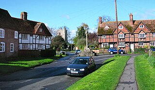
Turweston is a village and civil parish in the Aylesbury Vale district of Buckinghamshire, England. The village is beside the River Great Ouse, which bounds the parish to the north, west and south. Turweston is the most northwesterly parish in Buckinghamshire: the Ouse here forms the county boundary with Northamptonshire to the north and west and Oxfordshire to the south. Across the river the Northamptonshire market town of Brackley is just west of Turweston, with the town centre about 1 mile (1.6 km) west of the village. The parish has an area of 1,295 acres (524 ha) and the 2011 Census recorded a parish population of 211 people.
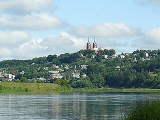
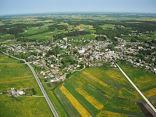
Prienai is a city in Lithuania situated on the Nemunas River, 29 km (18 mi) south of Kaunas. In 2011 the city had 9,867 inhabitants. The name of the city is a derivative from a surname Prienas. Pociūnai Airport is associated with the city.

Froxfield is a village and civil parish in the English county of Wiltshire. The parish is on the Wiltshire-West Berkshire border, and the village lies on the A4 national route about 3 miles (4.8 km) west of Hungerford and 7.5 miles (12 km) east of Marlborough.

Brimpton is a mostly rural village and civil parish in West Berkshire, England. The village occupies a few square miles of land between the Kennet and Avon Canal, a long tributary the Enborne which is used as part of the Hampshire boundary and the winding slopes of an escarpment in the far south-east, beyond the Enborne which is almost contiguous with the larger settlement of Baughurst a wood-buffered part of Tadley post town. This high common field contains five round barrows from the period of the Heptarchy in Anglo Saxon England.

Lustleigh is a small village and civil parish nestled in the Wrey Valley, inside the Dartmoor National Park in Devon, England. It is between the towns of Bovey Tracey and Moretonhampstead.

Buckden is a village and civil parish 3.7 miles (6.0 km) north of St Neots and 4 miles (6.4 km) south-west of Huntingdon. It lies in Huntingdonshire, a non-metropolitan district of Cambridgeshire as well as a historic county of England. The small hamlets of Stirtloe and Hardwick are also in the parish. Buckden is situated close to three major transport networks. The River Great Ouse forms the eastern boundary of the parish; the Great North Road used to pass through the centre of the village, although today there is a bypass just to the west; the East Coast Mainline runs along the eastern side of the Great Ouse river valley in the neighbouring parish of The Offords.

Warboys is a large village and civil parish in the Huntingdonshire district of Cambridgeshire, England, 7 miles (11 km) north-east of Huntingdon.

Appleby Magna is a village and civil parish in Leicestershire, England. It includes the small hamlets of Appleby Parva and Little Wigston, and the villages of Norton-Juxta-Twycross, Snarestone and Swepstone. The parish has a total collective population of 1,084 (2011), with Appleby its largest settlement. Historically, Appleby was one of the largest and wealthiest parishes in Leicestershire, which was reflected by its large church. However, the village and its population have remained fairly small.

Moorby is a small village in the East Lindsey district of Lincolnshire, England. The village is situated 4 miles (6 km) south-east from Horncastle and 1 mile (1.6 km) east from Wood Enderby. The village is in the civil parish of Claxby with Moorby, where Claxby refers to Claxby Pluckacre. Moorby has a population of about 50 inhabitants. At the 2011 census the population remained less than 100 and in included in the civil parish of Wood Enderby.

Kuršėnai is the twenty-fifth largest city in Lithuania. According to the 2001 census, it had 14,197 residents.

Vepriai is the largest town in Ukmergė district, Lithuania, situated south-west of Ukmergė with population of about 549 (2011). The capital of Vepriai elderate.
East Hagbourne is a village and civil parish about 1 mile (1.6 km) south of Didcot and 11 miles (18 km) south of Oxford. It was part of Berkshire until the 1974 boundary changes transferred it to Oxfordshire. The 2011 Census recorded the parish's population as 1,882.

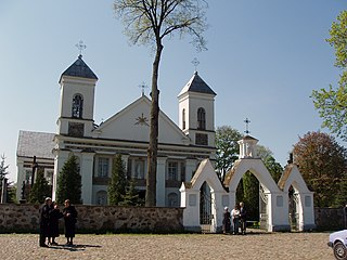
Kamajai is a small town in Rokiškis district municipality, Lithuania. It is situated on the banks of the Šetekšna River, some 14 km to south of Rokiškis. According to the 2011 census, it had 577 residents. The town has a small hospital, library, and hosts annual "Kuc kuc Kamajuos" festival.
Valkininkai is a historic town in Valkininkų (Valkininkai) eldership, Varėna district municipality, Alytus County, Lithuania, located about 22 km (14 mi) northeast from Varėna and about 55 km (34 mi) southwest from Vilnius. At the 2001 census its population was 238 and at the 2011 census it was 229.
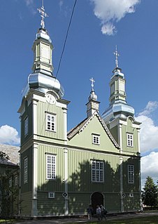
Kaltinėnai is a small town in the west of Lithuania, located near Žemaičių highway in Šilalė district municipality, Tauragė County. Kaltinėnai has around 728 inhabitants (2011). The town is in a hollow, and it is rumoured that a large lake existed at the end of the Ice age where it now sits. Kaltinėnai is surrounded by famous mounds such as Skuburkalnis, Švedkalnis, Kepaluškalnis and Medvėgalis. There are also two rivers nearby, the Akmena and the Ižnė.

Sydenham is a village and civil parish about 3 miles (5 km) southeast of Thame in Oxfordshire. To the south the parish is bounded by the ancient Lower Icknield Way, and on its other sides largely by brooks that merge as Cuttle Brook, a tributary of the River Thame. The 2011 Census recorded the parish's population as 451.

Buivydžiai is a village in Vilnius District Municipality, Lithuania. According to the 2011 census, it had 272 residents. It is located some 17 kilometres (11 mi) east of Nemenčinė and 3 kilometres (1.9 mi) west of the state border with Belarus. The village is situated on the left bank of the Neris River near its confluence with tributary Buivydė.

Kolainiai is a village in Kelmė District Municipality, Lithuania. It is located about 5 kilometres (3.1 mi) southwest from Užventis. According to the 2011 census, it had population of 261.
Kęstaičiai is a village in Telšiai District Municipality, Lithuania. According to the 2011 census, it had 32 residents.