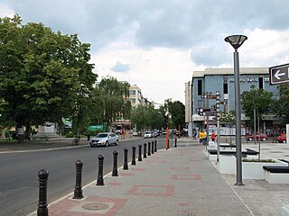
| Krušar | |
|---|---|
| Village | |
| Country | |
| District | Pomoravlje District |
| Municipality | Ćuprija |
| Population (2002) | |
| • Total | 1,546 |
| Time zone | CET (UTC+1) |
| • Summer (DST) | CEST (UTC+2) |
Krušar is a village in the municipality of Ćuprija, Serbia. According to the 2002 census, the village has a population of 1546 people. [1]

A village is a clustered human settlement or community, larger than a hamlet but smaller than a town, with a population ranging from a few hundred to a few thousand. Though villages are often located in rural areas, the term urban village is also applied to certain urban neighborhoods. Villages are normally permanent, with fixed dwellings; however, transient villages can occur. Further, the dwellings of a village are fairly close to one another, not scattered broadly over the landscape, as a dispersed settlement.

Ćuprija is a town and municipality located in the Pomoravlje District of central Serbia. The population of the town is 19,380, while the municipality has 30,645 inhabitants.

Serbia, officially the Republic of Serbia, is a country situated at the crossroads of Central and Southeast Europe in the southern Pannonian Plain and the central Balkans. The sovereign state borders Hungary to the north, Romania to the northeast, Bulgaria to the southeast, North Macedonia to the south, Croatia and Bosnia and Herzegovina to the west, and Montenegro to the southwest. The country claims a border with Albania through the disputed territory of Kosovo. Serbia's population is about seven million. Its capital, Belgrade, ranks among the oldest and largest citiеs in southeastern Europe.


