
Gołowierzchy is a village in the administrative district of Gmina Trzebieszów, within Łuków County, Lublin Voivodeship, in eastern Poland. It lies approximately 6 kilometres (4 mi) north-west of Trzebieszów, 14 km (9 mi) north-east of Łuków, and 86 km (53 mi) north of the regional capital Lublin.
Ludwinowo Zegrzyńskie is a village in the administrative district of Gmina Serock, within Legionowo County, Masovian Voivodeship, in east-central Poland. It lies approximately 4 kilometres (2 mi) west of Serock, 14 km (9 mi) north-east of Legionowo, and 32 km (20 mi) north of Warsaw.
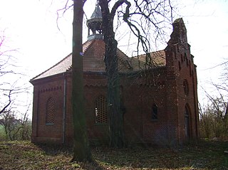
Teresin is a village in the administrative district of Gmina Trzcianka, within Czarnków-Trzcianka County, Greater Poland Voivodeship, in west-central Poland. It lies approximately 5 kilometres (3 mi) south-east of Trzcianka, 14 km (9 mi) north of Czarnków, and 74 km (46 mi) north of the regional capital Poznań.
Popowo is a village in the administrative district of Gmina Międzychód, within Międzychód County, Greater Poland Voivodeship, in west-central Poland. It lies approximately 10 kilometres (6 mi) east of Międzychód and 65 km (40 mi) west of the regional capital Poznań.
Tuczępy is a village in the administrative district of Gmina Międzychód, within Międzychód County, Greater Poland Voivodeship, in west-central Poland. It lies approximately 12 kilometres (7 mi) south-east of Międzychód and 63 km (39 mi) west of the regional capital Poznań.
Mylin is a village in the administrative district of Gmina Chrzypsko Wielkie, within Międzychód County, Greater Poland Voivodeship, in west-central Poland. It lies approximately 4 kilometres (2 mi) north of Chrzypsko Wielkie, 26 km (16 mi) east of Międzychód, and 54 km (34 mi) north-west of the regional capital Poznań.
Kurnatowice is a village in the administrative district of Gmina Kwilcz, within Międzychód County, Greater Poland Voivodeship, in west-central Poland. It lies approximately 6 kilometres (4 mi) north of Kwilcz, 14 km (9 mi) east of Międzychód, and 61 km (38 mi) west of the regional capital Poznań.
Lubosz is a village in the administrative district of Gmina Kwilcz, within Międzychód County, Greater Poland Voivodeship, in west-central Poland. It lies approximately 8 kilometres (5 mi) east of Kwilcz, 22 km (14 mi) east of Międzychód, and 52 km (32 mi) west of the regional capital Poznań.
Mechnacz is a village in the administrative district of Gmina Kwilcz, within Międzychód County, Greater Poland Voivodeship, in west-central Poland. It lies approximately 4 kilometres (2 mi) north-west of Kwilcz, 11 km (7 mi) east of Międzychód, and 63 km (39 mi) west of the regional capital Poznań.
Miłostowo is a village in the administrative district of Gmina Kwilcz, within Międzychód County, Greater Poland Voivodeship, in west-central Poland. It lies approximately 5 kilometres (3 mi) south of Kwilcz, 16 km (10 mi) south-east of Międzychód, and 60 km (37 mi) west of the regional capital Poznań.
Mościejewo is a village in the administrative district of Gmina Kwilcz, within Międzychód County, Greater Poland Voivodeship, in west-central Poland. It lies approximately 7 kilometres (4 mi) north-east of Kwilcz, 20 km (12 mi) east of Międzychód, and 55 km (34 mi) west of the regional capital Poznań.
Orzeszkowo is a village in the administrative district of Gmina Kwilcz, within Międzychód County, Greater Poland Voivodeship, in west-central Poland. It lies approximately 14 kilometres (9 mi) east of Kwilcz, 28 km (17 mi) east of Międzychód, and 47 km (29 mi) north-west of the regional capital Poznań.
Prusim is a village in the administrative district of Gmina Kwilcz, within Międzychód County, Greater Poland Voivodeship, in west-central Poland. It lies approximately 6 kilometres (4 mi) north-west of Kwilcz, 10 km (6 mi) east of Międzychód, and 65 km (40 mi) west of the regional capital Poznań.
Wituchowo is a village in the administrative district of Gmina Kwilcz, within Międzychód County, Greater Poland Voivodeship, in west-central Poland. It lies approximately 4 kilometres (2 mi) south-east of Kwilcz, 19 km (12 mi) south-east of Międzychód, and 56 km (35 mi) west of the regional capital Poznań.
Izdebno is a village in the administrative district of Gmina Sieraków, within Międzychód County, Greater Poland Voivodeship, in west-central Poland. It lies approximately 9 kilometres (6 mi) east of Sieraków, 24 km (15 mi) east of Międzychód, and 56 km (35 mi) north-west of the regional capital Poznań.
Ławica is a village in the administrative district of Gmina Sieraków, within Międzychód County, Greater Poland Voivodeship, in west-central Poland. It lies approximately 7 kilometres (4 mi) south-west of Sieraków, 10 km (6 mi) east of Międzychód, and 66 km (41 mi) west of the regional capital Poznań.
Lutom is a village in the administrative district of Gmina Sieraków, within Międzychód County, Greater Poland Voivodeship, in west-central Poland. It lies approximately 4 kilometres (2 mi) south-east of Sieraków, 19 km (12 mi) east of Międzychód, and 59 km (37 mi) north-west of the regional capital Poznań.
Marianowo is a village in the administrative district of Gmina Sieraków, within Międzychód County, Greater Poland Voivodeship, in west-central Poland. It lies approximately 3 kilometres (2 mi) north-west of Sieraków, 15 km (9 mi) north-east of Międzychód, and 65 km (40 mi) north-west of the regional capital Poznań.
Przemyśl is a village in the administrative district of Gmina Sieraków, within Międzychód County, Greater Poland Voivodeship, in west-central Poland. It lies approximately 4 kilometres (2 mi) south of Sieraków, 15 km (9 mi) east of Międzychód, and 61 km (38 mi) north-west of the regional capital Poznań.
Tuchola is a village in the administrative district of Gmina Sieraków, within Międzychód County, Greater Poland Voivodeship, in west-central Poland. It lies approximately 5 kilometres (3 mi) north-east of Sieraków, 20 km (12 mi) north-east of Międzychód, and 62 km (39 mi) north-west of the regional capital Poznań.


