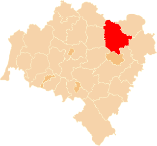
Lány u Dašic is a small village in the Pardubice Region of the Czech Republic, near town Dašice. It has 135 inhabitants.
Vesitükimaa is a small, uninhabited Estonian islet located in Torgu Parish, at the tip of Sõrve Peninsula of Saaremaa island. It is a site of European Community importance for the Boreal biogeographical region, its coordinates are 57°53′49″N22°02′26″E and its territory is 12,6 km2.

Pshatavan ; formerly, Igdalu and Igdali) is a town in the Armavir Province of Armenia.

Cağazur is a village in the Lachin Rayon of Azerbaijan.
Dub is a village in the administrative district of Gmina Tomaszów Lubelski, within Tomaszów Lubelski County, Lublin Voivodeship, in eastern Poland.

Kupimierz is a village in the administrative district of Gmina Gowarczów, within Końskie County, Świętokrzyskie Voivodeship, in south-central Poland. It lies approximately 3 kilometres (2 mi) north-east of Gowarczów, 12 km (7 mi) north of Końskie, and 48 km (30 mi) north of the regional capital Kielce.

Skowronki is a village in the administrative district of Gmina Gostyń, within Gostyń County, Greater Poland Voivodeship, in west-central Poland. It lies approximately 7 kilometres (4 mi) north of Gostyń and 53 km (33 mi) south of the regional capital Poznań.

Popów is a village in Kłobuck County, Silesian Voivodeship, in southern Poland. It is the seat of the gmina called Gmina Popów. It lies approximately 14 kilometres (9 mi) north of Kłobuck and 88 km (55 mi) north of the regional capital Katowice.

Stachowo is a settlement in Gmina Miastko, Bytów County, Pomeranian Voivodeship, in northern Poland. It lies approximately 17 kilometres (11 mi) west of Bytów, and 65 km (40 mi) south-west of Gdańsk.

Lichfield Court, in Richmond, London, consists of two Grade II listed purpose-built blocks of flats. Designed by Bertram Carter and built in fine Streamline Moderne style, it was completed in 1935.

Belfort is a village in the administrative district of Gmina Dziemiany, within Kościerzyna County, Pomeranian Voivodeship, in northern Poland. It lies approximately 7 kilometres (4 mi) north-east of Dziemiany, 13 km (8 mi) south-west of Kościerzyna, and 63 km (39 mi) south-west of the regional capital Gdańsk.

Pełki is a settlement in the administrative district of Gmina Dziemiany, within Kościerzyna County, Pomeranian Voivodeship, in northern Poland. It lies approximately 7 kilometres (4 mi) north-west of Dziemiany, 22 km (14 mi) south-west of Kościerzyna, and 72 km (45 mi) south-west of the regional capital Gdańsk.

Mianowice is a village in the administrative district of Gmina Damnica, within Słupsk County, Pomeranian Voivodeship, in northern Poland. It lies approximately 6 kilometres (4 mi) south-west of Damnica, 12 km (7 mi) east of Słupsk, and 93 km (58 mi) west of the regional capital Gdańsk.

Darżyno is a village in the administrative district of Gmina Potęgowo, within Słupsk County, Pomeranian Voivodeship, in northern Poland. It lies approximately 3 kilometres (2 mi) south-west of Potęgowo, 28 km (17 mi) east of Słupsk, and 77 km (48 mi) west of the regional capital Gdańsk.

Hrdlořezy is a village and municipality in Mladá Boleslav District in the Central Bohemian Region of the Czech Republic. The municipality covers an area of 9.7 km² and as of 2006 it had a population of 550.

Novaci is a village in the municipality of Aleksandrovac, Serbia. According to the 2002 census, the village has a population of 402.

Navalin is a village in the municipality of Leskovac, Serbia. According to the 2002 census, the village has a population of 898 people.
Veeremäe is a village in Saaremaa Parish, Saare County in western Estonia.

Nyköpings Arenor, Rosvalla is a sports and exhibition centre purely owned by the municipality of Nyköping and managed by Peab on behalf of Nyköping Sports and Exhibition Centre. The stadium includes indoor ice rinks, tennis courts, bowling lanes and a multi-purpose hall for sports, exhibitions and concerts. The facility, which opened in 2003, is home to the clubs; Nyköpings Hockey and Nyköpings BIS.

The metropolitan area of London, England, United Kingdom is served by six international airports and several smaller airports. Together, they make the busiest airport system in the world by passenger numbers and the second-busiest by aircraft movements. In 2018, the six airports handled a total of 177,054,819 million passengers. The London airports handle over 60% of all the UK's air traffic. The airports serve a total of 14 domestic destinations and 396 international destinations.


