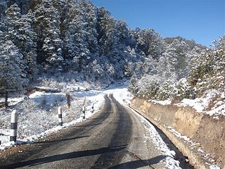
Bhojpur District is one of 14 districts of Province No. 1 of eastern Nepal. The district's area is 1,507 km² with a population of 182,459 (2011). The administrative center is Bhojpur. It is surrounded by Dhankuta and Sankhuwasabha in the east, Khotang in the west, again Sankhuwasabha in north-east and Solukhumbu in the north-west and Udayapur in the South.

Sankhuwasabha District is one of 14 districts of Province No. 1 of eastern Nepal. The district's area is 3,480 km² with a population of 159,203 in 2001 and 158,742 in 2011. The administrative center is Khandbari.

Solukhumbu District (Nepali: सोलुखुम्बु जिल्लाlisten , Sherpa: ཤར་ཁུམ་བུ་རྫོང་ཁ།, Wylie: shar khum bu dzong kha) is one of 14 districts of Province No. 1 of eastern Nepal. As the name suggests, it consists of the subregions Solu and Khumbu.

Annapurna is a village development committee in Bhojpur District in Province No. 1 of eastern Nepal. At the time of the 1991 Nepal census it had a population of 1856 persons living in 360 individual households.

Bastim,, is a village development committee in Bhojpur District in Province No. 1 of eastern Nepal. At the time of the 1991 Nepal census it had a population of 2920 persons living in 556 individual households.
Bhubal is a village development committee in Bhojpur District in Province No. 1 of eastern Nepal. At the time of the 1991 Nepal census it had a population of 2150.

Changre is a village development committee in Bhojpur District in the Kosi Zone of eastern Nepal. At the time of the 1991 Nepal census it had a population of 3344 persons living in 585 individual households.

Chaukidanda is an administrative Headquarter of Salpasilichho Rural Municipality in Bhojpur District in the Kosi Zone of eastern Nepal. It is ward no.-3 too on newly formed Salpasilichho Rural Municipality in northern part of District.

Deurali is a village development committee in Bhojpur District in the Kosi Zone of eastern Nepal. At the time of the 1991 Nepal census it had a population of 5367 persons living in 1052 individual households.

Dobhane is a village development committee in Bhojpur District in the Kosi Zone of eastern Nepal. At the time of the 1991 Nepal census it had a population of 4760 persons living in 860 individual households.

Khatamma is a village development committee in Bhojpur District in the Kosi Zone of eastern Nepal. At the time of the 1991 Nepal census it had a population of 2151 persons living in 407 individual households.

Khawa is a village development committee in Bhojpur District in the Kosi Zone of eastern Nepal. At the time of the 1991 Nepal census it had a population of 2610 persons living in 494 individual households.

Kot is a village development committee in Bhojpur District in the Kosi Zone of eastern Nepal. At the time of the 1991 Nepal census it had a population of 4485.

Lekharka is a village development committee in Bhojpur District in the Kosi Zone of eastern Nepal. According to the 1991 Nepal census it had a population of 2885 persons living in 509 individual households.

Nepaledanda is a village development committee in Bhojpur District in the Kosi Zone of eastern Nepal. At the time of the 1991 Nepal census it had a population of 3325 persons living in 659 individual households.

Okhre is a village development committee in Bhojpur District in the Kosi Zone of eastern Nepal. At the time of the 1991 Nepal census it had a population of 2729 persons living in 534 individual households. Here lies a calcium ore.

Pawala is a village development committee in Bhojpur District in the Kosi Zone of eastern Nepal. At the time of the 1991 Nepal census it had a population of 1431 persons living in 246 individual households.

Thidingkha is a village development committee in Bhojpur District in the Kosi Zone of eastern Nepal. At the time of the 1991 Nepal census it had a population of 2293.

Timma is a village development committee in Bhojpur District in the Kosi Zone of eastern Nepal. At the time of the 1991 Nepal census it had a population of 3336 persons living in 621 individual households.
The Kirat Kulung are one of the indigenous communities of Nepal, as well as parts of northeastern Sikkim and Darjeeling district of India, having their own Kulung language, culture, history and tradition. The Kulung population in Nepal is estimated to be in the region of 150,000-200,000.


