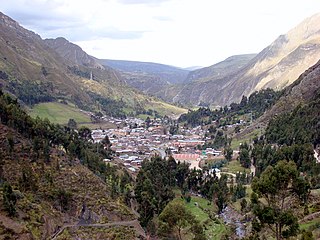
The Aija Province is one of 20 provinces of the Ancash Region in Peru.

The Bolognesi Province is one of 20 provinces of the Ancash Region of Peru.

The Huari Province is one of twenty provinces of the Ancash Region in Peru. Its seat is Huari.

Huallanca or Wallanka is a district of the Bolognesi Province in the Ancash Region of Peru.

The Recuay Province is one of twenty provinces of the Ancash Region in Peru. Its seat is the town of Recuay.
Cotaparaco District is one of ten districts of the Recuay Province in Peru.
Qishqiqucha is a lake in the Cordillera Blanca in Peru. It is located in the Ancash Region, Recuay Province, Catac District. It is situated at a height of about 4,284 metres (14,055 ft), about 0.7 km long and 0.39 km at its widest point. Qishqiqucha lies in the Huascarán National Park, southwest of Mururahu and Qishqi.

Santón is a 5,238-metre-high (17,185 ft) mountain in the southern Cordillera Blanca in the Andes of Peru. It is located in the Ancash Region, Recuay Province, Catac District. It is situated northeast of Caullaraju and north of Challhua. Santón lies south of Pumapampa River, a right tributary of the Santa River.

Cuncush is a mountain in the southern part of the Cordillera Blanca in the Andes of Peru, about 5,000 metres (16,404 ft) high. It is situated in the Ancash Region, Recuay Province, Catac District. Cuncush lies southwest of Mururaju and northwest of Pukarahu.

Yana Kunkush is a mountain in the southern part of the Cordillera Negra in the Andes of Peru, about 4,600 metres (15,092 ft) high. It is situated in the Ancash Region, Aija Province, Aija District, and in the Recuay Province, Catac District. Yana Kunkush lies southeast of Sach'a Hirka and east of a lake of that name.

Pumahuaín is a 5,008-metre-high (16,430 ft) mountain in the southern part of the Cordillera Blanca in the Andes of Peru. It is situated in the Ancash Region, Recuay Province, Catac District. Puma Wayin lies southwest of Mururahu and Kunkush and northwest of Pukarahu.

Kunkush is a 4,626-metre-high (15,177 ft) mountain in the Wallanka mountain range in the Andes of Peru. It is situated in the Ancash Region, Bolognesi Province, Huallanca District. Kunkush lies at the Ch'uspi valley on an eastern extension of the range, west of Tuna Wayin, Yana Puyku and Muya Wayin and east of Wallanka.

Kunkush Punta is a 4,907-metre-high (16,099 ft) mountain in the southern part of the Cordillera Blanca in the Andes of Peru. It is situated in the Ancash Region, Recuay Province, Catac District. Kunkush Punta lies east of Qiruqucha.

Kunkush is a mountain in the Andes of Peru, about 4,800 m (15,700 ft) high. It is located in the Lima Region, Oyón Province, Oyón District.

Kunkus is a mountain in the Paryaqaqa mountain range in the Andes of Peru which reaches an altitude of approximately 5,000 m (16,000 ft). It is located in the Junín Region, Yauli Province, Yauli District. Kunkus lies northwest of Putka and Yantayuq.

Kunkus Yantaq is a 5,354-metre-high (17,566 ft) mountain in the Paryaqaqa mountain range in the Andes of Peru. It is located in the Lima Region, Huarochirí Province, San Mateo District. Kunkus Yantaq lies southeast of Qullqayuq.

Kunkus is a mountain in the north of the Paryaqaqa mountain range in the Andes of Peru which reaches an altitude of approximately 5,000 m (16,000 ft). It is located in the Junín Region, Yauli Province, on the border of the districts of Huay-Huay and Yauli. Kunkus lies north of Chumpi.

Sach'a Hirka is a mountain in the Cordillera Negra in the Andes of Peru which reaches a height of approximately 4,600 m (15,100 ft). It lies in the Ancash Region on the border of the Aija Province, Aija District, and the Recuay Province, Catac District. Sach'a Hirka lies northwest of Yana Kunkush.

Kunkush is a mountain in the Andes of Peru which reaches a height of approximately 4,400 m (14,400 ft). It is located in the Ancash Region, Huari Province, Paucas District.


