Kiranipura is a census town in Ajmer district in the Indian state of Rajasthan.

Wyrwa is a village in the administrative district of Gmina Świecie, within Świecie County, Kuyavian-Pomeranian Voivodeship, in north-central Poland. It lies approximately 5 kilometres (3 mi) north-west of Świecie, 44 km (27 mi) north-east of Bydgoszcz, and 48 km (30 mi) north of Toruń.
Wólka Rozwadowska is a village in the administrative district of Gmina Firlej, within Lubartów County, Lublin Voivodeship, in eastern Poland.
Sierbowce is a village in the administrative district of Gmina Sokółka, within Sokółka County, Podlaskie Voivodeship, in north-eastern Poland, close to the border with Belarus. It lies approximately 6 kilometres (4 mi) north-west of Sokółka and 40 km (25 mi) north-east of the regional capital Białystok.
Widawa is a village in Łask County, Łódź Voivodeship, in central Poland. It is the seat of the gmina called Gmina Widawa. It lies approximately 22 kilometres (14 mi) south-west of Łask and 53 km (33 mi) south-west of the regional capital Łódź.
Bieliny is a village in the administrative district of Gmina Ulanów, within Nisko County, Subcarpathian Voivodeship, in south-eastern Poland. It lies approximately 7 kilometres (4 mi) south of Ulanów, 15 km (9 mi) south-east of Nisko, and 51 km (32 mi) north-east of the regional capital Rzeszów.
Rydzewo is a village in the administrative district of Gmina Ciechanów, within Ciechanów County, Masovian Voivodeship, in east-central Poland. It lies approximately 14 kilometres (9 mi) west of Ciechanów and 83 km (52 mi) north-west of Warsaw.
Marianów is a village in the administrative district of Gmina Rzeczniów, within Lipsko County, Masovian Voivodeship, in east-central Poland.
Małachowo-Szemborowice is a village in the administrative district of Gmina Witkowo, within Gniezno County, Greater Poland Voivodeship, in west-central Poland.

Hang Mei Tsuen is an MTR Light Rail stop. It is located at ground level at Ping Ha Road near Hang Mei Tsuen in Ping Shan, Yuen Long District. It began service on 10 January 1993 and belongs to Zone 4.
Trojanówka is a village in the administrative district of Gmina Brzeźnica, within Żagań County, Lubusz Voivodeship, in western Poland.
Czarnoszki is a village in the administrative district of Gmina Człuchów, within Człuchów County, Pomeranian Voivodeship, in northern Poland. It lies approximately 10 kilometres (6 mi) north-east of Człuchów and 106 km (66 mi) south-west of the regional capital Gdańsk.
Miłoszewo is a village in the administrative district of Gmina Linia, within Wejherowo County, Pomeranian Voivodeship, in northern Poland. It lies approximately 6 kilometres (4 mi) east of Linia, 24 km (15 mi) south-west of Wejherowo, and 42 km (26 mi) west of the regional capital Gdańsk.
Karczemki is a village in the administrative district of Gmina Szemud, within Wejherowo County, Pomeranian Voivodeship, in northern Poland. It lies approximately 12 kilometres (7 mi) south-east of Szemud, 20 km (12 mi) south-east of Wejherowo, and 19 km (12 mi) north-west of the regional capital Gdańsk.
Lipowiec Mały is a village in the administrative district of Gmina Szczytno, within Szczytno County, Warmian-Masurian Voivodeship, in northern Poland. It lies approximately 18 kilometres (11 mi) south-east of Szczytno and 58 km (36 mi) south-east of the regional capital Olsztyn.

Donji Vratari is a village in the municipality of Aleksandrovac, Serbia. According to the 2002 census, the village has a population of 297 people.
Subotica is a village in the municipality of Aleksandrovac, Serbia. According to the 2002 census, the village has a population of 715 people.
Oraše is a village in the municipality of Tutin, Serbia. According to the 2002 census, the village has a population of 455 people.
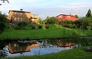
Vissi is a village in Nõo Parish, Tartu County in eastern Estonia. Lake Vissi is located in the village.
Esbu is a village in Sajjadrud Rural District, Bandpey-ye Sharqi District, Babol County, Mazandaran Province, Iran. At the 2006 census, its population was 161, in 39 families.


