The National Center for Electron Microscopy (NCEM) was a U.S. Department of Energy national user facility at Lawrence Berkeley National Laboratory in Berkeley, California, for unclassified scientific research using advanced electron microscopy. It has since been merged with the Molecular Foundry, also located at Berkeley Lab.

Ngũ Hành Sơn is a district (huyện) of Da Nang in the South Central Coast region of Vietnam.

Orgov is a town in the Aragatsotn Province of Armenia. Orgov is home to large radio-astronomy telescopes and remains of a Bronze Age fort.

Piekło is a village in the administrative district of Gmina Końskie, within Końskie County, Świętokrzyskie Voivodeship, in south-central Poland. It lies approximately 9 kilometres (6 mi) south of Końskie and 31 km (19 mi) north-west of the regional capital Kielce.

Poraj is a village in the administrative district of Gmina Końskie, within Końskie County, Świętokrzyskie Voivodeship, in south-central Poland. It lies approximately 13 kilometres (8 mi) north-west of Końskie and 49 km (30 mi) north-west of the regional capital Kielce.
Zemły is a village in the administrative district of Gmina Mokobody, within Siedlce County, Masovian Voivodeship, in east-central Poland.
Stary Białynin is a village in the administrative district of Gmina Nowa Sucha, within Sochaczew County, Masovian Voivodeship, in east-central Poland.

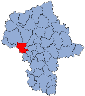
Antoniew is a village in the administrative district of Gmina Sochaczew, within Sochaczew County, Masovian Voivodeship, in east-central Poland. It lies approximately 6 kilometres (4 mi) north-west of Sochaczew and 57 km (35 mi) west of Warsaw.
Lisiny is a village in the administrative district of Gmina Lubowidz, within Żuromin County, Masovian Voivodeship, in east-central Poland.
Łubowice is a village in the administrative district of Gmina Kiszkowo, within Gniezno County, Greater Poland Voivodeship, in west-central Poland.

Strykówko is a settlement in the administrative district of Gmina Stęszew, within Poznań County, Greater Poland Voivodeship, in west-central Poland. It lies approximately 5 kilometres (3 mi) west of Stęszew and 25 km (16 mi) south-west of the regional capital Poznań.
Lubowo Drugie is a village in the administrative district of Gmina Wronki, within Szamotuły County, Greater Poland Voivodeship, in west-central Poland.

Osowa Góra is a village in the administrative district of Gmina Przodkowo, within Kartuzy County, Pomeranian Voivodeship, in northern Poland. It lies approximately 3 kilometres (2 mi) south-west of Przodkowo, 6 km (4 mi) north-east of Kartuzy, and 25 km (16 mi) west of the regional capital Gdańsk.
Główczyno is a village in the administrative district of Gmina Barciany, within Kętrzyn County, Warmian-Masurian Voivodeship, in northern Poland, close to the border with the Kaliningrad Oblast of Russia.

Okno is a settlement in the administrative district of Gmina Barlinek, within Myślibórz County, West Pomeranian Voivodeship, in north-western Poland. It lies approximately 8 kilometres (5 mi) south-east of Barlinek, 26 km (16 mi) east of Myślibórz, and 69 km (43 mi) south-east of the regional capital Szczecin.
Sandish Compound is a 30-year-old park and besides a zoo is located in Khanjarpur, Bhagalpur City, Bihar, opposite of police line Bhagalpur. It contains a Doordarshan TV Centre,volleyball court and a small open stadium. It also provides state level matches and is one of the best field in Bhagalpur. This is Sandy's Compound, originally named after a Briton who was the Mayor of Bhagalpur.A piece of land measuring, more or less, 307 bighas 15 cottahs and 14 chitaks of standard measurement, bounded on the -- -- is required within the aforesaid villages of Adampur, Kalibari and Khunjurpur.Mentioned on page no. 139 of the Calcutta Gazette of July 18, 1906, the land was acquired by the government for public purpose. {Zoos of India}}

Madžarevići is a village in the municipality of Višegrad, Bosnia and Herzegovina.
Beni Hocine is a town and commune in Sétif Province in north-eastern Algeria.
Paris is an unincorporated community in Lane County, in the U.S. state of Oregon. It is a rural locale in the Central Oregon Coast Range north of the Siuslaw River and south of the Alsea River along one of its tributaries, Five Rivers. Paris is located at 44°15′09″N123°46′14″W.


