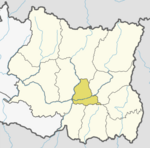
Daha is a former village development committee in Jajarkot District in the Karnali province of Nepal. At the time of the 1991 Nepal census it had a population of 3276 residing in 628 individual households.

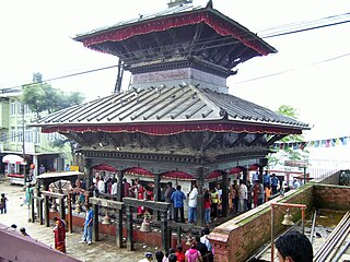
Manakamana is a village development committee in Gorkha District in the Gandaki Zone of northern-central Nepal. At the time of the 1991 Nepal census it had a population of 5,083 and had 889 houses in the town.

Ranishwara is a village development committee in Gorkha District in Gandaki Pradesh of northern-central Nepal. At the time of the 1991 Nepal census it had a population of 2,993 and had 580 houses in the town.
Lakshminibas is a village development committee in Dhanusa District in the Janakpur Zone of south-eastern Nepal. At the time of the 1991 Nepal census it had a population of 2,656 persons living in 459 individual households.
Dhuseni is a town and Village Development Committee in Ilam District in the Mechi Zone of eastern Nepal. At the time of the 1991 Nepal census it had a population of 4,514.
Shantidanda is a town and Village Development Committee in Ilam District in the Mechi Zone of eastern Nepal. At the time of the 1991 Nepal census it had a population of 4,373 persons living in 794 individual households.
Hardiya is a village and Village Development Committee in Bara District in the Narayani Zone of south-eastern Nepal. At the time of the 2011 Nepal census it had a population of 5,158 persons living in 739 individual households.There were 2,732 males and 2,426 females at the time of census.
South Jhitakaiya is a town and Village Development Committee, near by Dewapur- Chowk/Pokhara/Mandir/School/Police Station and Pashah River, Bara District in the Narayani Zone of south-eastern Nepal. At the time of the 1991 Nepal census it had a population of 7,235.
Lakshmipur Kotwali is a village and Village Development Committee in Bara District in the Narayani Zone of south-eastern Nepal. At the time of the 1991 Nepal census it had a population of 2,372 persons living in 382 individual households.
Thaprek is a Village Development Committee in Nuwakot District in the Bagmati Zone of central Nepal. At the time of the 1991 Nepal census it had a population of 3585 people residing in 632 individual households.
Bhagawati Tol is a former village development committee in Jajarkot District in the Karnali province of Nepal. At the time of the 1991 Nepal census it had a population of 2247 living in 424 individual households.
Khanikhola is a village development committee in Surkhet District in the Bheri Zone of mid-western Nepal. At the time of the 1991 Nepal census it had a population of 3127 people living in 512 individual households.
Bhumirajmandau is a village development committee in Doti District in the Seti Zone of western Nepal. At the time of the 1991 Nepal census it had a population of 3891 living in 743 individual households.
Bharatpur, Mahottari is a village development committee in Mahottari District in the Janakpur Zone of south-eastern Nepal. At the time of the 1991 Nepal census it had a population of 6410 people living in 1131 individual households.
Baigundhura is a village development committee in Jhapa District in the Mechi Zone of south-eastern Nepal. At the time of the 1991 Nepal census it had a population of 5409 people living in 983 individual households.
Dharampur was a village development committee in Rautahat District in the Narayani Zone of south-eastern Nepal.
Bhuwan Pokhari is a village development committee in Palpa District in the Lumbini Zone of southern Nepal. At the time of the 1991 Nepal census it had a population of 5113 people living in 969 individual households.
Galdha is a village development committee in Palpa District in the Lumbini Zone of southern Nepal. At the time of the 1991 Nepal census it had a population of 3304 people living in 544 individual households.
Jhapa Baijanathpur is a village development committee in Morang District in the Kosi Zone of south-eastern Nepal. At the time of the 1991 Nepal census it had a population of 3660 people living in 744 individual households.
Darbairiya is a village development committee in Morang District in the Kosi Zone of south-eastern Nepal. At the time of the 1991 Nepal census it had a population of 6280 people living in 1110 individual households.


