
The Sieg is a river in North Rhine-Westphalia and Rhineland-Palatinate, Germany. It is a right tributary of the Rhine.
The Aabach is a 14-kilometre (8.7 mi) long river in Germany, a left tributary of the river Afte. It rises near the village Madfeld, part of the town Brilon, in eastern North Rhine-Westphalia near the border with Hesse. From there it flows north between mountains up to 503 metres (1,650 ft) high through a forested landscape, partly in the natural park Diemelsee. After a few kilometers it flows into the artificial lake Aabachstausee. It flows to the north and empties only about 3.5 kilometres (2.2 mi) further north after Bad Wünnenberg, where it flows into the Afte.

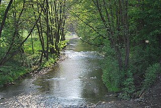
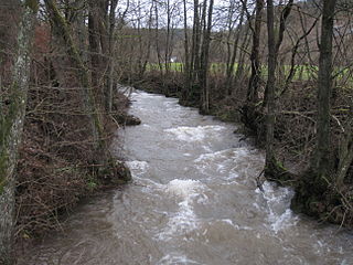
Ahr is a river in Germany, a left tributary of the Rhine. Its source is at an elevation of approximately 470 metres (1,540 ft) above sea level in Blankenheim in the Eifel, in the cellar of a timber-frame house near the castle of Blankenheim. After 18 kilometres (11 mi) it crosses from North Rhine-Westphalia into Rhineland-Palatinate.

The Rur or Roer is a major river that flows through portions of Belgium, Germany and the Netherlands. It is a right (eastern) tributary to the Meuse. About 90 percent of the river's course is in Germany.

The Düssel is a small right tributary of the river Rhine in North Rhine Westphalia, Germany. Its source is east of Wülfrath. It flows westward through the Neander Valley where the fossils of the first Neanderthal man were found in August 1856. At Düsseldorf it forms a river delta by splitting into four streams, which all join the Rhine after a few kilometres. The Nördliche Düssel flows through the Hofgarten and passes under the Golden Bridge.

The Agger is a river in Germany, a right arm of the Sieg in North Rhine-Westphalia. It is 69.5 kilometres (43.2 mi) long. Its source is in the Sauerland hills, near Meinerzhagen. It winds through the towns Engelskirchen, Overath and Lohmar. Near Siegburg the Agger flows into the Sieg.

Kall is a municipality in the district of Euskirchen in the state of North Rhine-Westphalia, Germany. It is located in the Eifel hills, approximatively 20 km south-west of Euskirchen.

The Swist is a stream, 43.6 kilometres (27.1 mi) long, in the German Rhineland. It rises on the northern edge of the Eifel at 330 metres above sea level and empties rom the right and southeast into the Rhine tributary, the Erft, between Weilerswist and Bliesheim. Occasionally the Swist is also called the Swistbach, and locals often just call it der Bach.

The Große Aue is an 88 kilometres (55 mi) long, southwestern, left tributary of the River Weser in northern North Rhine-Westphalia and central Lower Saxony in Germany.
The Klosterbach is a right-hand tributary of the Große Aue, which is known as the Neuer Mühlenbach at the point where they join, in north Germany. The Klosterbach lies entirely within the parish of Rödinghausen in the district of Herford, North Rhine-Westphalia.
The Nordbach is a 1.7 kilometre long, left tributary of the Große Aue in East Westphalian Rödinghausen in the district of Herford in the German state of North Rhine-Westphalia

The Schierenbeke is a 2.4-kilometre (1.5 mi) long, left tributary of the Große Aue, or Neuer Mühlenbach as it is known in its upper reaches in the German state of North Rhine-Westphalia. The stream lies entirely within the East Westphalian parish of Rödinghausen in the district of Herford.

The Klever Reichswald is an Imperial forest in North Rhine-Westphalia (Germany) between the Rivers Rhine and Meuse at the German Dutch border. The forest is located in the municipal territory of Kleve, Goch, Kranenburg and Bedburg-Hau. It is the largest coherent wooded area of the lower Rhine and the largest coherent public state forest of North Rhine-Westphalia with an area of 51 km2.
The Ahler Bruchgraben is a left tributary of the River Else in the northeast of the German federal states of North Rhine-Westphalia and Lower Saxony. The stream is part of the Weser basin and drains a small area of the Ravensberg Hills.
Röhr is a river of North Rhine-Westphalia, Germany. It is a left tributary of the Ruhr river, which is a tributary of the Rhine. It flows into the Ruhr in Arnsberg-Hüsten.

The Armuthsbach is an 18.4-kilometre-long, orographically left-hand tributary of the Ahr in the German states of North Rhine-Westphalia and Rhineland-Palatinate.

Aa is a river of North Rhine-Westphalia, Germany. It is a left tributary of the Werre, which it joins in Herford. It is formed by the confluence of two small streams in Bielefeld-Milse. In its upper part, it is called Johannisbach.
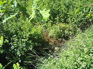
The Nonnenbach is a seven-kilometre-long tributary of the Ahr in the area of Blankenheim in the district of Euskirchen in the German state of North Rhine-Westphalia.
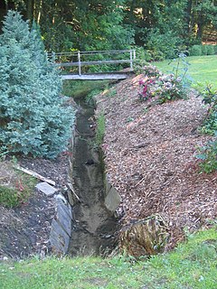
The Platißbach is a roughly seven-kilometre-long (4.3 mi), southern and orographically right-hand tributary of the River Olef in the municipality of Hellenthal in Germany.


