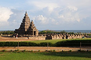
Tamil Nadu is the southern-most state of India. The tenth largest Indian state by area and the sixth largest by population, Tamil Nadu is the home of the Tamil people, whose Tamil language—one of the longest surviving classical languages in the world—is widely spoken in the state and serves as its official language. The capital and largest city is Chennai.

Coimbatore, also spelt as Koyamputhur, sometimes shortened as Kovai, is one of the major metropolitan cities in the Indian state of Tamil Nadu. It is located on the banks of the Noyyal River and surrounded by the Western Ghats. Coimbatore is the second largest city in Tamil Nadu after Chennai in terms of population and the 16th largest urban agglomeration in India as per the census 2011. It is administered by the Coimbatore Municipal Corporation and is the administrative capital of Coimbatore District. In 1981, Coimbatore formed as the third municipal corporation in Tamil Nadu after Chennai and Madurai. Podanur Junction is the oldest railway station in Coimbatore City. The city is one of the largest exporters of jewellery, wet grinders, poultry and auto components; the "Coimbatore Wet Grinder" and the "Kovai Cora Cotton" are recognised as Geographical Indications by the Government of India. Being a hub of textile industry in South India, the city is sometimes referred to as the "Manchester of South India". It was ranked the 7th best city in India in the Ease of Living index 2020.

Tiruchirappalli, also called Tiruchi or Trichy, is a major tier II city in the Indian state of Tamil Nadu and the administrative headquarters of Tiruchirappalli district. The city is credited with being the best livable city and the cleanest city of Tamil Nadu, as well as the fifth safest city for women in India. It is the fourth largest city as well as the fourth largest urban agglomeration in the state. Located 322 kilometres (200 mi) south of Chennai and 374 kilometres (232 mi) north of Kanyakumari, Tiruchirappalli sits almost at the geographic centre of Tamil Nadu state. The Cauvery Delta begins 16 kilometres (9.9 mi) west of the city where the Kaveri river splits into two, forming the island of Srirangam which is now incorporated into the Tiruchirappalli City Municipal Corporation. The city occupies an area of 167.23 square kilometres (64.57 sq mi) and had a population of 916,857 in 2011.

Salem, is a major city in Salem district, located on the banks of Thirumanimutharu river in the Indian state of Tamil Nadu. Salem is the Fifth largest urban agglomeration and metropolitan city in the state by next to Chennai, Coimbatore, Madurai, Tiruchirappalli in Tamil Nadu. Its area covering is 124 km2 (48 sq mi). Salem city has Major business in Silver Anklets, Sago, Mangoes, Steel, Textiles and larger exported value.

Thanjavur, also Tanjore, is a city in the Indian state of Tamil Nadu. Thanjavur is the 8th biggest city in Tamil Nadu. Thanjavur is an important center of South Indian religion, art, and architecture. Most of the Great Living Chola Temples, which are UNESCO World Heritage Monuments, are located in and around Thanjavur. The foremost among these, the Brihadeeswara Temple, built by the Chola emperor Rajaraja I, is located in the centre of the city. Thanjavur is also home to Tanjore painting, a painting style unique to the region. Thanjavur is the headquarters of the Thanjavur District. The city is an important agricultural centre located in the Kaveri Delta and is known as the Rice bowl of Tamil Nadu. Thanjavur is administered by a municipal corporation covering an area of 128.02 km2 (49.43 sq mi) and had a population of 590,720 in 2011. Roadways are the major means of transportation, while the city also has rail connectivity. The nearest airport is Tiruchirapalli International Airport, located 59.6 km (37.0 mi) away from the city. The nearest seaport is Karaikal, which is 94 km (58 mi) away from Thanjavur. The city first rose to prominence during the reign of the Cholas when it served as the capital of the empire. After the fall of the Cholas, the city was ruled by various dynasties such as the Mutharaiyar dynasty, the Pandyas, the Vijayanagar Empire, the Madurai Nayaks, the Thanjavur Nayaks, the Thanjavur Marathas and the British Empire. It has been a part of independent India since 1947.

Nagapattinam is a town in the Indian state of Tamil Nadu and the administrative headquarters of Nagapattinam District. The town came to prominence during the period of Medieval Cholas and served as their important port for commerce and east-bound naval expeditions. The Chudamani Vihara in Nagapattinam constructed by the Srivijayan king Sri Mara Vijayattungavarman of the Sailendra dynasty with the help of Rajaraja Chola I was an important Buddhist structure in those times. Nagapattinam was settled by the Portuguese and, later, the Dutch under whom it served as the capital of Dutch Coromandel from 1660 to 1781. In November 1781, the town was conquered by the British East India Company. It served as the capital of Tanjore district from 1799 to 1845 under Madras Presidency of the British. It continued to be a part of Thanjavur district in Independent India. In 1991, it was made the headquarters of the newly created Nagapattinam District. Nagapattinam is administered by a Special grade municipality covering an area of 17.92 km2 (6.92 sq mi) and had a population of 102,905 as of 2011.
Gobichettipalayam is the Selection grade municipality in the Indian state of Tamil Nadu. It is the administrative headquarters of Gobichettipalayam taluk. It is situated at the center of the South Indian Peninsula, 37 kilometres (23 mi) from the district headquarters Erode ,44 kilometres (27 mi) north of Tiruppur and 80 kilometres (50 mi) east of Coimbatore. Agriculture and textile industries contribute majorly to the economy of the town and is popularly known as the rice bowl of western Tamil Nadu. The town is situated at 213 metres (699 ft) above sea level, surrounded by Western Ghats.

Ariyalur district is an administrative district, one of the 38 districts in the state of Tamil Nadu in India. The district headquarters is located at Ariyalur. The district encompasses an area of 1,949.31 km².

Madurai district is one of the 38 districts of the state of Tamil Nadu in southeastern India. The city of Madurai serves as the district headquarters. It houses the famous Sri Meenakshi Sundareshwarar temple and is situated on the banks of the river Vaigai. Thiruparankundram is one of the major tourist place in the district. As of 2011, the district had a population of 3,038,252 with a sex-ratio of 990 females for every 1,000 males. Aside from the city of Madurai, the larger towns are Melur, Vadipatti, Thirumangalam, Thirupparankundram, Peraiyur, and Usilampatti. It is an important hub for various film shootings. Alanganallur is a popular spot in the district for Jallikattu, as are Palamedu and Avaniyapuram.

Tiruttani is a town in Tiruvallur district, suburb of Chennai within Chennai Metropolitan Area limit in state of Tamil Nadu, India. This town is famous for Tiruttani Murugan Temple which is one of the Arupadaiveedu and is dedicated to (Kartikeya) Murugan.In October 2022 Tiruttani is a part of Chennai Metropolitan Area.

Perambalur is a town in the Indian state of Tamil Nadu. It is the headquarters of Perambalur district and Perambalur taluk (sub-district). As of 2011 census, the town had a population of 49,648.
Tindivanam is a town and a municipality in Viluppuram district in the Indian state of Tamil Nadu. It is the second largest town in Villupuram District after the headquarters town Villupuram. Important roads from north to south Tamil Nadu pass through Tindivanam and similarly from west to east.
Papanasam taluk is a taluk of Thanjavur district of the Indian state of Tamil Nadu. The headquarters of the taluk is the town of Papanasam.
Udayarpalayam taluk is a taluk of Ariyalur district of the Indian state of Tamil Nadu. The headquarters of the taluk is the town of Jayankondam.

Sathyamangalam Tiger Reserve is a protected area and tiger reserve in the Eastern Ghats in the Erode District of the Indian state of Tamil Nadu. It has a tiger population of 83 individuals and a leopard population of 111 individuals according to the 2019 census.
Sulur taluk is a taluk of Coimbatore district of the Indian state of Tamil Nadu. The headquarters is the town of Sulur. This revenue block consist of 41 revenue villages.
Vadamadurai is a panchayat village in Thiruvallur district in the Indian state of Tamil Nadu.
Tiruppur or Tirupur is a city in the Indian state of Tamil Nadu. Tiruppur is the administrative headquarters of Tiruppur district and the Seventh largest city as well as an urban agglomeration in Tamil Nadu. Located on the banks of Noyyal River, it has been ruled at different times, by the Early Pandyas, Medieval Cholas, Later Cholas, Mysore Kingdom and the British. It is about 450 kilometres (280 mi) southwest of the state capital Chennai about 50 kilometres (31 mi) east of Coimbatore 50 kilometres (31 mi) south of Erode and 50 kilometres (31 mi) north of Dharapuram.
In the state of Tamil Nadu the most widely professed religion is Hinduism, with significant Christian and Muslim communities. Tamil Nadu has centers of worship for a multitude of faiths. According to 2011 Census of India figures, 87.6% of Tamil Nadu's population are Hindus, 6.12% are Christians, 5.86% are Muslims, 0.12% are Jains, 0.02% are Buddhists and 0.02% are Sikhs.
A Elavarasan is an Indian politician from the State of Tamil Nadu who belongs to the AIADMK party.

