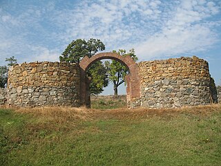
Kučajna

Last updated
Kučajna
Кучајна
Village
Serbia adm location map.svg
Red pog.svg
Kučajna
Coordinates: 44°27′05″N21°39′13″E / 44.45139°N 21.65361°E / 44.45139; 21.65361
CountryFlag of Serbia.svg  Serbia
District Braničevo District
Municipality Kučevo
Population (2002)
  Total 468
Time zone CET (UTC+1)
  Summer (DST) CEST (UTC+2)

Kučajna is a village in the municipality of Kučevo, Serbia. According to the 2002 census, the village has a population of 468 people. [1]

Village Small clustered human settlement smaller than a town

A village is a clustered human settlement or community, larger than a hamlet but smaller than a town, with a population ranging from a few hundred to a few thousand. Though villages are often located in rural areas, the term urban village is also applied to certain urban neighborhoods. Villages are normally permanent, with fixed dwellings; however, transient villages can occur. Further, the dwellings of a village are fairly close to one another, not scattered broadly over the landscape, as a dispersed settlement.

Kučevo Town and municipality in Southern and Eastern Serbia, Serbia

Kučevo is a town and municipality located in the Braničevo District of the eastern Serbia. In 2011, the population of the town was 3,950, while the population of the municipality was 15,490.

Serbia Republic in Southeastern Europe

Serbia, officially the Republic of Serbia, is a country situated at the crossroads of Central and Southeast Europe in the southern Pannonian Plain and the central Balkans. The sovereign state borders Hungary to the north, Romania to the northeast, Bulgaria to the southeast, North Macedonia to the south, Croatia and Bosnia and Herzegovina to the west, and Montenegro to the southwest. The country claims a border with Albania through the disputed territory of Kosovo. Serbia's population is about seven million. Its capital, Belgrade, ranks among the oldest and largest citiеs in southeastern Europe.

Related Research Articles

Stadio Alberto Braglia football stadium

Stadio Alberto Braglia is a football stadium in Modena, Italy. The stadium was built in 1936 and holds 21,092 people.

Ncaang village in Botswana

Ncaang is a village in Kgalagadi District of Botswana. It is located in the northern part of the district, in Kalahari Desert. The population was 228 in 2011 census.

Kalwińszczyna is a village in the administrative district of Gmina Sidra, within Sokółka County, Podlaskie Voivodeship, in north-eastern Poland.

Qaragöz, Zangilan Place in Zangilan, Azerbaijan

Qaragöz is a village in the Zangilan Rayon of Azerbaijan.

Bayrambinə Place in Balakan, Azerbaijan

Bayrambinə is a village in the Balakan Rayon of Azerbaijan. The village forms part of the municipality of Talalar.

Nowa Dąbia is a village in the administrative district of Gmina Ryki, within Ryki County, Lublin Voivodeship, in eastern Poland.

Nagodów is a village in the administrative district of Gmina Gostynin, within Gostynin County, Masovian Voivodeship, in east-central Poland.

Brzostowiec is a village in the administrative district of Gmina Mogielnica, within Grójec County, Masovian Voivodeship, in east-central Poland.

Podmieście is a village in the administrative district of Gmina Głowaczów, within Kozienice County, Masovian Voivodeship, in east-central Poland.

Stara Wieś Druga is a village in the administrative district of Gmina Kołbiel, within Otwock County, Masovian Voivodeship, in east-central Poland.

Łępice is a village in the administrative district of Gmina Pokrzywnica, within Pułtusk County, Masovian Voivodeship, in east-central Poland.

Wola Taczowska is a village in the administrative district of Gmina Zakrzew, within Radom County, Masovian Voivodeship, in east-central Poland.

The Serbia Open was an ATP World Tour 250 series men's tennis tournament held in Belgrade, Serbia and played on outdoor clay courts. The event was held for the first time in 2009, from May 4–10. It was the first for Serbia, as the country never before hosted an Association of Tennis Professionals or a Women's Tennis Association tournament.

Diana Fortress

The Diana Fortress is a Roman castrum built in 100-101 AD, located in Kladovo, in eastern Serbia.

Zlatance Village in Jablanica District, Serbia

Zlatance is a village in the municipality of Crna Trava, Serbia. According to the 2002 census, the village has a population of 158 people.

Uništa, Bosansko Grahovo Village in Federation of Bosnia and Herzegovina, Bosnia and Herzegovina

Uništa is a village in the municipality of Bosansko Grahovo, Bosnia and Herzegovina.

Stragari (Trstenik) Village in Rasina District, Serbia

Stragari is a village in the municipality of Trstenik, Serbia. According to the 2002 census, the village has a population of 664 people.

Yemişli is a village in the District of Karataş, Adana Province, Turkey.

Slivje Village in Nišava District, Serbia

Slivje is a village in the municipality of Svrljig, Serbia. According to the 2002 census, the village has a population of 130 people.

Chamazak is a village in Rudpey-ye Jonubi Rural District, in the Central District of Sari County, Mazandaran Province, Iran. At the 2006 census, its population was 184, in 44 families.

References

  1. Popis stanovništva, domaćinstava i Stanova 2002. Knjiga 1: Nacionalna ili etnička pripadnost po naseljima. Republika Srbija, Republički zavod za statistiku Beograd 2003. ISBN   86-84433-00-9

Coordinates: 44°27′05″N21°39′13″E / 44.45139°N 21.65361°E / 44.45139; 21.65361

Geographic coordinate system Coordinate system

A geographic coordinate system is a coordinate system that enables every location on Earth to be specified by a set of numbers, letters or symbols. The coordinates are often chosen such that one of the numbers represents a vertical position and two or three of the numbers represent a horizontal position; alternatively, a geographic position may be expressed in a combined three-dimensional Cartesian vector. A common choice of coordinates is latitude, longitude and elevation. To specify a location on a plane requires a map projection.