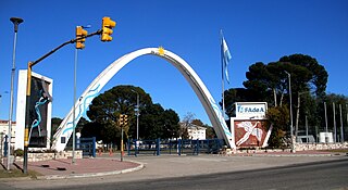
The Fábrica Argentina de Aviones SA (FAdeA), officially Fábrica Argentina de Aviones "Brigadier San Martín" S.A., is Argentina's main aircraft manufacturer. Founded on 10 October 1927 and located in Córdoba, for most of its existence it was known as Fábrica Militar de Aviones (FMA), until its privatization in the 1990s to Lockheed Martin. In 2009 the concession ended and is now wholly owned by the Argentine government.

North Bass Island is an island of the U.S. state of Ohio located in Lake Erie. A small unincorporated community, Isle Saint George, is on the island. The North Bass Island Post Office was established on May 25, 1864, and the name changed to Isle Saint George Post Office on March 2, 1874. The Isle Saint George ZIP code 43436 provides PO Box service.

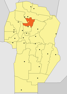
The Punilla Valley is a broad fluvial valley in the province of Córdoba, Argentina. It is located in the center-northwest of the province, bordered by the Sierras Chicas in the east and the Sierras Grandes and the Pampa Achala in the west, oriented from north to south. In the southern part of the valley lies the San Roque Lake, fed mainly by the San Antonio River and the Cosquín River.
Jovita is a town located south of the Province of Córdoba, in central Argentina.
The Alkali Lake Indian Band, also known as the Esketemc First Nation, is a First Nations government of the Secwepemc (Shuswap) people, located at Alkali Lake in the Cariboo region of the Central Interior of the Canadian province of British Columbia. It was created when the government of the then-Colony of British Columbia established an Indian Reserve system in the 1860s. It is one of three Secwepemc bands that is not a member of either the Shuswap Nation Tribal Council or the Northern Shuswap Tribal Council.
The Compton Névé is an icefield in the Pacific Ranges of the Coast Mountains in southwestern British Columbia, Canada, located southeast of the Homathko Icefield and Mount Gilbert and to the south of the Bishop River. It lies west of the Lillooet Icecap and is connected to it by the Ring Glacier, which sits astride Ring Pass, the divide between the Lillooet and Bishop Rivers, and has an area of 714 km2 (276 sq mi).
The Horseranch Range is a 40 km (25 mi) long north-south trending mountain range in northern British Columbia, Canada, located at the head of the Red River to the northwest of Deadwood Lake. Part of the Dease Plateau of the Cassiar Mountains system, it contains no glaciers and lies completely above tree line.
The Boas is a river on Southampton Island in Nunavut, Canada. The river rises at 64°49′58″N084°23′34″W and its mouth is located at the Bay of Gods Mercy. Proceeding inland, the river becomes braided and is about 5 kilometres (3.1 mi) wide.

The National University of Northwestern Buenos Aires is a national university with head office and campus in Junín, Argentina. This city concentrates 80% of the activities, and nearly 2 out of 3 students take classes there. The university has also a campus in Pergamino city.

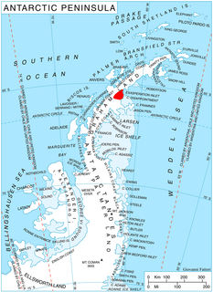
Pirin Glacier is the 5.7 km long and 6 km wide glacier situated next east of Chavdar Peninsula on Davis Coast on the Antarctic Peninsula. Situated west of Wright Ice Piedmont, north of Gregory Glacier and east of Samodiva Glacier. Draining north-northwestwards from Boulton Peak to enter Curtiss Bay east of Seaplane Point.

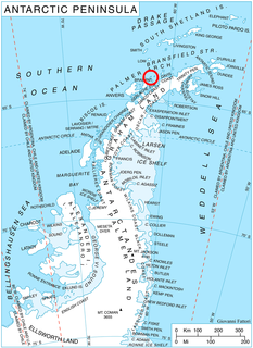
Malorad Glacier is the 14 km long and 10.5 km wide glacier on Trinity Peninsula, Antarctic Peninsula. Situated north of Russell West Glacier, and bounded by Marescot Ridge to the northeast, Louis-Philippe Plateau to the southeast, Srednogorie Heights to the south and Hanson Hill to the southwest. Draining northwestwards to enter Bransfield Strait east of Cape Roquemaurel and west of Thanaron Point.

Kutlovitsa Glacier is the 9.4 km long and 4.2 km wide glacier in southern Aristotle Mountains on Oscar II Coast in Graham Land, Antarctica situated north of Flask Glacier. It is draining the southeast slopes of Madrid Dome, and flowing southeastwards along the north slopes of Mount Fedallah to join Belogradchik Glacier.

Solari Bay is the 11.2 km wide bay indenting for 4.5 km Nordenskjöld Coast in Graham Land north of Balvan Point and south of the east extremity of Richard Knoll. It was formed as a result of the break-up of Larsen Ice Shelf in the area in the late 20th century, and subsequent retreat of Drygalski Glacier. The feature is named after the settlement of Solari in Northern Bulgaria.

Kran Peninsula is the heavily indented peninsula forming the northeast extremity of Liège Island in the Palmer Archipelago, Antarctica. It extends 2.85 km in north-south direction and 2.35 km in east-west direction, ending up in Moureaux Point to the north and Neyt Point to the east, and connected to the rest of the island by a 200 m wide neck to the south.
Rolling Prairie was a South Shore Line flag stop located at County Road 500 East which served the communities of Rolling Prairie and Birchim in LaPorte County, Indiana. The station opened prior to 1910, and closed on July 5, 1994, as part of an NICTD service revision which also saw the closure of Ambridge, Kemil Road, Willard Avenue, LaLumiere, and New Carlisle.
Copper Peak is a peak, 1,125 metres (3,691 ft) high and vivid green in color, standing 2 nautical miles (3.7 km) north-northeast of Billie Peak on the southeast side of Anvers Island, in the Palmer Archipelago. First seen by the Belgian Antarctic Expedition under Adrien de Gerlache (1897-99). The descriptive name appears on a chart based on a 1927 survey by DI personnel on the RRS Discovery.
Hewitt Bay is a rectangular bay 1 nautical mile (1.9 km) long between Biscoe Point and Access Point on Anvers Island in the Palmer Archipelago. Named by the Advisory Committee on Antarctic Names in 2007 after Roger P. Hewitt of the Antarctic Ecosystem Research Group, Southwest Fisheries Science Center, La Jolla, CA; leader of surveys of the ecosystem in waters adjoining the South Shetland Islands and northern Antarctic Peninsula from 1989 to 2005; convener of the Commission for the Conservation of Antarctic Marine Living Resources (CCAMLR) working group from 2000 to 2005.

Quaker Harbour is the irregularly shaped bay indenting for 3.7 km the north coast of Weddell Island in the Falkland Islands. It is centred at 51°49′00″S61°04′35″W, and has its head fed by Pitt Creek. The bay takes its name from nearby Quaker Island.


