La Portera | |
|---|---|
 La Portera | |
 Interactive map of La Portera | |
| Country | Spain |
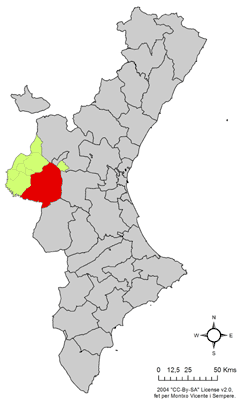
| Province | Valencia |
| Municipality | Requena |
| Comarca | Requena-Utiel |
| Population (2015) | |
• Total | 134 |
La Portera is a village in Valencia, Spain. It is part of the municipality of Requena. [1]