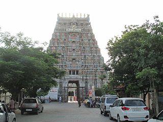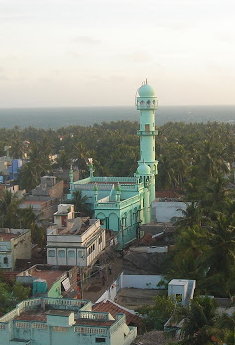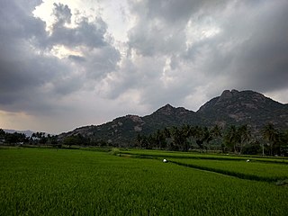
Ariyalur district is an administrative district, one of the 38 districts in the state of Tamil Nadu in India. The district headquarters is located at Ariyalur. The district encompasses an area of 1,949.31 km2.

Perambalur is one of the 38 districts in the state of Tamil Nadu, India. The district headquarters is located at Perambalur. The district occupies an area of 1,752 km2 and had a population of 565,223 with a sex-ratio of 1,003 females for every 1,000 males in 2011.

Tiruchirappalli District is one of the 38 districts, located along the Kaveri River, in Tamil Nadu, India. The headquarters of the district is the city of Tiruchirappalli.

Karur District is one of the 38 districts in the Indian state of Tamil Nadu. The main town in Karur District is the city of Karur, which is also the district headquarters. The district has a population of 1,064,493 with a sex-ratio of 1,015 females for every 1,000 males, according to 2011 census.

Cuddalore District is one of the 38 districts in the state of Tamil Nadu in India.

The Perambalur District is in the center of Tamil Nadu and is 267 kilometers from Chennai in the south. The district covers an area of 1,757 square kilometers, located between 10.54' and 11.30' degrees of Northern latitude and 78.40' and 79.30' degrees of Eastern longitude. There are no coastal lines in this inland district.

Jayankondam is a First Grade Municipality in Ariyalur district of Tamil Nadu in India. As of 2023, the town had a population of 46,000.

Kulithalai is a municipality in Karur district & Sub-urb of Tiruchirapalli City in the Indian state of Tamil Nadu. The recorded history of Kulithalai is known from Cheras, followed by medieval Chola period of the 9th century and has been ruled, at different times, by the Medieval Cholas, Later Cholas, Later Pandyas, Vijayanagar Empire and the British.

Lalgudi is a prominent municipality located in the Tiruchirapalli district of Tamil Nadu, India. This region has historical and cultural significance, serving as the administrative center for various divisions including Lalgudi taluk, Lalgudi Educational District, and Lalgudi DSP. Its importance stems from its governance structure, educational institutions, and constituency representation, as it has been part of the legislative assembly since 1952.
Thammampatti is a Town Panchayat in the Gangavalli taluk of Salem District of Tamil Nadu, India. The town is located between Pachamalai and the Kolli Hills on the banks of the River Swetha bordering Tiruchirappalli district, and is known mainly for its fine wood carvings.

Thuraiyur is a municipality in the Tiruchirappalli district in the Indian state of Tamil Nadu. It was upgraded to a III Grade Municipality from Town Panchayat on 17 January 1970, and to a II Grade Municipality in May 1998. It was upgraded to Selection Grade Municipality in the year 2008. It is also a taluka. It is located 310 km away from Chennai.

Ariyalur is a town and district headquarters of Ariyalur district in the South Indian state of Tamil Nadu and is rich in limestone, surrounded with seven cement factories and two sugar factories. The town is located at a distance of 310 km (190 mi) from the state capital Chennai.
Kulasekharam is a town located in the district of Kanyakumari, Tamil Nadu, India. It is one of the most important business centres in the district, after Marthandam.

Pudumadam is a village located in the Ramanathapuram district of the Indian state of Tamil Nadu. Situated near the old National Highway 49, which connects Kochi and Dhanushkodi, Pudumadam serves as a vital gateway to the picturesque Pamban Island. The village is approximately 25 kilometers away from the city of Ramanathapuram and 37 kilometers away from the renowned pilgrimage site of Rameswaram. The nearest train station is Uchippuli, located just 4 kilometers away from Pudumadam.
Brammadesam is an Indian Panchayat village located in Tindivanam taluk of Villupuram district in the state of Tamil Nadu. It is one of the 56 village panchayats coming under Marakkanam block of the Villupuram district. The village code for Brahmadesam is 10 and it falls under the Marakkanam Block. Br Guys team at brammadesam.

Tiruchirappalli has a well-developed transport infrastructure. Being located almost at the geographic centre of the state Tamil Nadu India, Tiruchirappalli is well connected by Road, Rail and Air with most cities.
V Kalathur is a village in Veppanthattai taluk of Perambalur district, Tamil Nadu, India. It lies at a distance of 28 km to the north of the district headquarters Perambalur. Nearest Airport is Tiruchirappalli Airport, situated at a distance of 85 km from the village.

The Perambalur Buddhas are a set of historic Buddhist images found in Thiyaganur, a village in salem district in the South Indian state of Tamil Nadu. There are two 6 ft (1.8 m) images of Buddha in sitting posture, one of which is enshrined in a small temple and various other images scattered in the village. The temple is the only extant Buddhist temple in the state. One of the images in a private farm was later housed in a meditation hall built during 2013 with the help of public contributions. Historians identify the images to the 11th century. With the presence of the images, Thyaganur is counted among Madurai, Kanchipuram, Nagapattinam, Uraiyur, Kaveripattinam and Perambalur among famous Buddhist centres in Tamil Nadu. The villagers administer the temple and practise worship similar to Hindu worship practises. The images are spread across three villages, namely, Paravai, Okalur and Perumathur with a majority found in Paravai.

Kallakurichi is one of the 38 districts in the state of Tamil Nadu in India. The district headquarter is Kallakurichi. Kallakurichi District was announced on 8 January 2019 and it came into existence on 26 November 2019.

Ranipet district is one of the 38 districts of Tamil Nadu, India, formed by trifurcating Vellore district. The Government of Tamil Nadu announced its proposal on 15 August 2019, together with Tirupattur district, and it was officially declared on 28 November 2019 by Tamil Nadu Government. The town of Ranipet is the district headquarters.


