Lahomno

Last updated
Lahomno
Slovenia location map.svg
Red pog.svg
Lahomno
Location in Slovenia
Coordinates: 46°8′32.93″N15°15′47.81″E / 46.1424806°N 15.2632806°E / 46.1424806; 15.2632806 Coordinates: 46°8′32.93″N15°15′47.81″E / 46.1424806°N 15.2632806°E / 46.1424806; 15.2632806
Country Flag of Slovenia.svg Slovenia
Traditional region Styria
Statistical region Savinja
Municipality Laško
Area
  Total 1.82 km2 (0.70 sq mi)
Elevation 281.9 m (924.9 ft)
Population (2002)
  Total 243
[1]

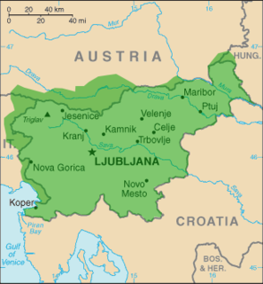
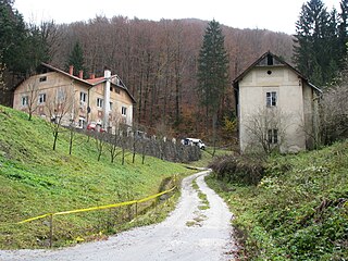
Lahomno (pronounced  [laˈxoːmnɔ] ) is a settlement in the Municipality of Laško in eastern Slovenia. It lies in the valley of Lahomnica Creek [2] (also known as Lahomščica Creek), [3] a minor left tributary of the Savinja River east of Laško. The area was traditionally part of the Styria region. It is now included with the rest of the municipality in the Savinja Statistical Region. [4]

Municipality of Laško Municipality in Slovenia

The Municipality of Laško is a municipality in eastern Slovenia. The seat of the municipality is the town of Laško. Traditionally the area was part of the Styria region. The municipality is now included in the Savinja Statistical Region.

Slovenia republic in Central Europe

Slovenia, officially the Republic of Slovenia, is a sovereign state located in southern Central Europe at a crossroads of important European cultural and trade routes. It is bordered by Italy to the west, Austria to the north, Hungary to the northeast, Croatia to the southeast, and the Adriatic Sea to the southwest. It covers 20,273 square kilometers (7,827 sq mi) and has a population of 2.07 million. One of the successor states of the former Yugoslavia, Slovenia is a parliamentary republic and a member of the United Nations, of the European Union, and of NATO. The capital and largest city is Ljubljana.

Savinja river in Slovenia

The Savinja is a river in northeast Slovenia which flows mostly in the Upper and Lower Savinja Valley and through the cities of Celje and Laško. The Savinja is the main river of the Savinja Alps. It flows into the Sava River at the town of Zidani Most. It has often flooded, such as in the 1960s, 1990, and 1995. The Savinja has a length of 101.75 kilometres (63.22 mi) and a catchment area of 1,847.7 km2 (713.4 sq mi).

Contents

Name

Lahomno was first attested in written sources in 1209 and 1212–27 as Lachomel (and as Lochmel in 1280–95, and Lochomel in 1338). The name is believed to be derived from *Vlaxomьno selo (literally, 'Vlaxomъ's village'), based on a nickname for Vladislav. Accentual and morphological evidence makes it unlikely that the name is connected with Slovene Lah 'Vlach, Romance-language speaker'. [5]

Vlachs ethnic group

Vlachs, also Wallachians, is a historical term from the Middle Ages that designates an exonym—a name that foreigners use—mostly for the Romanians who lived north and south of the Danube.

Romance languages all the related languages derived from Vulgar Latin

The Romance languages are the modern languages that evolved from Vulgar Latin between the third and eighth centuries and that form a subgroup of the Italic languages within the Indo-European language family.

Mass graves

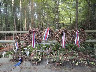
Lahomno is the site of four unmarked or mass graves from the end of the Second World War. The Lahomščica 1 and 2 graves (Slovene : Grobišče ob Lahomščici 1, 2) both lie along Lahomščica Creek and each contain the remains of one person, probably a Croatian, buried in the first half of May 1945. The first grave is located by the first tree to the right of the bridge on the path to Marija Gradec. [6] The second grave is located opposite the Lešnik farm and 70 m before the side road to Harje. [7] The Lahomščica 3 Mass Grave (Grobišče ob Lahomščici 3) lies on the left bank of Reka Creek, a tributary of the Lahomščica. It contained the remains of seven Ustaša soldiers that were disinterred in 1990. [8] The Lahomno No. 62 Mass Grave (Grobišče pri hiši Lahomno 62) lies along the road by the farm at Lahomno No. 62, by a hornbeam hedge. It contains the remains of three people. [9]

Mass graves in Slovenia

Mass graves in Slovenia were created in Slovenia as the result of extrajudicial killings during and after the Second World War. They are known as "concealed mass graves" or "silenced mass graves" because their existence was concealed under the communist regime from 1945 to 1990.

Slovene language language spoken in Slovenia

Slovene or Slovenian belongs to the group of South Slavic languages. It is spoken by approximately 2.5 million speakers worldwide, the majority of whom live in Slovenia. It is the first language of about 2.1 million Slovenian people and is one of the 24 official and working languages of the European Union.

Marija Gradec in Styria, Slovenia

Marija Gradec is a settlement in the Municipality of Laško in eastern Slovenia. It lies on the left bank of the Savinja River, just south of the town of Laško. The area was traditionally part of the Styria region. It is now included with the rest of the municipality in the Savinja Statistical Region.

Related Research Articles

Bistrica ob Sotli Place in Styria, Slovenia

Bistrica ob Sotli is a settlement in eastern Slovenia. It is the seat of the Municipality of Bistrica ob Sotli. The settlement lies on a river terrace above the right bank of the Sotla River. The area traditionally belonged to the region of Styria. It is now included in the Lower Sava Statistical Region; until January 2014 it was part of the Savinja Statistical Region. The settlement includes the hamlets of Čehovec, Koče, and Marof.

Bukovžlak Place in Styria, Slovenia

Bukovžlak is a settlement in the City Municipality of Celje in eastern Slovenia. It lies on the eastern outskirts of Celje, just north of Teharje. The area was traditionally part of the Styria region. It is now included with the rest of the municipality in the Savinja Statistical Region.
Šmartno pri Slovenj Gradcu Place in Styria, Slovenia

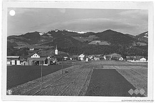
Šmartno pri Slovenj Gradcu is a settlement in the City Municipality of Slovenj Gradec in northern Slovenia. The area was traditionally part of Styria. The entire municipality is now included in the Carinthia Statistical Region.

Zgornji Otok Place in Upper Carniola, Slovenia

Zgornji Otok is a settlement in the Municipality of Radovljica in the Upper Carniola region of Slovenia.

Vincarje Place in Upper Carniola, Slovenia

Vincarje is a settlement in the Municipality of Škofja Loka in the Upper Carniola region of Slovenia.

Brce Place in Inner Carniola, Slovenia

Brce is a small settlement in the hills west of Ilirska Bistrica in the Inner Carniola region of Slovenia.

Dolenje pri Jelšanah Place in Inner Carniola, Slovenia

Dolenje pri Jelšanah is a village north of Jelšane in the Municipality of Ilirska Bistrica in the Inner Carniola region of Slovenia, next to the border with Croatia. The settlement includes the hamlets of Dolnji Kraj, Gornji Kraj, and Vrh Žloštajna.

Harije Place in Inner Carniola, Slovenia

Harije is a village in the hills west of Ilirska Bistrica in the Inner Carniola region of Slovenia.
Huda Jama Place in Styria, Slovenia

Huda Jama is a settlement east of Laško in east-central Slovenia. The area was traditionally part of the Styria region. It is now included with the rest of the Municipality of Laško in the Savinja Statistical Region.

Dol, Gornji Grad Place in Styria, Slovenia

Dol is a small settlement in the Upper Dreta Valley in the Municipality of Gornji Grad in Slovenia. Traditionally the area belonged to the Styria region and is now included in the Savinja Statistical Region.

Ples, Bistrica ob Sotli Place in Styria, Slovenia

Ples is a settlement in the hills above the right bank of the Sotla River in the Municipality of Bistrica ob Sotli in eastern Slovenia. The area was traditionally part of Styria. It is now included in the Lower Sava Statistical Region; until January 2014 it was part of the Savinja Statistical Region.

Mostec Place in Styria, Slovenia

Mostec is a village in the Municipality of Brežice in eastern Slovenia. The area was traditionally part of Styria. It is now included in the Lower Sava Statistical Region.

Olešče Place in Styria, Slovenia

Olešče is a settlement in the Municipality of Laško in eastern Slovenia. It lies in the hills east of Laško. The area was traditionally part of the Styria region. It is now included with the rest of the municipality in the Savinja Statistical Region.

Bezovica, Vojnik Place in Styria, Slovenia

Bezovica is a small settlement in the Municipality of Vojnik in eastern Slovenia. The area was traditionally part of the Styria region. It is now included with the rest of the municipality in the Savinja Statistical Region.

Dovže Place in Carinthia, Slovenia

Dovže is a village in the Municipality of Mislinja in northern Slovenia. The area was traditionally part of Carinthia. It is now included in the Carinthia Statistical Region.

Bele Vode, Šoštanj Place in Styria, Slovenia

Bele Vode is a settlement in the Municipality of Šoštanj in northern Slovenia. It lies in the Mozirje Hills northwest of the town of Šoštanj. The area is part of the traditional region of Styria. The entire municipality is now included in the Savinja Statistical Region. The settlement includes the hamlets of Kloše, Punčkov Vrh, Visočki Vrh, and Zaloka.

Zabukovica Place in Styria, Slovenia

Zabukovica is a settlement in the Municipality of Žalec in east-central Slovenia. It lies in the hills south of Žalec. The area is part of the traditional region of Styria. The Municipality of Žalec is included in the Savinja Statistical Region. Zabukovica includes the hamlets of Kurja Vas, Močle, Odele, Podvine, Porence, Slovenski Dol, Sončni Hrib, and Zabukovška Vas.

Marija Reka Place in Styria, Slovenia

Marija Reka is a settlement in the Municipality of Prebold in east-central Slovenia. It lies in the hills south of Prebold. The area is part of the traditional region of Styria. The municipality is now included in the Savinja Statistical Region. The settlement includes the hamlets of Mala Reka, Velika Reka, and Jelenca.

Čužnja Vas Place in Lower Carniola, Slovenia

Čužnja Vas is a village in the hills southeast of Mokronog in the Municipality of Mokronog-Trebelno in southeastern Slovenia. The area is part of the historical region of Lower Carniola and is now included in the Southeast Slovenia Statistical Region. The village includes the hamlets of Jerenga, Sela, and Zapadeži.

Breg, Sevnica Place in Styria, Slovenia

Breg is a settlement on the left bank of the Sava River in the Municipality of Sevnica in central Slovenia. The area is part of the historical region of Styria. The municipality is now included in the Lower Sava Statistical Region. The settlement includes the hamlets of Gradišče, Jelše, and Zagradec.

References

  1. Statistical Office of the Republic of Slovenia
  2. Savnik, Roman, ed. 1976. Krajevni leksikon Slovenije, vol. 3. Ljubljana: Državna založba Slovenije. pp. 185–186.
  3. Karmelska Mati božja v Marija Gradcu (in Slovene)
  4. Laško municipal site
  5. Snoj, Marko. 2009. Etimološki slovar slovenskih zemljepisnih imen. Ljubljana: Modrijan and Založba ZRC, p. 224.
  6. Lahomščica 1 Grave on Geopedia (in Slovene)
  7. Lahomščica 2 Grave on Geopedia (in Slovene)
  8. Lahomščica 3 Mass Grave on Geopedia (in Slovene)
  9. Lahomno No. 62 Mass Grave on Geopedia (in Slovene)