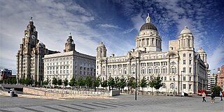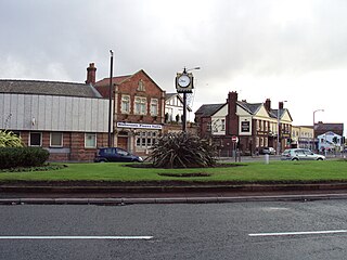
Merseyside is a ceremonial and metropolitan county in North West England. It borders Lancashire to the north, Greater Manchester to the east, Cheshire to the south, the Welsh county of Flintshire across the Dee Estuary to the southwest, and the Irish Sea to the west. The largest settlement is the city of Liverpool.

Birkenhead is a town in the Metropolitan Borough of Wirral, Merseyside, England; It was part of Cheshire until 1974. The town is on the Wirral Peninsula, along the west bank of the River Mersey, opposite Liverpool. At the 2011 census, it had a population of 88,818.

Bidston is a village and civil parish in the Metropolitan Borough of Wirral in Merseyside, England.

Oxton is a suburb of Birkenhead, Merseyside, England. Administratively it is a ward of the Metropolitan Borough of Wirral. Originally a village in its own right, it became part of the Municipal Borough of Birkenhead upon its creation in 1877. Before local government reorganisation on 1 April 1974, it was part of the County Borough of Birkenhead, within the county of Cheshire.

Moreton is a town in the Metropolitan Borough of Wirral in Merseyside, England. Located on the north coast of the Wirral Peninsula, it is approximately 3 mi (4.8 km) to the west of Wallasey. Historically part of Cheshire and now within the Metropolitan Borough of Wirral, the town was divided in 2004 between the local government wards of Leasowe & Moreton East and Moreton West & Saughall Massie. Moreton is also part of the parliamentary constituency of Wallasey.

Tranmere is a suburb of Birkenhead, on the Wirral Peninsula, England. Administratively, it is within the Birkenhead and Tranmere Ward of the Metropolitan Borough of Wirral, in Merseyside. Before local government reorganisation on 1 April 1974, it was part of the County Borough of Birkenhead, within the county of Cheshire.

The Great Float is a body of water on the Wirral Peninsula, England, formed from the natural tidal inlet, the Wallasey Pool. It is split into two large docks, East Float and West Float, both part of the Birkenhead Docks complex. The docks run approximately 2 miles (3 km) inland from the River Mersey, dividing the towns of Birkenhead and Wallasey. The Great Float consists of 110 acres (45 ha) of water and more than 4 miles (6 km) of quays.

The Wirral Railway was a railway network in the northern part of the Wirral Peninsula, England. Its route was from Birkenhead Park in the east of the Wirral to West Kirby in the west. A branch off this line at Bidston went north to Secombe and New Brighton. It was incorporated in 1863 as the Hoylake Railway, running from Hoylake to Birkenhead Docks. After changes of name and of ownership, it was purchased by the Wirral Railway Company Limited in 1884. The network was extended to West Kirby, New Brighton, and Seacombe, and to Birkenhead Park station where it joined the Mersey Railway, enabling through trains through the Mersey Railway Tunnel to Liverpool. In the 1923 grouping the Wirral company became part of the London, Midland and Scottish Railway, which electrified the line in 1938, allowing passenger services to be integrated with the Liverpool urban system. Most of the Wirral Railway network is still in use today as part of the Wirral Line of the Merseyrail rail network.

The Wirral Peninsula, known locally as the Wirral, is a peninsula in North West England. The roughly rectangular peninsula is about 15 miles (24 km) long and 7 miles (11 km) wide, and is bounded by the Dee Estuary to the west, the Mersey Estuary to the east, and Liverpool Bay to the north.

Birkenhead School is a private, academically-selective, co-educational day school located in Oxton, Wirral, in North West England. The school offers educational opportunities for girls and boys from three months to eighteen years of age.

The Wirral line is one of two commuter rail routes operated by Merseyrail and centred on Merseyside, England, the other being the Northern line.

Bidston railway station serves the village of Bidston, in Merseyside, England. It is situated at a junction of the West Kirby branch of the Wirral line, which is part of the Merseyrail network; it also serves as the northern terminus for the Borderlands line to Wrexham Central, with services operated by Transport for Wales.

Birkenhead North railway station serves the town of Birkenhead, in Merseyside, England. The station is situated on the Wirral Line of the Merseyrail network, close to the junction of the New Brighton and West Kirby branches. Birkenhead North TMD, situated just to the west of the station, is the main traction maintenance depot for the Merseyrail fleet.

Bidston Hill is 100 acres (0.40 km2) of heathland and woodland containing historic buildings and ancient rock carvings, on the Wirral Peninsula, near the Birkenhead suburb of Bidston, in Merseyside, England. With a peak of 231 feet (70 m), Bidston Hill is one of the highest points on the Wirral. The land was part of Sir Robert Vyner's estate and purchased by Birkenhead Corporation in 1894 for use by the public.

Upton railway station serves the village of Upton and the Noctorum area of Birkenhead, on the Wirral Peninsula, England. The station is situated on the Borderlands line. Transport for Wales operates the station and all trains serving it.

Rock Ferry is an area of Birkenhead on the Wirral Peninsula, England. Administratively it is a ward of the Metropolitan Borough of Wirral. Before local government reorganisation on 1 April 1974, it was part of the county of Cheshire. At the 2011 Census, the population was 14,298.

Birkenhead Dock Branch is a disused railway line running from the South junction of Rock Ferry, to the site of the former Bidston Dock on the Wirral Peninsula, England. The branch is approximately 4+1⁄2 miles (7.2 km) in length. Although called a branch, the line was accessible from both ends, from Bidston East junction and from Rock Ferry railway station. The former Mollington Street Rail Depot was branched into the line. A section of the line runs through Haymarket Tunnel and a low-level cutting through the centre of Birkenhead; visible from the road flyovers. The former Canning Street North signal box has now been demolished following fire damage, and the rails across the level crossing there have been removed due to the provision of cycle lanes on the roadway. The non-standard gates remain on the east side, but a fence has been erected on the other side despite the railway being officially out of use, rather than closed. Level crossings are also located at Duke Street and Wallasey Bridge Road. The railway lines are still partially intact.

Claughton is a village and suburb of Birkenhead, on the Wirral Peninsula, Merseyside, England. It is situated approximately 3 km (1.9 mi) to the west of Birkenhead town centre, adjacent to Birkenhead Park. Administratively, Claughton is a ward of the Metropolitan Borough of Wirral. Before local government reorganisation on 1 April 1974, it was part of the County Borough of Birkenhead, within the county of Cheshire.

Birkenhead General Hospital was a hospital situated on Park Road North, between Prince Edward Street and Livingstone Street, in Birkenhead, England.

Beechwood is a housing estate in the west of Birkenhead, on the Wirral Peninsula, in Merseyside, England. Administratively it is within the Metropolitan Borough of Wirral as part of Bidston and St James Ward. The area is bounded by Bidston to the north, Upton to the west and Noctorum to the south. The elevation of Bidston Hill is immediately to the east.


