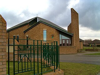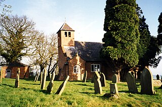
A hamlet is a small human settlement. In different jurisdictions and geographies, hamlets may be the size of a town, village or parish, be considered a smaller settlement or subdivision or satellite entity to a larger settlement. The word and concept of a hamlet have roots in the Anglo-Norman settlement of England, where the old French hamlet came to apply to small human settlements. In British geography, a hamlet is considered smaller than a village and distinctly without a church.

Holwick is a small village in Teesdale, north-east England. Located in the Pennine hills, it consists of a few houses spread along a road in the pattern of a linear settlement. As the population taken at the 2011 Census was less than 100, details are maintained in the parish of Lunedale.
Wasdale is a valley and civil parish in the western part of the Lake District National Park in Cumbria, England. The River Irt flows through the valley to its estuary at Ravenglass. A large part of the main valley floor is occupied by Wastwater, the deepest lake in England (258 feet). The population of Wasdale was only minimal and, from the 2011 Census is included in the parish of Gosforth.
Hunderthwaite is a village and civil parish in Teesdale, in the Pennines of England. The population of the civil parish taken at the 2011 census was 114. It was historically located in the North Riding of Yorkshire but along with the rest of the former Startforth Rural District it was transferred to County Durham for administrative and ceremonial purposes on 1 April 1974, under the provisions of the Local Government Act 1972. Gok Wan, the British fashion consultant, author and television presenter of British Chinese heritage is a resident of Hunderthwaite. Etymologically speaking, Hunderthwaite is derived most plausibly from Old Norse Hunrothr-þveit, meaning 'Hunrothr's clearing'. The first element in the name could also be Old English hundred, a type of administrative division.

Meadowfield is a small village in County Durham, England, situated approximately 2 miles south-west of Durham on the A690. It is situated within the civil parish of Brandon and Byshottles.
Ingleton is a village and civil parish in County Durham, England. The population of the parish as taken at the 2011 census was 420. It is situated about eight miles to the west of Darlington, and a short distance from the villages of Langton, Hilton and Killerby. The Church of St John the Evangelist in Ingleton was built in 1843 by Ignatius Bonomi and J.A. Cory., and is a Grade II listed building.

Pittington is a village and civil parish in County Durham, in England. It is situated a few miles north-east of Durham. The population as taken at the 2011 census was 2,534.
Morton Tinmouth is a village or, perhaps more accurately, a hamlet of a few farms in County Durham, England. It is situated a few miles to the north-west of Darlington close to the village of Bolam.
Headlam is a village in the borough of Darlington and the ceremonial county of County Durham, England. It lies to the west of Darlington. The population taken at the 2011 Census was less than 100. Details are included in the parish of Ingleton. The hamlet has 14 stone houses plus 17th-century Headlam Hall, now a country house hotel. The village is set around a village green with a medieval cattle-pound and an old stone packhorse bridge across the beck. Headlam is classed as Lower Teesdale and has views to the south as far as Richmond and to the Cleveland Hills in the east.

Coulby Newham is a large housing estate in the borough of Middlesbrough and the ceremonial county of North Yorkshire, England, with a resident population of 10,700, measured at 8,967 at the 2011 Census.

Stanway is a small crossroads village in the county of Gloucestershire, England, and about 1 mile south of Stanton: both villages are on the Cotswold Way. The population of Stanway taken at the 2011 census was 343. It is part of the Tewkesbury Borough Council area.
Stanwix is a district of Carlisle, Cumbria in North West England. The ward population had a population taken at the 2011 census of 5,934. It is located on the north side of River Eden, across from Carlisle city centre. Although long counted as a suburb it did not officially become part of the city until 1912 when part of the civil parish of Stanwix became part of the parish, city and municipal borough of Carlisle. Further areas were added to the city, which was by then a county borough, in 1934 and 1951. The remaining part of the parish was eventually renamed Stanwix Rural in 1966.

Desertmartin is a small village in County Londonderry, Northern Ireland. It is four miles from Magherafelt, at the foot of Slieve Gallion. In the 2001 Census Desertmartin greater area had a population of 1,276. It had a population of 2257 in 1837 and 3101 in 1910. It lies within Desertmartin parish, Mid-Ulster District, and the historic barony of Loughinsholin. Neighbouring settlements include Draperstown, Magherafelt, Moneymore, and Tobermore.
Creggan is a small village, townland and civil parish near Crossmaglen in County Armagh, Northern Ireland. In the 2001 Census it had a population of 246 people. It lies within the Newry and Mourne District Council area.

Shanmaghery or Shanmaghry is a small hamlet and townland in County Tyrone, Northern Ireland, situated three miles from Pomeroy and three miles from Galbally. It is situated in the barony of Dungannon Middle and the civil parish of Pomeroy and covers an area of 426 acres. In 1841 the population of the townland was 193 people and in 1851 it was 161 people. Pauls planting was a notable landmark on top of the hill.

Coffinswell is a small village in South Devon, England, just off the A380, the busy Newton Abbot to Torquay road. It lies within Teignbridge District Council.

St Chad's Chapel is an isolated church in the scattered community of Tushingham in the civil parish of Tushingham-cum-Grindley, Macefen and Bradley, Cheshire, England. The only approach to the chapel is on footpaths across fields from the A41 road. It is recorded in the National Heritage List for England as a designated Grade I listed building.

St Mary and St Helen Church is in the town of Neston, Cheshire, England. The church is recorded in the National Heritage List for England as a designated Grade II* listed building. It is an active Anglican parish church in the diocese of Chester, the archdeaconry of Chester and the deanery of Wirral South. Its benefice is combined with that of St Michael, Little Neston. St Thomas' Church, Parkgate, is a chapel of ease in the parish.


