This article may be expanded with text translated from the corresponding article in German. (February 2010)Click [show] for important translation instructions.
|
Lajma | |
|---|---|
Town | |
| Country | |
| Time zone | UTC-4 (BOT) |
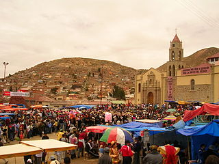
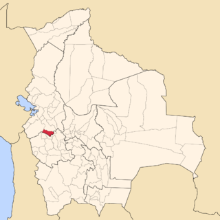
Lajma is a small town in Bolivia.
This article may be expanded with text translated from the corresponding article in German. (February 2010)Click [show] for important translation instructions.
|
Lajma | |
|---|---|
Town | |
| Country | |
| Time zone | UTC-4 (BOT) |
Lajma is a small town in Bolivia.

The Arctic Archipelago, also known as the Canadian Arctic Archipelago, is an archipelago lying to the north of the Canadian continental mainland, excluding Greenland.

Oruro is a department in Bolivia, with an area of 53,588 km2 (20,690 sq mi). Its capital is the city of Oruro. According to the 2012 census, the Oruro department had a population of 494,178.

Caranavi Province is one of the twenty provinces of the Bolivian La Paz Department and is situated in the department's eastern parts. The province was created by Law 1401 on 16 December 1992 from a portion of what was then Nor Yungas Province. The creation of the province had been a local cause embraced by Ramiro Revuelta, a Deputy in the national legislature who was assassinated on November 28, 1992.

Gualberto Villarroel is a province in the La Paz Department, Bolivia. Its capital is San Pedro de Curahuara de Carangas.

Nor Yungas is a province in the Yungas-area of the Bolivian department of La Paz. During the presidency of José Manuel Pando the Yungas Province was divided into two parts, the Nor Yungas and the Sud Yungas Province, by law of January 12, 1899. Its administrative seat is the town of Coroico.

Enrique Baldivieso is a province in the Bolivian department of Potosí. It is named after the former vice president Enrique Baldivieso. Its seat is San Agustín with a population of 533 during the census of 2001 situated on the bank of the Turuncha River in San Agustín Canton.
Rayner Glacier is a prominent glacier, 19 kilometres (10 nmi) wide, flowing north to the coast of Enderby Land just west of Condon Hills. It was sighted in October 1956 by Squadron Leader D. Leckie during a flight in an ANARE Beaver aircraft, and named by ANCA for J.M. Rayner, Director of the Bureau of Mineral Resources in the Australian Department of National Development.

Veredinha is a municipality in the northeast of the Brazilian state of Minas Gerais. As of 2020 the population was 5,727 in a total area of 635 km². The elevation of the urban area is 635 meters. It is part of the IBGE statistical meso-region of Jequitinhonha and the micro-region of Capelinha. It became a municipality in 1995.
Irvine Inlet is a body of water in Nunavut, Canada. Located in the Qikiqtaaluk Region, it lies in western Cumberland Sound, forming a wedge into Baffin Island's Hall Peninsula. There are many irregularly shaped islands at the mouth of the inlet.
Cumbers Reef is a group of rocks aligned in an arc forming the north and west parts of the Amiot Islands, off the southwest part of Adelaide Island. It was named by the UK Antarctic Place-Names Committee for Roger N. Cumbers, 3rd officer of RRS John Biscoe, 1961–62, the ship which assisted the Royal Navy Hydrographic Survey Unit in the charting of this area in 1963.
Strange Glacier is a glacier in the Latady Mountains, draining southeast along the south side of Crain Ridge to enter Gardner Inlet between Schmitt Mesa and Mount Austin, in Palmer Land. Mapped by United States Geological Survey (USGS) from surveys and U.S. Navy air photos, 1961–67. Named by Advisory Committee on Antarctic Names (US-ACAN) for Donald L. Strange, hospital corpsman at South Pole Station in 1964.
Fuchs Ice Piedmont is an ice piedmont 70 nautical miles (130 km) long, extending in a northeast–southwest direction along the entire west coast of Adelaide Island. It was first mapped in 1909 by the French Antarctic Expedition under Jean-Baptiste Charcot. It was named by the Falkland Islands Dependencies Survey (FIDS) for Sir Vivian E. Fuchs, FIDS base leader and geologist at Stonington Island in 1948–49.
Paschal Glacier is a glacier about 20 nautical miles (37 km) long and 4 nautical miles (7 km) wide, draining northwest between two ridges, the terminal points of which are Mount McCoy and Lewis Bluff. The lower end of this glacier merges with the flow of White Glacier and the larger Land Glacier near Mount McCoy before the latter feature debouches into Land Bay on the coast of Marie Byrd Land. Paschal Glacier was photographed from aircraft of the United States Antarctic Service (USAS), 1939–41, and was mapped by United States Geological Survey (USGS) from surveys and U.S. Navy aerial photography, 1959–65. Named by Advisory Committee on Antarctic Names (US-ACAN) for Evans W. Paschal, Scientific Leader at Byrd Station, 1970.
Millett Glacier is a heavily crevassed glacier in Antarctica, 13 nautical miles (24 km) long and 7 nautical miles (13 km) wide, flowing west from the Dyer Plateau of Palmer Land to George VI Sound, immediately north of Wade Point. In its lower reaches the north side of this glacier merges with Meiklejohn Glacier. Millett Glacier was first surveyed in 1936 by the British Graham Land Expedition (BGLE) under John Rymill, and was named by the UK Antarctic Place-Names Committee in 1954 for Hugh M. Millett, chief engineer of the Penola during the BGLE.
McClinton Glacier is a glacier between the base of Martin Peninsula and the Jenkins Heights, flowing east-northeast into the Dotson Ice Shelf, on the Walgreen Coast of Marie Byrd Land, Antarctica. It was mapped by the United States Geological Survey from surveys and U.S. Navy aerial photographs, 1959–67, and was named by the Advisory Committee on Antarctic Names after Racie A. McClinton, Jr., U.S. Navy, an LC-130 flight engineer of Squadron VXE-6, who served in nine Operation Deep Freeze deployments through to 1977.
Matthes Glacier is a glacier 9 nautical miles (17 km) long, flowing east into Whirlwind Inlet between Demorest Glacier and Chamberlin Glacier, on the east coast of Graham Land, Antarctica. It was discovered by Sir Hubert Wilkins on a flight of December 20, 1928, and photographed from the air by the United States Antarctic Service in 1940. It was charted by the Falkland Islands Dependencies Survey in 1947 and named for François E. Matthes, then chief geologist with the U.S. Geological Survey.
Rigsby Islands is a small group of ice-capped islands lying off the northeast coast of Adelaide Island, about 2 nautical miles (3.7 km) south of Sillard Islands. Mapped from air photos taken by Ronne Antarctic Research Expedition (RARE) (1947–48) and Falkland Islands and Dependencies Aerial Survey Expedition (FIDASE) (1956–57). Named by United Kingdom Antarctic Place-Names Committee (UK-APC) for George P. Rigsby, American geologist who has specialized in the investigation of ice crystal structure and the plasticity of ice.

Lewis Glacier is the northerly of two glaciers flowing from Hemimont Plateau east into Seligman Inlet, on the east coast of Graham Land, Antarctica. The glacier was photographed from the air by the United States Antarctic Service in 1940. It was charted in 1947 by the Falkland Islands Dependencies Survey, who named it for British glaciologist William Vaughan Lewis, a lecturer at the Department of Geography, Cambridge University.
German submarine U-667 was a Type VIIC U-boat built for Nazi Germany's Kriegsmarine for service during World War II. She was laid down on 16 August 1941 by Deutsche Werft, Hamburg as yard number 816, launched on 29 August 1942 and commissioned on 21 October 1942 under Kapitänleutnant Heinrich Schroeteler.