Related Research Articles

The American Discovery Trail is a system of recreational trails and roads that collectively form a coast-to-coast hiking and biking trail across the mid-tier of the United States. Horses can also be ridden on most of this trail. The coastal trailheads are the Delmarva Peninsula on the Atlantic Ocean and the northern California coast on the Pacific Ocean. The trail has northern and southern alternates for part of its distance, passing through Chicago and St. Louis respectively. The total length of the trail, including both the north and south routes, is 6,800 miles (10,900 km). The northern route covers 4,834 miles (7,780 km) with the southern route covering 5,057 miles (8,138 km). It is the only non-motorized coast-to-coast trail.

The Superior Hiking Trail, also known as the SHT, is a 310-mile (500 km) long hiking trail in northeastern Minnesota that follows the rocky ridges overlooking Lake Superior for most of its length. The trail travels through forests of birch, aspen, pine, fir, and cedar. Hikers enjoy views of boreal forests, the Sawtooth Mountains, babbling brooks, rushing waterfalls, and abundant wildlife. The lowest point in the path is 602 ft (183 m) above sea level and the highest point is 1,829 ft (557 m) above sea level. The footpath is intended for hiking only. Motorized vehicles, mountain bikes, and horses are not allowed on the trail. Many people use the trail for long-distance hiking, and facilitating this purpose are 94 backcountry, fee-free campsites.

Cloudland Canyon State Park is a 3,485 acres (14.10 km2) Georgia state park located near Trenton and Cooper Heights on the western edge of Lookout Mountain. One of the largest and most scenic parks in Georgia, it contains rugged geology, and offers visitors a range of vistas across the deep gorge cut through the mountain by Sitton Gulch Creek, where the elevation varies from 800 to over 1,800 feet. Views of the canyon can be seen from the picnic area parking lot, in addition to additional views located along the rim trail. At the bottom of the gorge, two waterfalls cascade across layers of sandstone and shale, ending in small pools below.
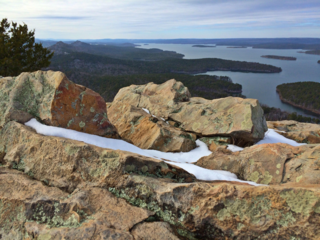
Pinnacle Mountain State Park is a 2,356-acre state park located in Pulaski County, Arkansas just outside of Little Rock. The main attraction is Pinnacle Mountain, an iconic landmark surrounded by the bottomlands of the Big Maumelle and Little Maumelle rivers.
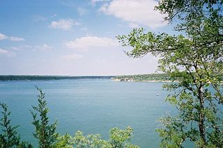
Lake Georgetown is a reservoir on the north fork of the San Gabriel River in central Texas in the United States. Lake Georgetown is a U.S. Army Corps of Engineers reservoir formed on the San Gabriel by the North San Gabriel Dam, which is located about three miles west of Georgetown, Texas. The dam, lake and all adjacent property are managed by the Fort Worth District of the Corps of Engineers. The dam was officially completed on October 5, 1979, and serves to provide flood control for the community of Georgetown. Lake Georgetown, a popular recreational destination, is also a source of drinking water for Georgetown and the nearby city of Round Rock.
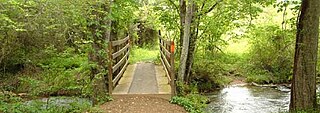
Elk City State Park is a state park in Montgomery County, Kansas, United States, located west of Independence.

Three Rivers Park District is a special park district serving the suburban areas of the Twin Cities including suburban Hennepin, Carver, Dakota, Scott, and Ramsey counties. Three Rivers's mission is "To promote environmental stewardship through recreation and education in a natural resources-based park system." Three Rivers operates twenty parks and ten regional trails, with at least two more regional trails planned. Nearly seven million people visit Three Rivers facilities each year. It has over 27,000 acres (11,000 ha) of parks and trails.
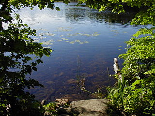
Lebanon Hills Regional Park is a park in Eagan and Apple Valley, Minnesota. The 1,869-acre (7.56 km2) park, the largest in Dakota County, contains forests, grasslands, marshes, and wetlands. Winter activities include skiing, snowshoeing, ice skating, ice fishing, hiking, and winter mountain biking. Summer activities include mountain biking, canoeing, kayaking, swimming, camping, horseback riding, and hiking.
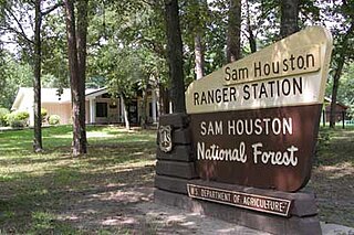
The Sam Houston National Forest, one of four National Forests in Texas, is located 50 miles north of Houston. The forest is administered together with the other three United States National Forests and two National Grasslands located entirely in Texas, from common offices in Lufkin, Texas. The units include Angelina, Davy Crockett, Sabine, and Sam Houston National Forests, plus Caddo National Grassland and Lyndon B. Johnson National Grassland. There are local ranger district offices located in New Waverly. It is located in portions of three Texas counties including Montgomery, San Jacinto, and Walker.

Hartshorne Woods Park is a 736-acre (298 ha) county park located in Northern Monmouth County, New Jersey, United States, in New Jersey's Bayshore Region. The park has 16 miles (26 km) of trails, several old military bunkers and a small beach with a fishing pier. It is roughly bordered to the north and west by Navesink Ave and Route 36. Its southern borders are Hartshorne Road and the Navesink River. Its eastern border is the Upper Shrewsbury River. The Park is split into three sections from west to east: The Buttermilk Valley Section, the Monmouth Hills Section, and the Rocky Point Section.
Mount Wilson is a mountain in the Green Mountains in the U.S. state of Vermont. Located in the Breadloaf Wilderness of the Green Mountain National Forest, its summit is in the town of Ripton in Addison County. The mountain is named after Woodrow Wilson, former president of the United States. Flanked by Bread Loaf Mountain to the southwest, Mount Wilson is one of five peaks in Vermont's Presidential Range. At 3,745 feet (1,141 m), it is the 12th highest peak in Vermont and one of the hundred highest peaks in New England.

Rattlesnake Lake is a lake in the northwest United States, located in Rattlesnake Mountain Scenic Area in King County, Washington, approximately thirty miles (50 km) east of Seattle, south of Interstate 90.

The Palatka-Lake Butler State Trail (PLB) corridor stretches nearly 47 miles (76 km) from the vicinity of Lake Butler, Florida to Palatka, Florida. The project is located along the former Georgia Southern and Florida Railway right-of-way and the trail is being constructed on top of the existing abandoned railroad bed through Putnam, Clay, Bradford, and Union counties.

Doughton Park is the largest recreation area the National Park Service manages on the Blue Ridge Parkway. It is located between mile markers 238.5 - 244.7 on the border between Wilkes and Alleghany Counties in North Carolina. Doughton Park consists of highland meadows with numerous scenic overlooks, miles of hiking and bridle trails, areas for camping and cookouts, and it is one of the few areas on the Parkway that has a restaurant along with an adjacent visitors center maintained by the National Park Service. Elevations in Doughton Park generally range from 3,500 to 4,000 feet. The park is named after North Carolina politician Robert L. Doughton, who lived in nearby Laurel Springs, North Carolina and who as a US Congressman played a key role in the creation of the Blue Ridge Parkway in the 1930s.

Bierstadt Lake is located in Larimer County, Colorado and within the Rocky Mountain National Park. Near McHenrys Peak and Longs Peak, there are "spectacular views" of the Continental Divide at the lake. The Bierstadt Lake Trailhead is located about 6.5 miles (10.5 km) from the turn-off at U.S. Route 36 into the Rocky Mountain National Park. During the summer, shuttle buses provide transportation to the trailhead.
Magnolia Park is a county park located on the eastern shore of Lake Apopka. It is managed by the Orange County Parks and Recreation.
Green Mountain Scenic Overlook and Trailhead is a small county park located a short distance west of Lake Apopka. It is managed by Lake County.

Vatia is a village on Tutuila Island in American Samoa. It is a north shore village located on Vatia Bay. The road to Vatia, American Samoa Highway 006, is the only road going through National Park of American Samoa. Vatia is a scenic community at the foot of Pola Ridge and surrounded by the national park. It is only reached by Route 6 which traverses the national park before reaching Vatia. There was once a hiking trail over Maugaloa Ridge from Leloaloa, but since the completion of Route 6, this trail is now overgrown. It is home to a beach, and panoramic views of jungle-covered peaks surround the village on all sides. Vatia is the center of the Tutuila-section of National Park of American Samoa. It is located in Vaifanua County.
Mount Roosevelt is a mountain in the Green Mountains in the U.S. state of Vermont. Located in the Breadloaf Wilderness of the Green Mountain National Forest, its summit is in the town of Ripton in Addison County. The mountain is named after Theodore Roosevelt, former president of the United States. Mount Roosevelt is one of five peaks in Vermont's Presidential Range.
References
- 1 2 "Lake Apopka Loop Trail". TrailLink. Retrieved 13 January 2017.
- ↑ "Lake County Paved Recreational Trails". Lake County Public Resources Department. Retrieved 13 January 2017.
- 1 2 3 "Lake Apopka Loop Trail". Orange County Parks and Recreation . Retrieved 13 January 2017.
- 1 2 "Lake Apopka Timeline". Friends of Lake Apopka. Retrieved 13 January 2017.
- 1 2 3 4 5 6 "Lake Apopka North Shore". St. Johns River Water Management District . Retrieved 13 January 2017.