Lake Carpa

Last updated
Lake Carpa
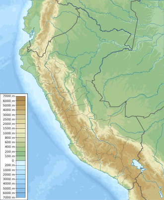
Location Lima Region, Huarochirí Province, Huanza District
Coordinates 11°32′4″S76°22′38″W / 11.53444°S 76.37722°W / -11.53444; -76.37722 Coordinates: 11°32′4″S76°22′38″W / 11.53444°S 76.37722°W / -11.53444; -76.37722
Basin  countriesPeru

Lake Carpa is a lake in Peru, located northeast of Arahuay in Huanza District, Huarochiri Province, Lima Region. It covers an area of 3 square kilometers (1 square mile) and has an average depth of 20 meters (64 feet). [1]

Peru republic in South America

Peru, officially the Republic of Peru, is a country in western South America. It is bordered in the north by Ecuador and Colombia, in the east by Brazil, in the southeast by Bolivia, in the south by Chile, and in the west by the Pacific Ocean. Peru is a megadiverse country with habitats ranging from the arid plains of the Pacific coastal region in the west to the peaks of the Andes mountains vertically extending from the north to the southeast of the country to the tropical Amazon Basin rainforest in the east with the Amazon river.

Arahuay is a village in Canta Province, Lima Region, Peru, South America. It is the seat of Arahuay District. Its geographical coordinates are 11° 37' 20" South, 76° 40' 10" West. "Arahuay is located 22 kilometres away from Santa Rosa de Quives, at over 2300 metres above sea level, and pierced over a small valley. The small town is surrounded by pre-Inca archaeological remains and a cluster of blue lagoons."

Huanza District is one of thirty-two districts of the province Huarochirí in Peru.

See also

Related Research Articles

Miami County, Indiana County in the United States

Miami County is a county located in the U.S. state of Indiana. As of 2010, the population was 36,903. The county seat is the City of Peru.

Kendale Lakes, Florida CDP in Florida, United States

Kendale Lakes is a census-designated place (CDP) and a suburb of Miami in Miami-Dade County, Florida, United States. The population was 56,901 at the 2000 census.

Peru, Illinois City in Illinois, United States

Peru is a city in LaSalle County, Illinois, United States. The population was 10,295 at the 2010 census. It is part of the Ottawa–Peru, IL Micropolitan Statistical Area. Peru and its twin city, LaSalle, make up the core of Illinois Valley.

Lake Titicaca lake in Peru and Bolivia

Lake Titicaca is a large, deep lake in the Andes on the border of Bolivia and Peru, often called the "highest navigable lake" in the world. By volume of water and by surface area, it is the largest lake in South America. Lake Maracaibo has a larger surface area, but it is a tidal bay, not a lake.

Peru, New York Town in New York, United States

Peru is a town in Clinton County in the U.S. state of New York. The population was 6,998 at the 2010 census. The town was so named for its views of the Adirondack Mountains to the west and the farmlands throughout the town, resembling scenery found in the country of Peru in South America. Peru, New York is in the southeastern part of Clinton County, south of Plattsburgh.

Department of Ancash Region in 20 provinces and 166 districts, Peru

Ancash is a region of northern Peru. It is bordered by La Libertad Region on the north, Huánuco and Pasco regions on the east, the Lima Region on the south, and the Pacific Ocean on the west. Its capital is the city of Huaraz, and its largest city and port is Chimbote. The name of the region originates from the Quechua word anqash, from anqas (blue) or from anka (eagle).

Department of Apurímac Region in 7 provinces and 80 districts, Peru

Apurímac is a region in southern-central Peru. It is bordered on the east by the Cusco Region, on the west by the Ayacucho Region, and on the south by the Arequipa and Ayacucho regions. The region's name originates from the Quechua language and means "where the gods speak" in reference to the many mountains of the region that seem to be talking to each other.

Lake Conococha lake in Peru

Lake Conococha is a South American lake located in the Andes mountains of northwestern Peru. It is located in the region of Ancash near the junction of the roads going from Callejón de Huaylas to Chiquián.

In Mexico and the Southwestern United States, the carpa theater flourished during the 1920s and 1930s. Like its American counterpart vaudeville, performances were varied, including comedic sketches, puppet shows, political satire, acrobatics, and dance.

Bajo de la Carpa Formation

The Bajo de la Carpa Formation is a geologic formation of the Neuquén Basin that crops out in northern Patagonia, in the provinces of Río Negro and Neuquén, Argentina. It is the oldest of two formations belonging to the Río Colorado Subgroup within the Neuquén Group. Formerly, that subgroup was treated as a formation, and the Bajo de la Carpa Formation was known as the Bajo de la Carpa Member.

Andahuaylas Province Province in Apurímac, Peru

Andahuaylas Province is the second largest of the seven provinces of the Apurímac Region in Peru. The capital of the province is the city of Andahuaylas. The province is located in the north-eastern part of the region and measures 3,987.00 square kilometres (1,539.39 sq mi).

Recuay, Peru Town in Ancash, Peru

Recuay is a town in the Ancash Region, Peru. It is located at the border of the Santa River, 3422 msnm, and it the capital of the Recuay Province. it was created by law 11326 on April 14, 1950.

Carabaya Province Province in Puno, Peru

Carabaya Province is a province of the Puno Region in the southern part of Peru. It is bounded on the north by the Madre de Dios Region, on the east by the Sandia Province, on the south by the provinces of Azángaro, Melgar and Putina and on the west by the Cusco Region. The capital of the province is the city of Macusani.

Lake Ashmere lake of the United States of America

Lake Ashmere, or Ashmere Lake, is a small lake in rural Berkshire County of Massachusetts, located in Peru and Hinsdale, Massachusetts.

Lake Parinacochas lake in the Ayacucho Region in Peru

Lake Parinacochas is a lake in Ayacucho Region in Peru. It is located west of Sara Sara volcano at an elevation of 3,272 metres (10,735 ft) above sea level. The lake is 12 km long and 9 km wide, and has a catchment area of 606.5 square kilometres (234 sq mi).

Qishqiqucha is a lake in the Cordillera Blanca in Peru. It is located in the Ancash Region, Recuay Province, Catac District. It is situated at a height of about 4,284 metres (14,055 ft), about 0.7 km long and 0.39 km at its widest point. Qishqiqucha lies in the Huascarán National Park, southwest of Mururahu and Qishqi.

Coropuna volcano in Peru

Coropuna is a dormant volcano in the southern Peruvian Andes that belongs to the Central Volcanic Zone; it has several summits, the highest of which reaches an altitude of 6,377 metres above sea level. The volcano, located 150 kilometres from Arequipa, is mostly made of ignimbrites and lava flows on a basement formed by additional ignimbrites and lava flows, some of which may have been formed by Coropuna itself. Coropuna has been active for at least five million years, with the bulk of the current cone having formed during the Quaternary. It has had three Holocene eruptions 6,000, 2,100 ± 200 and either 1,100 ± 100 or 700 ± 200 years ago which generated lava flows. Currently, activity occurs exclusively in the form of hot springs.

Lake Ballivián is an ancient lake in the Altiplano of South America and is named after the Bolivian scholar Don Manuel Vicente Ballivian. It is part of a series of lakes which developed in the Titicaca basin along with Lake Mataro and Lake Cabana, reaching an altitude of 3,860 metres (12,660 ft). Lake Ballivián itself is of late Quaternary age and may have influenced the spread and development of animals in the Altiplano. In the southern Altiplano, Lake Escara may be coeval with Lake Ballivián.

References

  1. "Laguna Carpa, Peru - 3.400sq km - Facts, Map". www.lakepedia.com. Retrieved 2017-12-21.