Lake Chivero

Last updated

Lake Chivero
Lake Chivero.JPG
viewed from the north bank
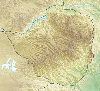
Zimbabwe relief location map.jpg
Red pog.svg
Lake Chivero
Africa relief location map.jpg
Red pog.svg
Lake Chivero
Coordinates 17°54′01″S30°47′28″E / 17.90028°S 30.79111°E / -17.90028; 30.79111 Coordinates: 17°54′01″S30°47′28″E / 17.90028°S 30.79111°E / -17.90028; 30.79111
Type reservoir
Primary inflows Manyame River, Marimba River, Mukuvisi River
Primary outflows Manyame River
Basin  countriesZimbabwe
Max. width8 km (5.0 mi)
Surface area2,632 ha (6,500 acres)
Max. depth27 m (89 ft)
Water volume250×10^6 m3 (200,000 acre⋅ft)
Shore length148 km (30 mi)
Official nameLake Chivero and Manyame
Designated3 May 2013
Reference no.2105 [1]
1 Shore length is not a well-defined measure.

Lake Chivero is a reservoir on the Manyame River in Zimbabwe. It was formerly called Lake McIlwaine in memory of Sir Robert McIlwaine, a former judge of the High Court and founder of Southern Rhodesia's (later Rhodesia's, now Zimbabwe's) soil and water conservation movement.

Located southwest of Harare, it provides the main water supply for the city. The lake was constructed over two-and-a-half years and opened to the public in 1952. The dam wall is 400 metres long.

The water is also used for irrigation purposes and commercial fishing. Some of the fishes that are found in the lake include common grass carp, tigerfish, black bream, Clarias gariepinus, yellowfish, and green-headed bream.

The lake and hinterland are protected as part of Lake Chivero Recreational Park. The lake was designated a Ramsar wetland of international importance on 3 January 2013. [2]

See also

Related Research Articles

Transboundary protected area

A transboundary protected area (TBPA) is an ecological protected area that spans boundaries of more than one country or sub-national entity. Such areas are also known as transfrontier conservation areas (TFCAs) or peace parks.

Zimbabwe Parks and Wildlife Management Authority

Zimbabwe Parks and Wildlife Management Authority (Zimparks) is an agency of the Zimbabwe government managing national parks. Zimbabwe's game reserves are managed by the government. They were initially founded as a means of using unproductive land.

Peace–Athabasca Delta

The Peace–Athabasca Delta, located in northeast Alberta, is the largest freshwater inland river delta in North America. It is located partially within the southeast corner of Wood Buffalo National Park, Canada's largest national park, and also spreads into the Regional Municipality of Wood Buffalo, west and south of the historical community of Fort Chipewyan. The delta encompasses approximately 321,200 ha, formed where the Peace and Athabasca rivers converge on the Slave River and Lake Athabasca. The delta region is designated a wetland of international importance and a UNESCO World Heritage Site. The region is large enough that it is considered one of twenty distinct natural subregions of Alberta by the provincial government's Natural Regions Committee.

Gippsland Lakes

The Gippsland Lakes are a network of lakes, marshes and lagoons in east Gippsland, Victoria, Australia covering an area of about 354 square kilometres (137 sq mi). The largest of the lakes are Lake Wellington, Lake King and Lake Victoria. The lakes are collectively fed by the Avon, Thomson, Latrobe, Mitchell, Nicholson and Tambo rivers.

Mana Pools National Park

Mana Pools National Park is a 219,600 ha wildlife conservation area and national park in northern Zimbabwe. It is a region of the lower Zambezi River in Zimbabwe where the flood plain turns into a broad expanse of lakes after each rainy season. As the lakes gradually dry up and recede, the region attracts many large animals in search of water, making it one of Africa's most renowned game-viewing regions.

Illinois Beach State Park

Adeline Jay Geo-Karis Illinois Beach State Park is part of the Illinois state park system and is located along Lake Michigan in Winthrop Harbor, Zion, Beach Park and unincorporated Benton Township in northeast Illinois. Together with lands to the north, including Chiwaukee Prairie, it forms the Chiwaukee Prairie Illinois Beach Lake Plain, an internationally recognized wet-land of importance under the Ramsar Convention. The park is broken into two units that encompass an area of 4,160 acres (1,683 ha) and contains over six miles of Lake Michigan shoreline.

Khabikki Lake

Khabikki Lake is a salt water lake, in the Soan Sakaser Valley in the southern Salt Range area in Khushab District, Punjab, Pakistan. This lake is formed due to the absence of drainage in the range. It is part of Uchhali Wetlands Complex and has been designated a Ramsar site.

Lake Connewarre

Lake Connewarre, a shallow estuarine 880-hectare (2,200-acre) lake on the Barwon River, is located on the Bellarine Peninsula southeast of Geelong in the Australian state of Victoria.

Matchedash Bay is a bay and Ramsar wetland in Simcoe County in Central Ontario, Canada. It is the "final inland extension of Severn Sound" on Lake Huron's Georgian Bay, and is "situated at the interface between the Saint Lawrence Lowlands and the Canadian Shield ". It exhibits geologically unique features at the junction of the Canadian Shield and southern Ontario limestone. Wetland habitats in Matchedash Bay are varied, and include swamps, fens, cattail marshes, wet meadows and beaver ponds. Other features include "permanent freshwater lakes; upland hardwood forest, agricultural lands, native grass meadows and a unique, coniferous wetland forest".

Blue Lake (New South Wales)

The Blue Lake is one of only four cirque lakes found in mainland Australia. The other three, Cootapatamba, Albina, and Club, are shallower and are held entirely by terminal moraines. Blue Lake's valley contains the best-developed glacial features in the Kosciuszko National Park alpine area of New South Wales. It was recognised as a wetland of international importance on 17 March 1996 when a 320-hectare (790-acre) area, comprising the lake and its surrounds, including nearby Hedley Tarn, was designated Ramsar Site 800 under the Ramsar Convention on wetlands. The lake lies within the Australian Alps National Parks and Reserves.

Lake Chivero Recreational Park

Lake Chivero Recreational Park is a protected area around Lake Chivero within the Zimbabwe Parks and Wildlife Estate.

Coongie Lakes

The Coongie Lakes is a freshwater wetland system located in the Far North region of South Australia. The 21,790-square-kilometre (8,410 sq mi) lakes system is located approximately 1,046 kilometres north of the Adelaide city centre. The wetlands includes lakes, channels, billabongs, shallow floodplains, deltas, and interdune swamps. It lies on the floodplain of Cooper Creek, an ephemeral river flowing through a desert landscape in the Lake Eyre Basin which rarely, after occasional large floods, empties into Lake Eyre. The wetland system has been recognised both as being of international importance by designation under the Ramsar Convention with a listing on 15 June 1987 and being nationally important within Australia with a listing in A Directory of Important Wetlands in Australia (DIWA). Its extent includes the regional town of Innamincka, the Malkumba-Coongie Lakes National Park, the Innamincka Regional Reserve, the Strzelecki Regional Reserve and the Coongie Lakes Important Bird Area.

North Victorian Wetlands

The North Victorian Wetlands, also known as the Kerang Wetlands, comprise an extensive series of over 100 freshwater, brackish and saline lakes and swamps on the floodplain of the Loddon River where it enters the Murray valley, in the vicinity of the town of Kerang, in northern Victoria, south-eastern Australia. They are important for a variety, and sometimes large numbers, of waterbirds.

Kanjia Lake

Kanjia Lake is a natural lake on the northern outskirts of Bhubaneswar, Odisha, India. While the main lake covers 75 hectares, the total wetland covers an area of 105 hectares with the scuba diving facility. It has a rich biodiversity and is a wetland of national importance which is helpful for maintaining the city's ecology.

The Interlaken Lakeside Reserve is a wetland reserve at subalpine Interlaken, lying at the north-western end of Lake Crescent on the Interlaken isthmus between the reservoirs of Lakes Sorell and Crescent, about 20 km west of Tunbridge, in the Central Highlands of Tasmania, Australia. In 1982 it was designated a wetland of international importance under the Ramsar Convention.

Meshchyorsky National Park

Meshchyorsky National Park covers extensive wetlands and pine/birch woodlands in the Meshchera Lowlands on the East European Plain in the northern section of Ryazan Oblast, Russia, about 120 km east of Moscow. The wetland habitat provides for extremely rich biodiversity among the plants and animals. "Meshchersky" (Мещёрский) National Park is not to be confused with "Meshchyora" (Мещёра) National Park, which is just to the north, over the border in Vladimir Oblast. The park protects a section of the Pra River, Lake Beloye, and associated wetlands and forests. About 54% of the park territory is used and managed for agricultural purposes by local communities.

Pryazovskyi National Nature Park

Pryazovskyi National Nature Park is the second largest national park of Ukraine, covering the estuaries, coastal plains seaside landforms around the Molochna River estuary the Utlyuksky estuary, on the northwest coast of the Sea of Azov. The area is one of high biodiversity, protecting both steppe and aquatic habitats, and the unique transition zones in between. The wetlands support very large populations of nesting and migratory waterfowl. The park is crosses several administrative districts, including Pryazovske Raion, Melitopol Raion, Berdiansk Raion, and Yakymivka Raion in Zaporizhia Oblast

References

  1. "Lake Chivero and Manyame". Ramsar Sites Information Service. Retrieved 25 April 2018.
  2. "The Annotated Ramsar List: Zimbabwe". The Ramsar Convention on Wetlands. Retrieved 20 February 2013.