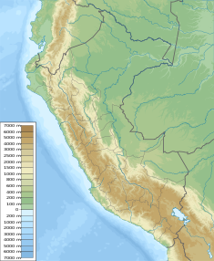
Orcococha is a lake in Peru located in the Huancavelica Region, Castrovirreyna Province, Santa Ana District, and in the Huaytará Province, Pilpichaca District. It is situated east of Lake Choclococha and northwest of the smaller lake named Caracocha.

Lake Sibinacocha is a lake in Peru. It is ranked as the 22nd highest lake in the world. It is located in the Cusco Region, Canchis Province, Pitumarca District. The lake is situated at a height of approximately 4,873 metres (15,988 ft), about 15.19 km long and 2.86 km at its widest point. Sibinacocha lies in the Vilcanota Range, south of Chumpe and southwest of Condoriquiña.

Lake Agnococha is a lake in Peru located in the Huancavelica Region, Castrovirreyna Province, Santa Ana District. It is situated at a height of approximately 4,714 m (15,466 ft), about 3.54 km long and 1.80 km at its widest point. Agnococha lies north of a larger lake named Orcococha.
Pumacocha is a lake in Peru located in the Junín Region, Yauli Province, Yauli District. It is situated at a height of approximately 4,265 m (13,993 ft), about 5.144 km long and 0.95 km at its widest point. Pumacocha lies northwest of a lake named Huallacocha and southwest of the town of Yauli.
Lake Ancascocha is a lake in Peru located in the Ayacucho Region, Lucanas Province, Chaviña District, and in the Parinacochas Province, Coracora District. It is situated at a height of approximately 3,424 metres (11,234 ft), about 2.24 km long and 1.48 km at its widest point.
Wamanrasu is a mountain in the Chunta mountain range in the Andes of Peru, about 5,304 metres (17,402 ft) high. It is located in the Huancavelica Region, Castrovirreyna Province, Santa Ana District and in the Huancavelica Province, Huancavelica District. Wamanrasu lies northeast of the mountain Antarasu and northwest of the mountain Qarwarasu (Carhuarazo) of the Huancavelica Region.
Lake Caracocha or Lake Ccaraccocha is a lake in Peru located in the Huancavelica Region, Huaytará Province, Pilpichaca District. It is situated at a height of about 4,528 metres (14,856 ft). Caracocha lies south of the lakes named Choclococha and Orcococha.
Waskhaqucha is a lake in Peru located in the Junín Region, Yauli Province, Morococha District. It lies east of a lake named Waqraqucha.
Chuqi Warmi or Chuki Warmi is a 5,049-metre-high (16,565 ft) mountain in the Andes of southern Peru. It is situated in the Huancavelica Region, Castrovirreyna Province, on the border of the districts of Castrovirreyna and Santa Ana, and in the Huaytará Province, Pilpichaca District. Chuqi Warmi lies south of the lake Urququcha, between Yuraq Pata in the northeast and Yana Ranra in the southwest.
Yana Ranra is a mountain in the Andes of Peru, about 4,800 metres (15,748 ft) high. It is situated in the Huancavelica Region, Castrovirreyna Province, on the border of the districts of Castrovirreyna and Santa Ana. Chuqi Warmi lies south of the lake Urququcha, southwest of Yuraq Pata and Chuqi Warmi, and southeast of Runa Wañusqa Urqu.
Ccarhuarazo or Qarwarasu is a 5,169-metre-high (16,959 ft) mountain in the Chunta mountain range in the Andes of Peru. It is located in the Huancavelica Region, Castrovirreyna Province, Santa Ana District, and in the Huancavelica Province, Huancavelica District. Ccarhuarazo is situated southeast of Kuntur Wamani and Wamanrasu. Its highest peak is on the border of the provinces. Two other peaks which reach 5,062 metres (16,608 ft) and more than 5,000 metres (16,404 ft) lie to the northeast in the Huancavelica District.
Pata Pata is a 5,052-metre-high (16,575 ft) mountain in the Chunta mountain range in the Andes of Peru. It is located in the Huancavelica Region, Castrovirreyna Province, Castrovirreyna District, and in the Huancavelica Province, Ascensión District. Pata Pata lies southwest of Pinqullu and Hatun Pata. The river Kachimayu originates southeast of the mountain. It flows to the northeast as a tributary of Ichhu River.
Qarwa Q'asa is a 5,005-metre-high (16,421 ft) mountain in the Chunta mountain range in the Andes of Peru. It is located in the Huancavelica Region, Castrovirreyna Province, on the border of the districts of Chupamarca and Aurahuá. Qarwa Q'asa lies west of Ichhu Rutuna, northwest of Wallu Q'asa and Phiruru Urqu and northeast of Wichinka Lake.
Qarwa K'anti is a mountain in the Chunta mountain range in the Andes of Peru, about 5,000 metres (16,404 ft) high. It lies in the Huancavelica Region, Castrovirreyna Province, on the border of the districts of Castrovirreyna and Santa Ana, and in the Huancavelica Province, Huancavelica District. Qarwa K'anti lies south of Wachu Intiyuq, southwest of Antarasu and north of Yawar Q'asa.
Lake Chilicocha or LakeChiricocha is a lake in Peru located in the Huancavelica Region, Huancavelica Province, Acobambilla District. Lake Chilicocha lies southeast of lakes Acchicocha and Angascocha. The mountain at the western shore of Lake Chilicocha is named Wilacocha. The lake belongs to the watershed of the Mantaro River.
Qusqu is a mountain in the Chunta mountain range in the Andes of Peru, about 5,000 m (16,000 ft) high. It is located in the Huancavelica Region, Castrovirreyna Province, Castrovirreyna District, and in the Huancavelica Province, Ascensión District.

Q'ara Wayuna is a mountain in the Chunta mountain range in the Andes of Peru, about 4,800 m (15,700 ft) high. It is located in the Huancavelica Region, Castrovirreyna Province, on the border of the districts of Aurahuá and Castrovirreyna. It lies southwest of Sukullu and a lake named Antaqucha.
Wamanripayuq is a mountain in the Chunta mountain range in the Andes of Peru, about 5,000 m (16,000 ft) high. It lies in the Huancavelica Region, Castrovirreyna Province, on the border of the districts of Castrovirreyna and Santa Ana.
The Yuraqmayu or Río Blanco is a 36.2 km long river in Peru located in the Lima Region, Huarochirí Province, in the districts of Chicla and San Mateo. It is a left tributary of the Rimac River which empties into the Pacific Ocean.
The Upamayo Dam is a dam at Lake Junin, the largest lake entirely in Peru. It is located on the border of the Junín Region, Junín Province, Ondores District, and the Pasco Region, Pasco Province, Vicco District.