The Meuse or Maas is a major European river, rising in France and flowing through Belgium and the Netherlands before draining into the North Sea from the Rhine–Meuse–Scheldt delta. It has a total length of 925 km.

The Weser is a river of Lower Saxony in north-west Germany. It begins at Hannoversch Münden through the confluence of the Werra and Fulda. It passes through the Hanseatic city of Bremen. Its mouth is 50 km (31 mi) further north against the ports of Bremerhaven and Nordenham. The latter is on the Butjadingen Peninsula. It then merges into the North Sea via two highly saline, estuarine mouths.

Eupen is the capital of German-speaking Community of Belgium and is a city and municipality in the Belgian province of Liège, 15 kilometres from the German border (Aachen), from the Dutch border (Maastricht) and from the "High Fens" nature reserve (Ardennes). The town is also the capital of the Euroregion Meuse-Rhine.

Limbourg or Limbourg-sur-Vesdre is a city and municipality of Wallonia located in the province of Liège, Belgium.

The Eder is a 177-kilometre-long (110 mi) major river in Germany that begins in eastern North Rhine-Westphalia and passes in to Hesse, where it empties into the River Fulda.

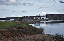
The Edersee Dam is a hydroelectric dam spanning the Eder river in northern Hesse, Germany. Constructed between 1908 and 1914, it lies near the small town of Waldeck at the northern edge of the Kellerwald. Breached by Allied bombs during World War II, it was rebuilt during the war, and today generates hydroelectric power and regulates water levels for shipping on the Weser river.

The Ourthe is a 165-kilometre (103 mi) long river in the Ardennes in Wallonia, Belgium.

The Vesdre, Weser or Vesder is a river in Liège Province, eastern Belgium.

The High Fens, which were declared a nature reserve in 1957, are an upland area, a plateau region in Liège Province, in the east of Belgium and adjoining parts of northwestern Germany, between the Ardennes and the Eifel highlands. The High Fens are the largest nature reserve or park in Belgium, with an area of 4,501.2 ha ; it lies within the German-Belgian natural park Hohes Venn-Eifel, in the Ardennes. Its highest point, at 694 metres (2,277 ft) above sea level, is the Signal de Botrange near Eupen, and also the highest point in Belgium. A tower 6 metres (20 ft) high was built here that reaches 700 metres (2,297 ft) above sea level. The reserve is a rich ecological endowment of Belgium covered with alpine sphagnum raised bogs, both on the plateau and in the valley basin; the bogs, which are over 10,000 years old, with their unique subalpine flora, fauna and microclimate, are key to the conservation work of the park.

K.A.S. Eupen is a Belgian professional association football club located in Eupen, Province of Liège, which currently plays in the Belgian Pro League, the top tier of Belgian football. The club was formed on 9 July 1945 through the merger of two older Eupen clubs, Jugend Eupen and FC Eupen 1920.

The Duchy of Limburg or Limbourg was an imperial estate of the Holy Roman Empire. Much of the area of the duchy is today located within Liège Province of Belgium, with a small portion in the municipality of Voeren, an exclave of the neighbouring Limburg Province. Its chief town was Limbourg-sur-Vesdre, in today's Liège Province.

Eupen-Malmedy is a small, predominantly German-speaking region in eastern Belgium. It consists of three administrative cantons around the towns of Eupen, Malmedy, and Sankt Vith which encompass some 730 square kilometres (280 sq mi). Elsewhere in Belgium, the region is commonly referred to as the East Cantons.

The Gileppe is a river in Belgium with a length of about 20 kilometres (12 mi). It is a left tributary of the Vesdre. Its source is in the High Fens of eastern Belgium. The Gileppe flows through an artificial lake, built in 1867–78 and enlarged to 1.3 square kilometres (0.50 sq mi) in 1968–71, created by the Gileppe Dam. The Gileppe flows into the Vesdre between Eupen and Limbourg.

The Sillon industriel is the former industrial backbone of Belgium. It runs across the region of Wallonia, passing from Dour, the region of Borinage, in the west, to Verviers in the east, passing along the way through Mons, La Louvière (Centre-region), Charleroi, Namur, Huy, and Liège. It follows a continuous stretch of valleys of the rivers Haine, Sambre, Meuse and Vesdre, and has an area of roughly 1000 km2.

The Baraque Michel is a locality in the municipality Jalhay, in the High Fens, Wallonia. Before the annexation of the Eastern Cantons by Belgium in 1919, it was the highest point of Belgium. Now it is the third highest point at 674 metres (2,211 ft), after the nearby Signal de Botrange and the Weißer Stein.

The Gileppe Dam is an arch-gravity dam on the Gileppe river in Jalhay, Liège province, Wallonia, Belgium. It was built in the 1870s to supply water for the wool industry in nearby Verviers. The monumental structure with its unusually thick profile played an important role in establishing an international standard for masonry gravity dams as a technology for major water supply systems. It was considered one of the strongest dams in Europe at the time, and it was the first dam built in modern Belgium. In the first decade of the 21st century, it was noted as supplying most of the drinking water for Verviers, as well as industrial water, and as producing hydroelectricity.

The Hill is a stream in the High Fens in east Belgium.

The Steling is a mountain, 658.3 m above sea level (NN) on the High Fens plateau. The German-Belgian border runs 60 meters from the mountaintop. The closest borderpoint near the summit is also the highest point in the municipal region of Aachen.
Weser is a river in Northwestern Germany.


