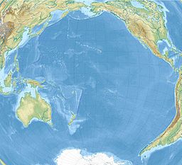
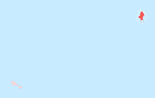
Wallis and Futuna, officially the Territory of the Wallis and Futuna Islands, is a French island collectivity in the South Pacific, situated between Tuvalu to the northwest, Fiji to the southwest, Tonga to the southeast, Samoa to the east, and Tokelau to the northeast.
Wallingat is a national park located in New South Wales, Australia, 211 kilometres (131 mi) northeast of Sydney. The park has forest walks, a campsite on the banks of the Wallingat River and a viewpoint, the Whoota Whoota Lookout, with views of Wallis Lake and the coast. The roads are unsealed.

Wallis is a Polynesian atoll/island in the Pacific Ocean belonging to the French overseas collectivity of Wallis and Futuna. It lies north of Tonga, northeast of Fiji, east-northeast of the Hoorn Islands, east of Fiji's Rotuma, southeast of Tuvalu, southwest of Tokelau and west of Samoa. Its area is almost 100 km2 (39 sq mi) with 8,333 people. Its capital is Mata Utu. Roman Catholicism is the predominant religion. Its highest point is Mount Lulu Fakahega. Wallis is of volcanic origin with fertile soil and some remaining lakes. Rainfall is plentiful.

Mata Utu is the capital city of Wallis and Futuna, an overseas collectivity of France. It is located on the island of Uvéa (ʻUvea), in the district of Hahake, of which it is also the capital. It is one of two ports in Wallis and Futuna, the other being at Leava on Futuna. Hihifo Airport, the main airport serving the island and city, is 5.6 kilometres (3.5 mi) to the northwest. Its population was 1,029 in 2018, up from 815 in 1998.

HMS Dolphin was a 24-gun sixth-rate frigate of the Royal Navy. Launched in 1751, she was used as a survey ship from 1764 and made two circumnavigations of the world under the successive commands of John Byron and Samuel Wallis. She was the first ship to circumnavigate the world twice. She remained in service until she was paid off in September 1776. She was broken up in early 1777.

Sigavé is one of the three official chiefdoms of the French territory of Wallis and Futuna in Oceania in the South Pacific Ocean.

Alo is one of three official chiefdoms of the French territory of Wallis and Futuna, in Oceania, in the South Pacific Ocean.

Lake Lalolalo is a volcanic crater lake surrounded by jungle to the southwest of the island of Wallis (Uvea) in the Pacific Ocean. The largest lake on the island, it lies off Route 1 between the coastal village of Mala'etoli and Ahoa. A small lake, Lake Lano, lies just to the northwest.
The following outline is provided as an overview of and topical guide to Wallis and Futuna:
Coolongolook River, a watercourse of the Mid-Coast Council system, is located in the Mid North Coast district of New South Wales, Australia.

Wallamba River, a watercourse of the Mid-Coast Council system, is located in the Mid North Coast district of New South Wales, Australia.

ʻUvea is one of the three official chiefdoms of the French territory of Wallis and Futuna in Oceania in the South Pacific Ocean.
Ha'afuasia is a village in Wallis and Futuna. It is located in Hahake District on the east coast of Wallis Island. Its population according to the 2018 census was 299 people. To the northwest is Lake Kikila.
Fineveke is a village in Wallis and Futuna. It is located in Mua District on the southwest coast of Wallis Island, just northwest of Halalo. Lake Lanutavake lies just to the northeast.

Wallis Lake, an open and trained wave dominated barrier estuary, is located within the Mid-Coast Council local government area in the Mid North Coast region of New South Wales, Australia. Wallis Lake is located adjacent to the towns of Forster and Tuncurry, and adjacent to the east coast, about 308 kilometres (191 mi) north of Sydney.

Lake Lanutavake is a small crater lake surrounded by jungle on the southwest side of Wallis (Uvea) in the Pacific. It lies to the northeast of Fineveke. Like Lake Lalolalo, there is a rumor that the US military dumped equipment in the lake at the end of World War II. The smaller lakes Lanumaha and Lanutuli lie to the northeast and northwest respectively.
Lake Alofivai is a lake on the northeastern side of Wallis (Uvea) in the Pacific. It is located off Route 1 (RT1) adjacent to the village of Alofivai. The lake is reportedly "often dry, and the bottom of the crater then affords pasture for the cows of the nearby mission schools." However, during wetter periods, the lake is populated with frogs.
Nuku is a village in Wallis and Futuna. It is located in Sigave District on the northwestern coast of Futuna Island. Its population according to the 2018 census was 204 people.
The Makobe River is a river in northeastern Ontario, Canada. It is in the Saint Lawrence River drainage basin, and is a left tributary of the Montreal River.
The COVID-19 pandemic in the Wallis and Futuna is part of the ongoing worldwide pandemic of coronavirus disease 2019 caused by severe acute respiratory syndrome coronavirus 2. The COVID-19 pandemic was confirmed to have reached the French overseas collectivity of Wallis and Futuna on 16 October 2020. As of 24 August 2021, there have been 454 confirmed cases of COVID-19 with 7 deaths reported to WHO. The last reported confirmed case was reported in April 2021.