This article relies largely or entirely on a single source .(June 2019) |
| Lake Limestone | |
|---|---|
 Lake Limestone  Lake Limestone | |
| Location | Limestone / Leon / Robertson counties, Texas, US |
| Coordinates | 31°19′31″N96°19′03″W / 31.32528°N 96.31750°W |
| Basin countries | United States |
| Surface area | 13,680 acres (55.4 km2) |
| Max. depth | 42 ft (13 m) |
| Surface elevation | 351 ft (107 m) [1] |
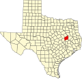
Lake Limestone is a 13,680 acres (55.4 km2) reservoir near Thornton, Texas . It lies 15 miles (24 km) southeast of Groesbeck, Texas on Texas FM 3371 in Leon, Robertson and Limestone Counties.
Contents
The lake's water is slightly alkaline, moderately clear, with a maximum of 42 feet (13 m) deep. The shoreline is irregular, and fish habitat is provided by brush, timber and aquatic plants.
The controlling authority for the reservoir and the Sterling C. Robertson Dam is the Brazos River Authority.
Lake Limestone has extensive recreational facilities including fishing, motor boating, jet skiing, and swimming.